Moored ADCP (NOAA): ADCP survey Cook Inlet, multiple years#
adcp_moored_noaa_coi_other
See the full dataset page for more information: Moored ADCP (NOAA): ADCP survey Cook Inlet, multiple years
Map of Moored ADCPs#
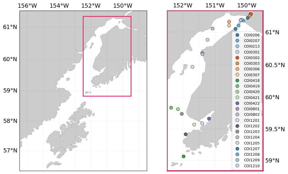
Fig. 90 Map of adcp_moored_noaa_coi_other data locations#
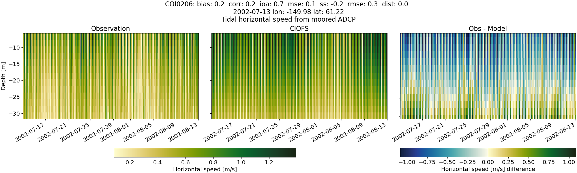
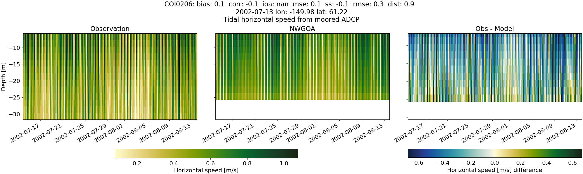
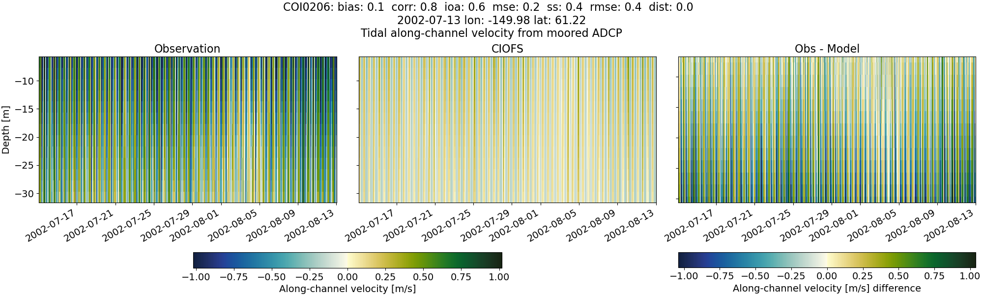
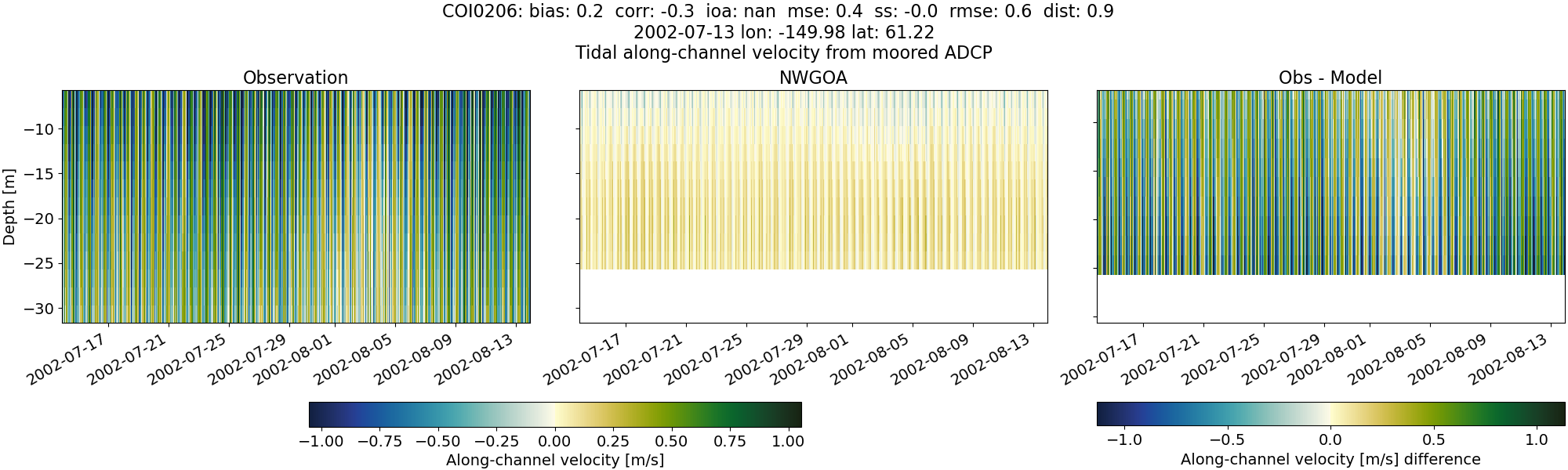
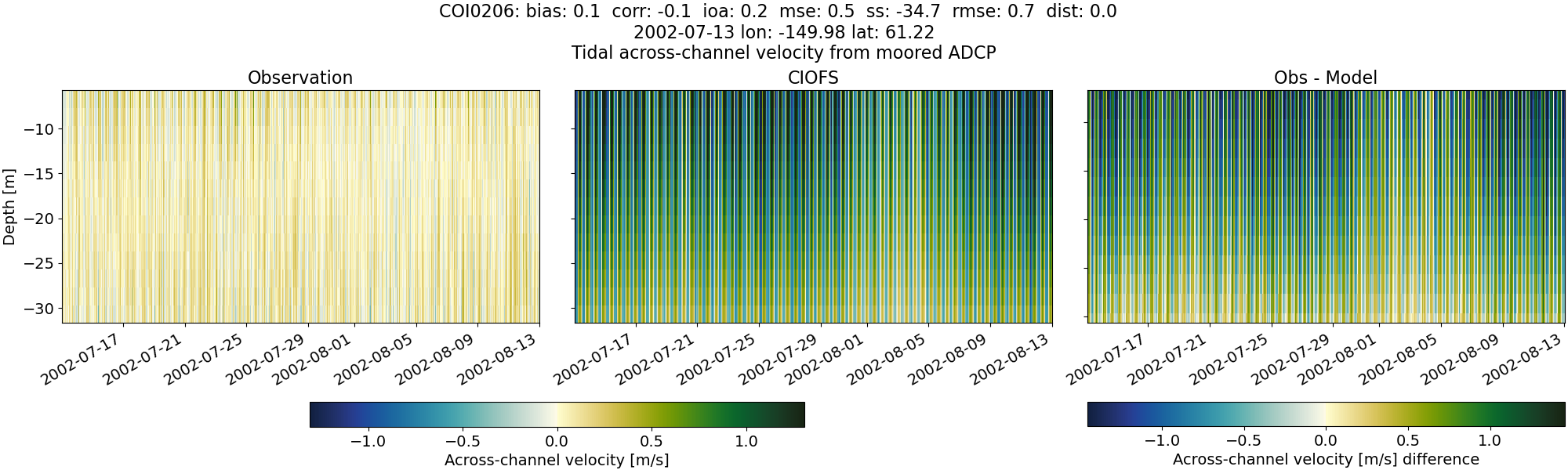
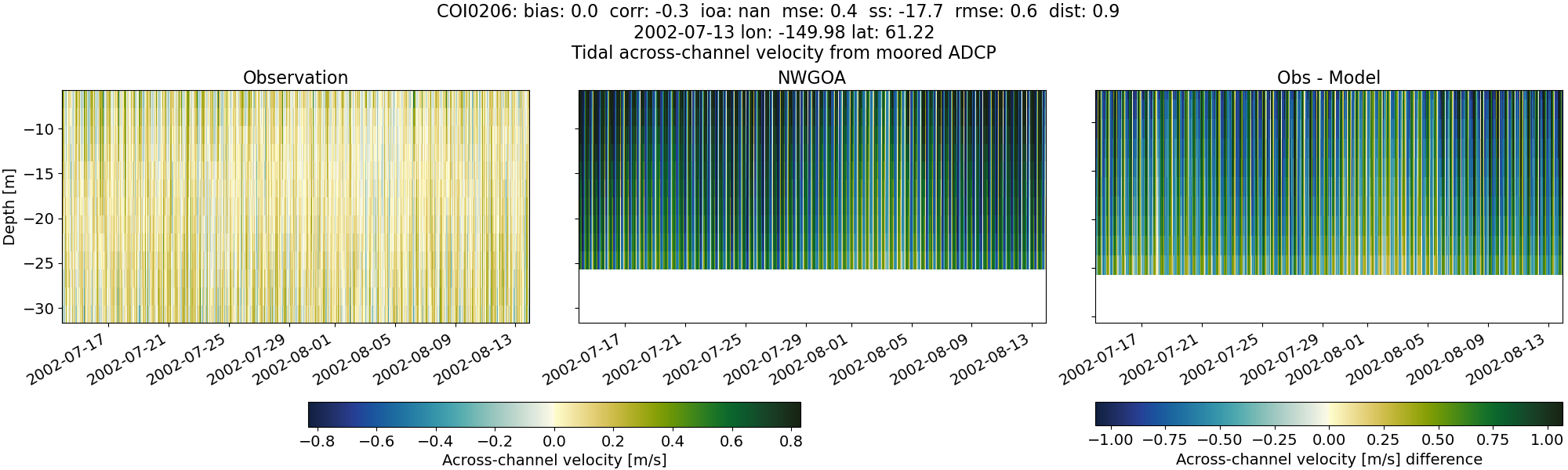
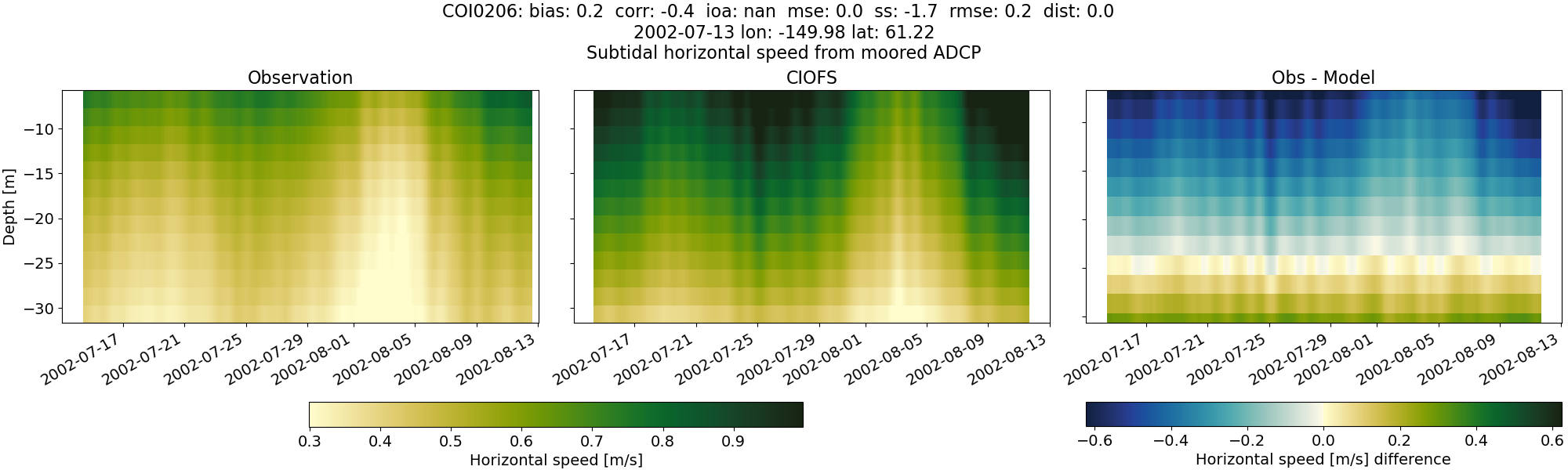
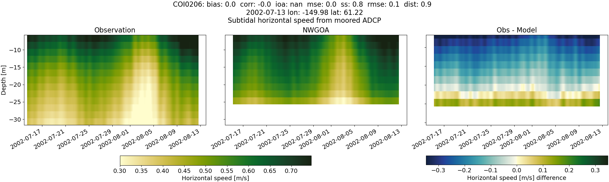
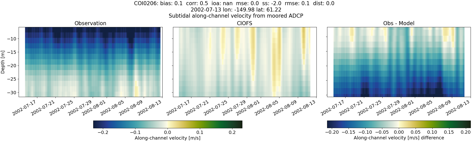
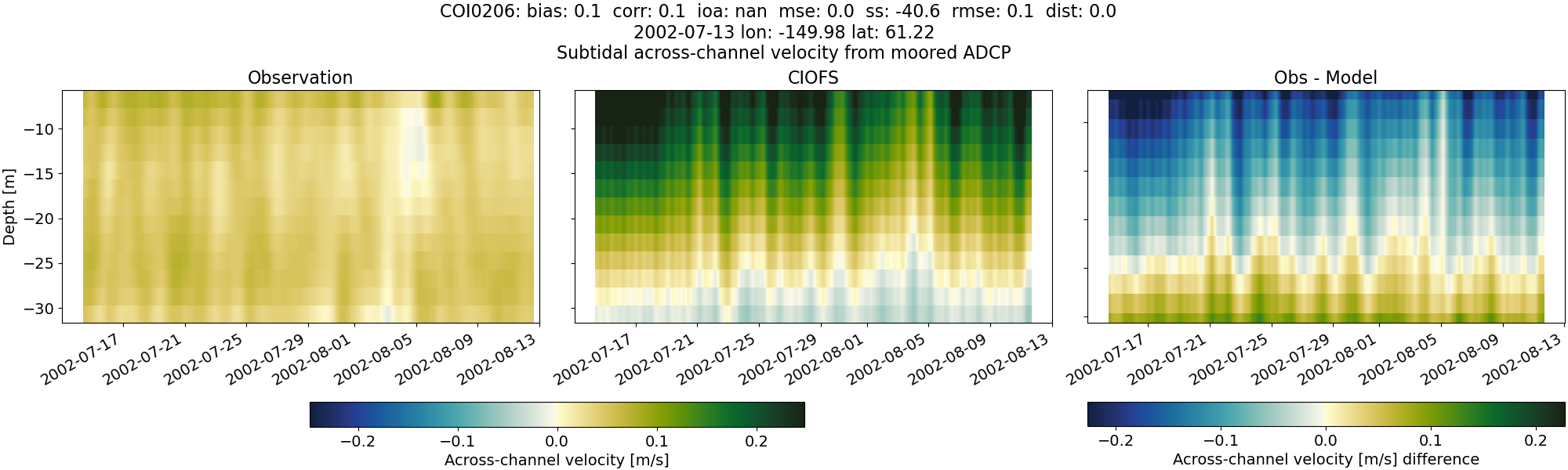
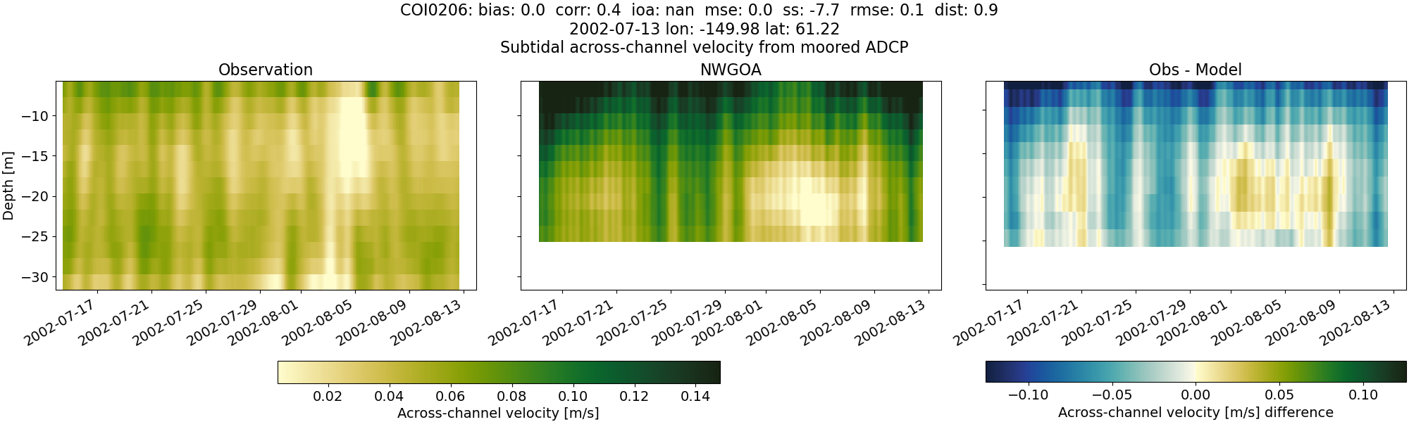
COI0206#
Tidal#
Horizontal speed#
CIOFS#
NWGOA#
Along-channel velocity#
CIOFS#
NWGOA#
Across-channel velocity#
CIOFS#
NWGOA#
Subtidal#
Horizontal speed#
CIOFS#
NWGOA#
Along-channel velocity#
CIOFS#
NWGOA#

Across-channel velocity#
CIOFS#
NWGOA#
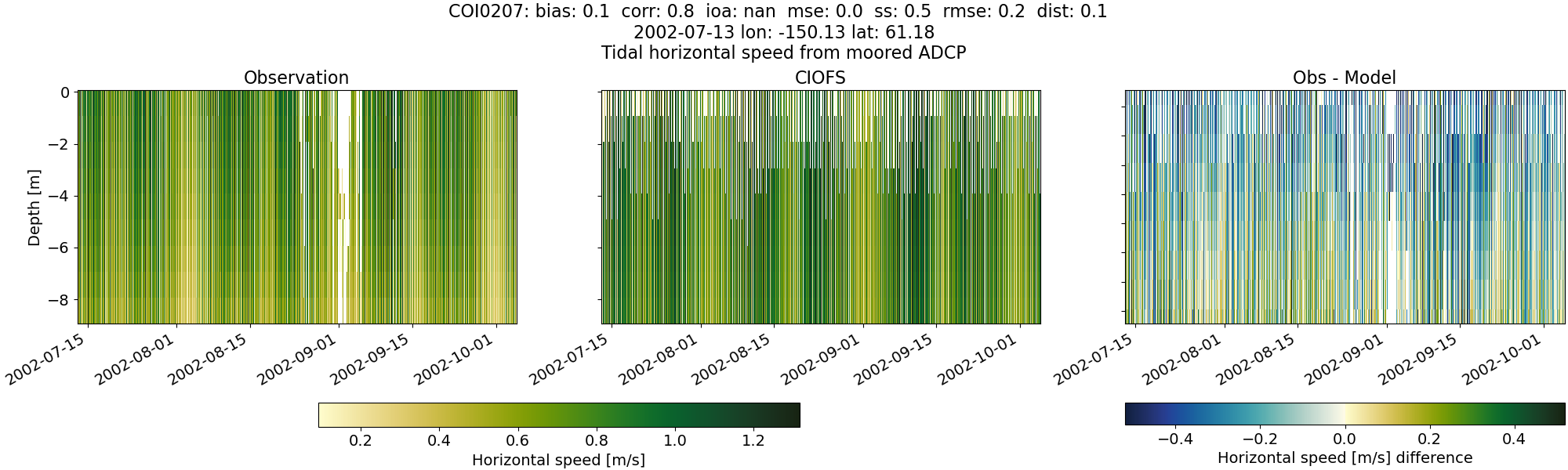
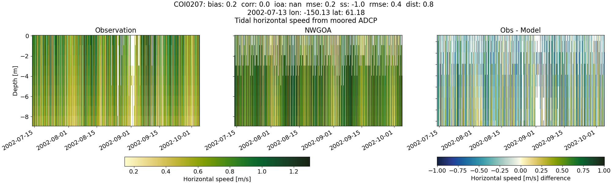
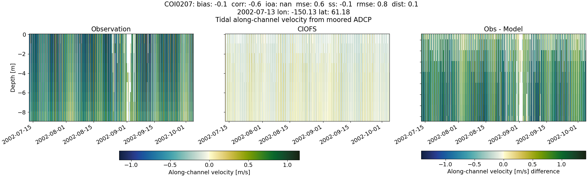
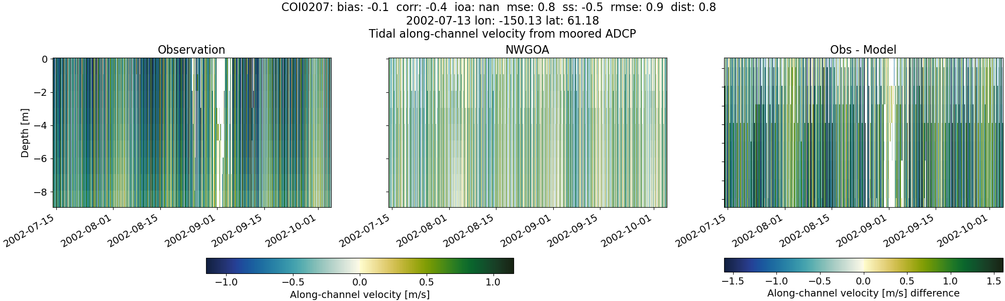
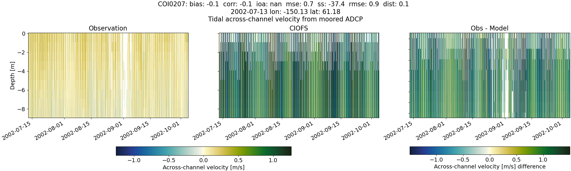
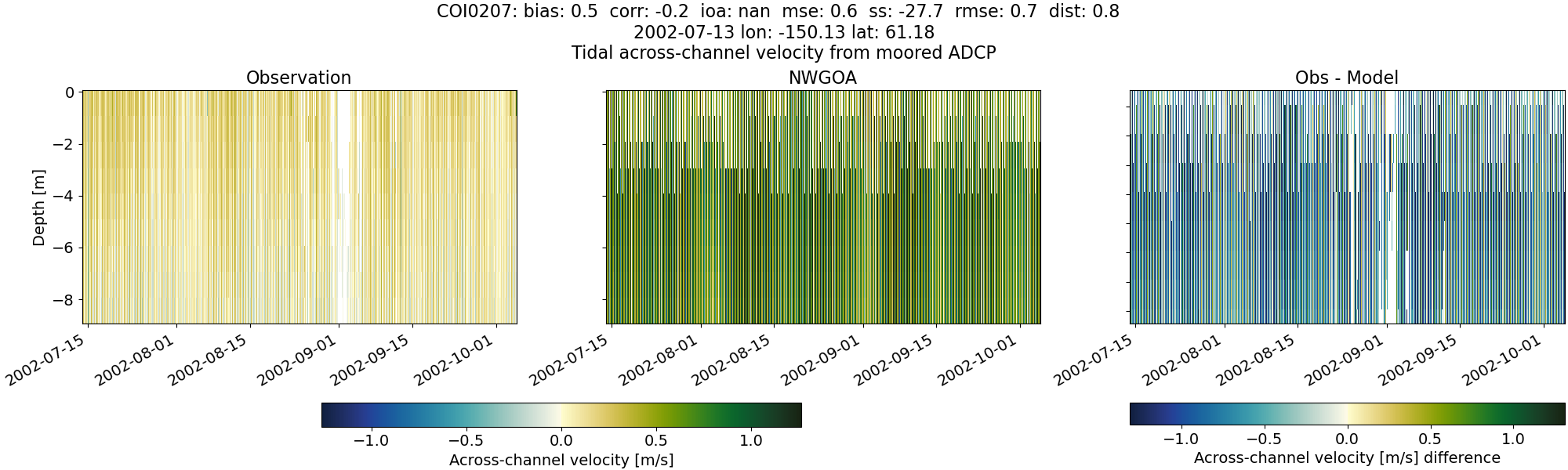
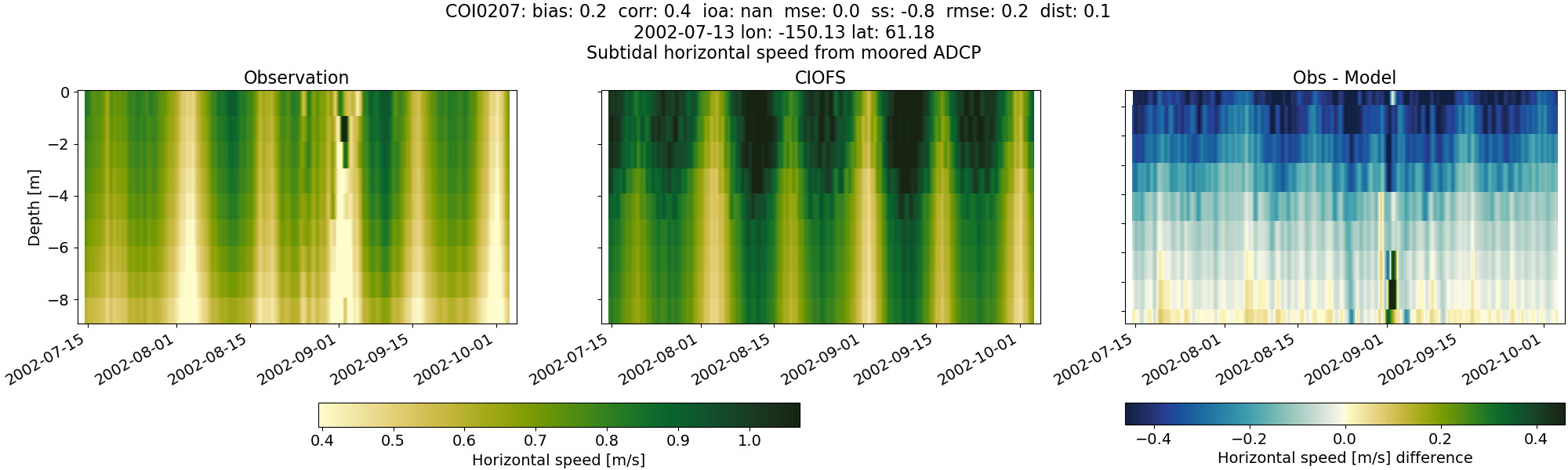
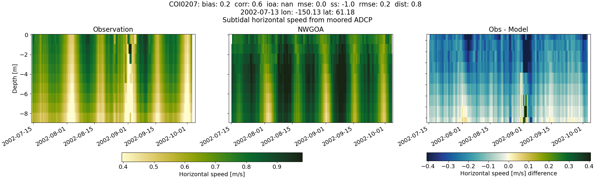
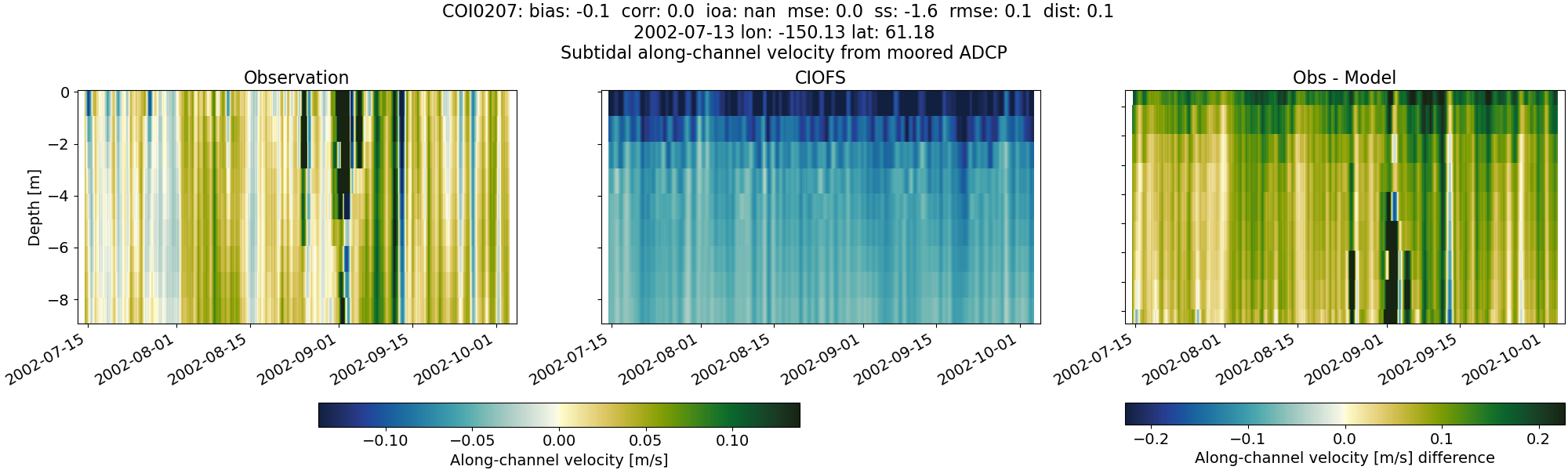
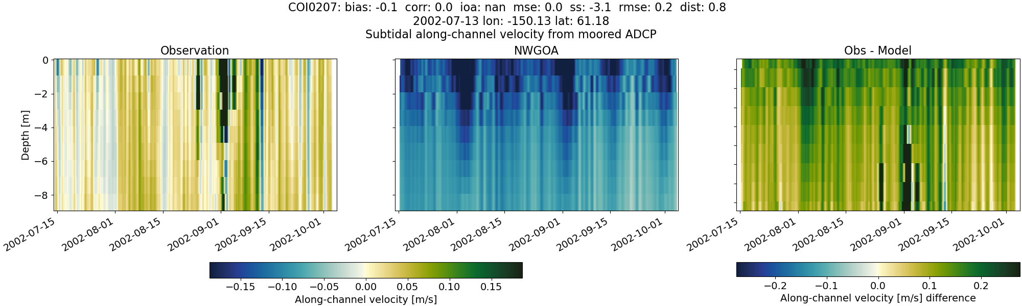
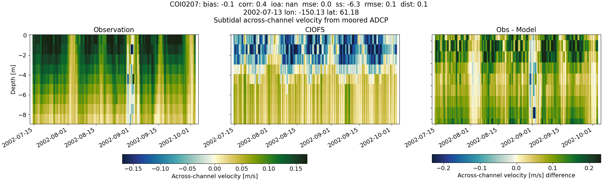
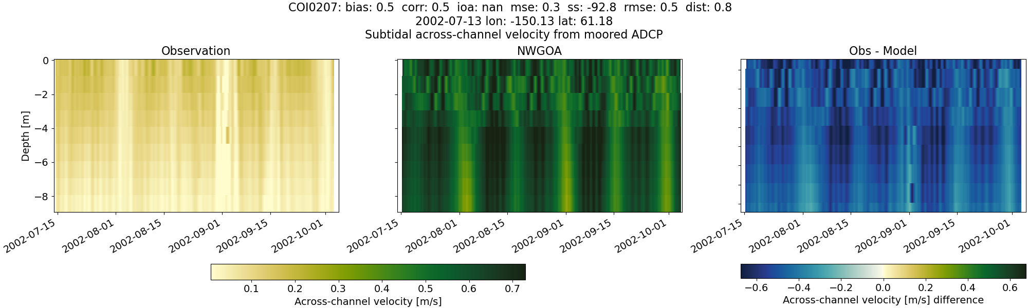
COI0207#
Tidal#
Horizontal speed#
CIOFS#
NWGOA#
Along-channel velocity#
CIOFS#
NWGOA#
Across-channel velocity#
CIOFS#
NWGOA#
Subtidal#
Horizontal speed#
CIOFS#
NWGOA#
Along-channel velocity#
CIOFS#
NWGOA#
Across-channel velocity#
CIOFS#
NWGOA#
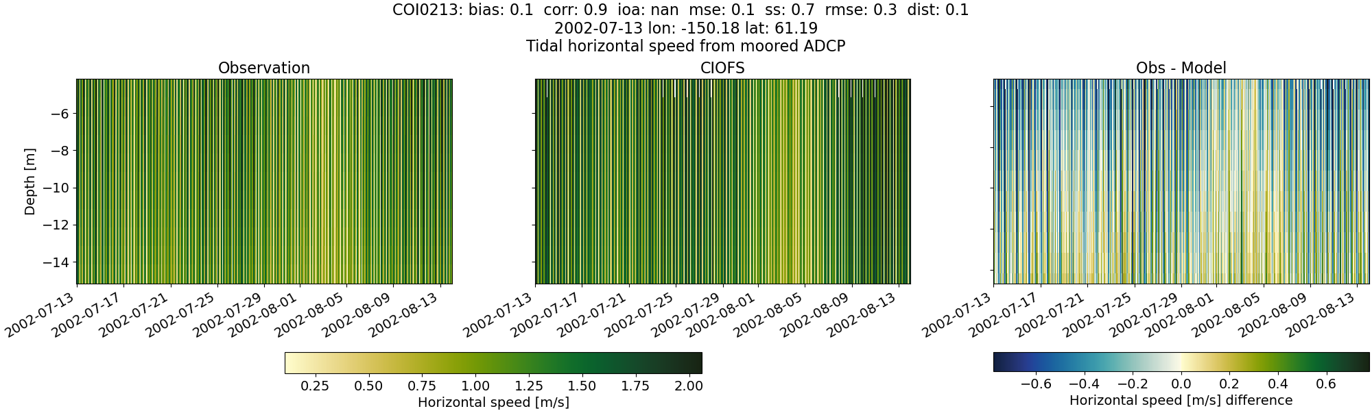
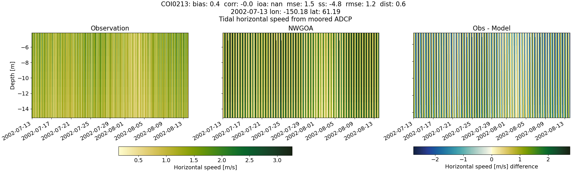
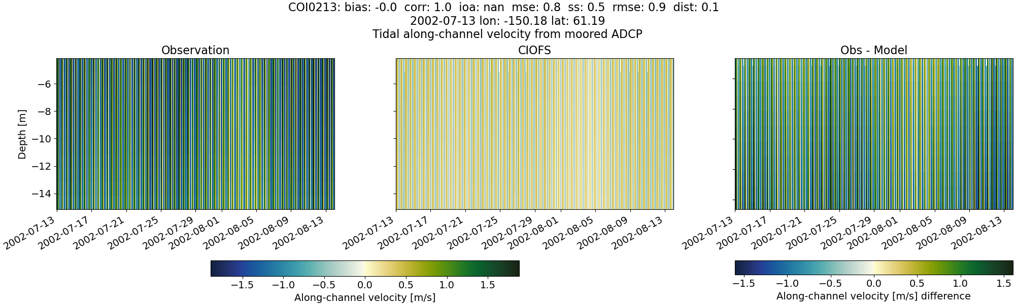
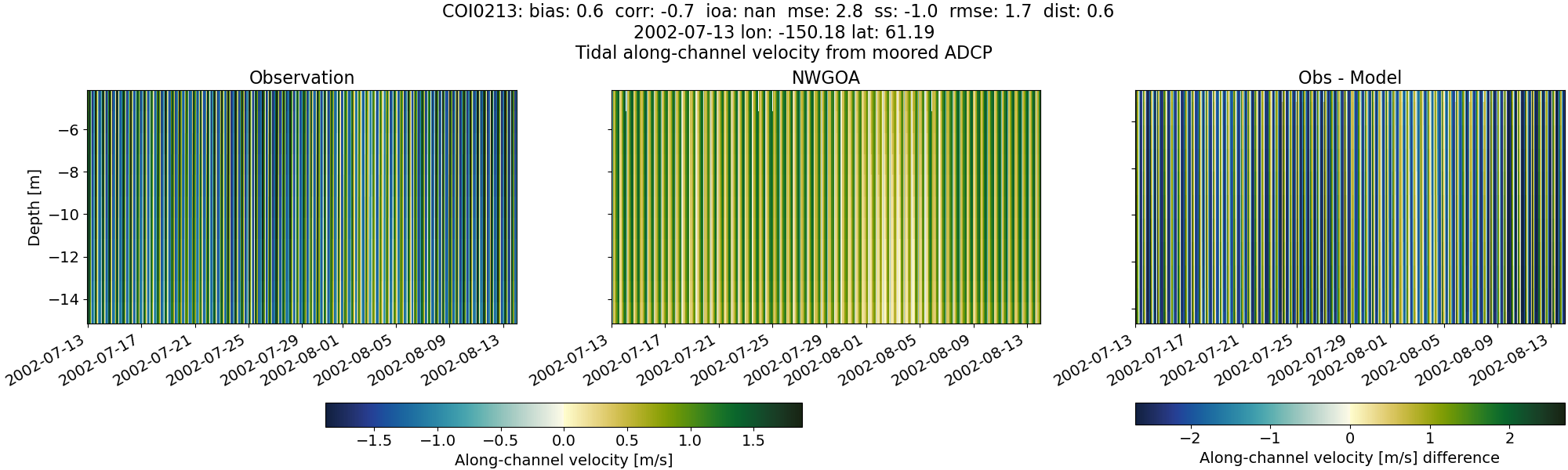
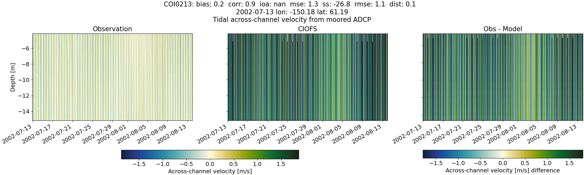
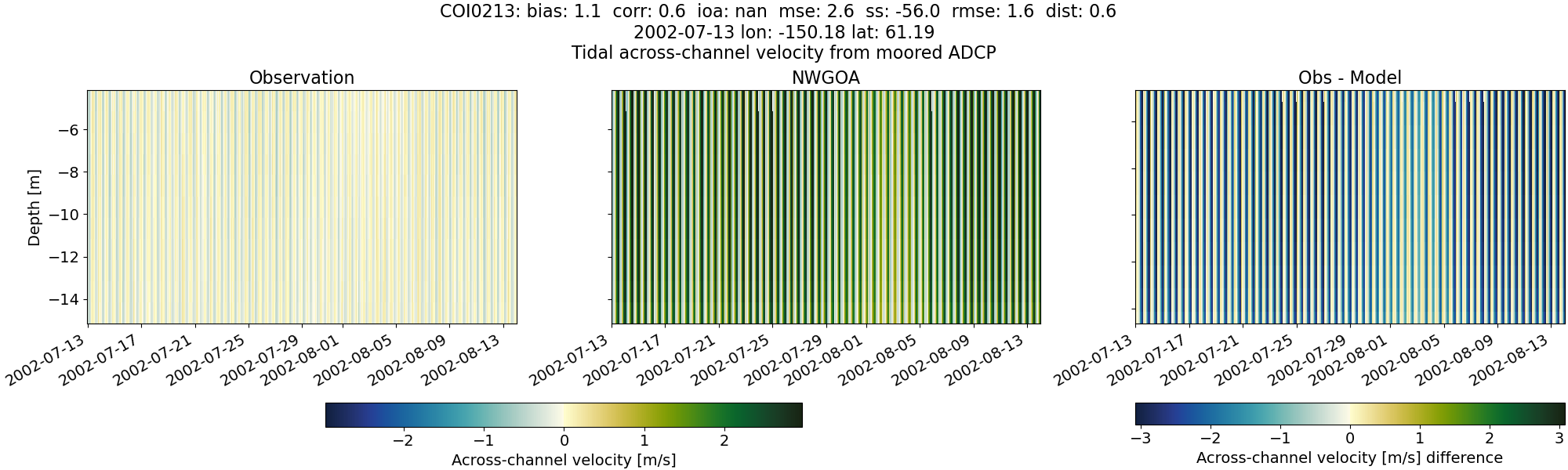
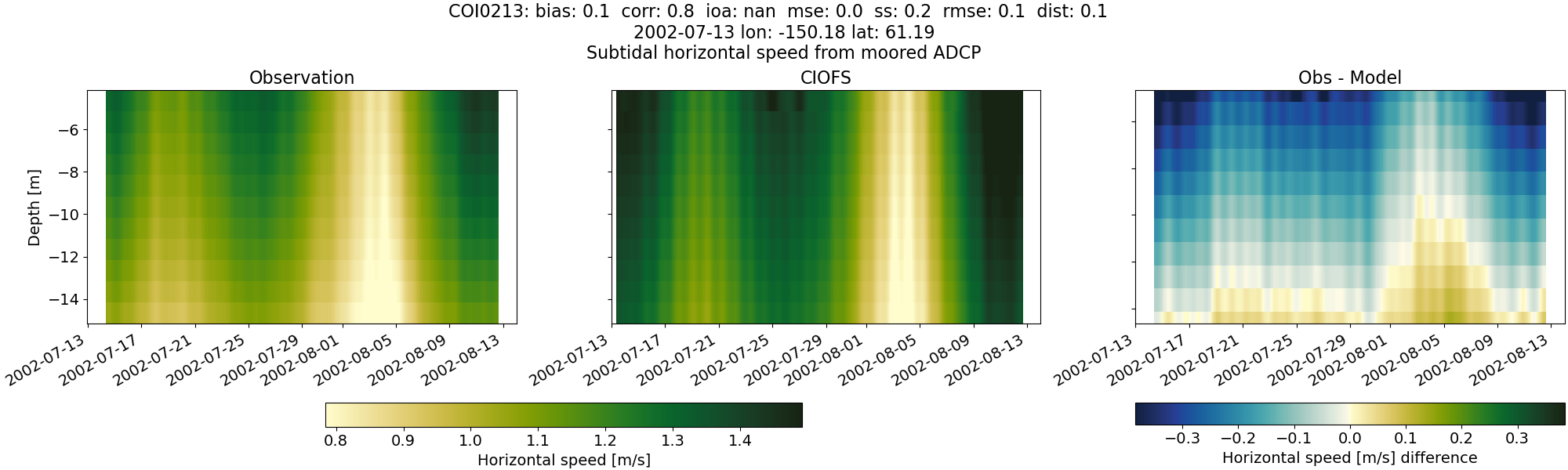
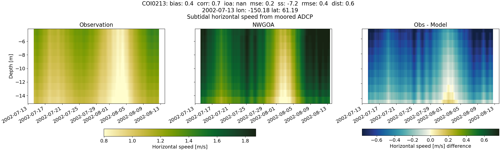
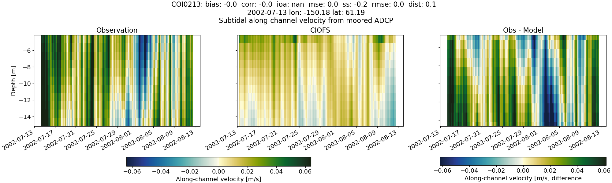
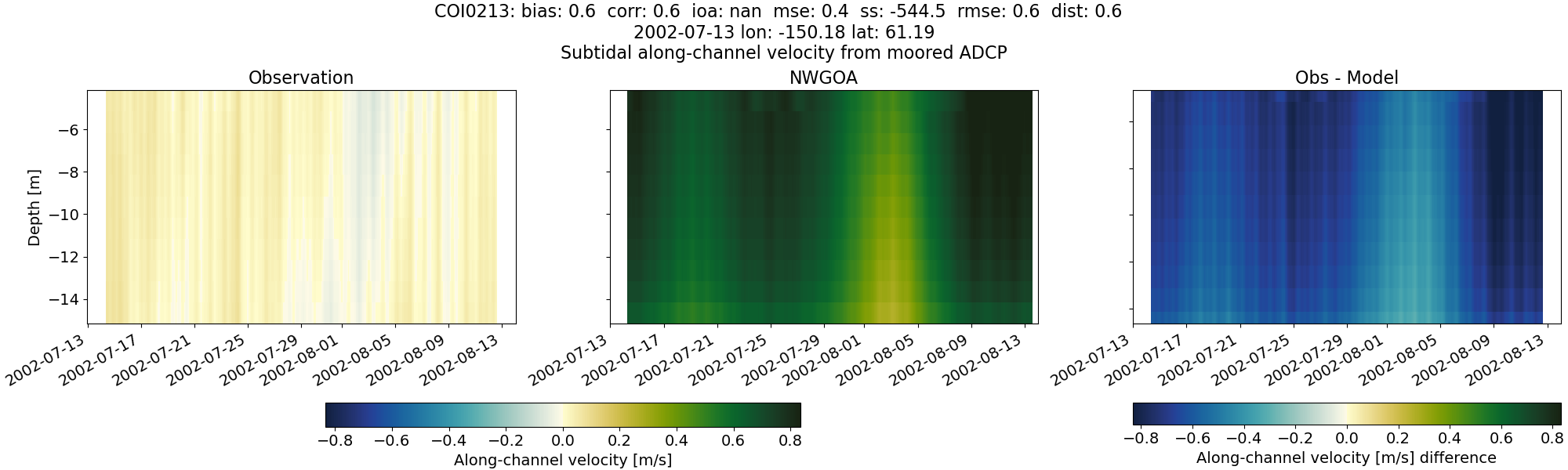
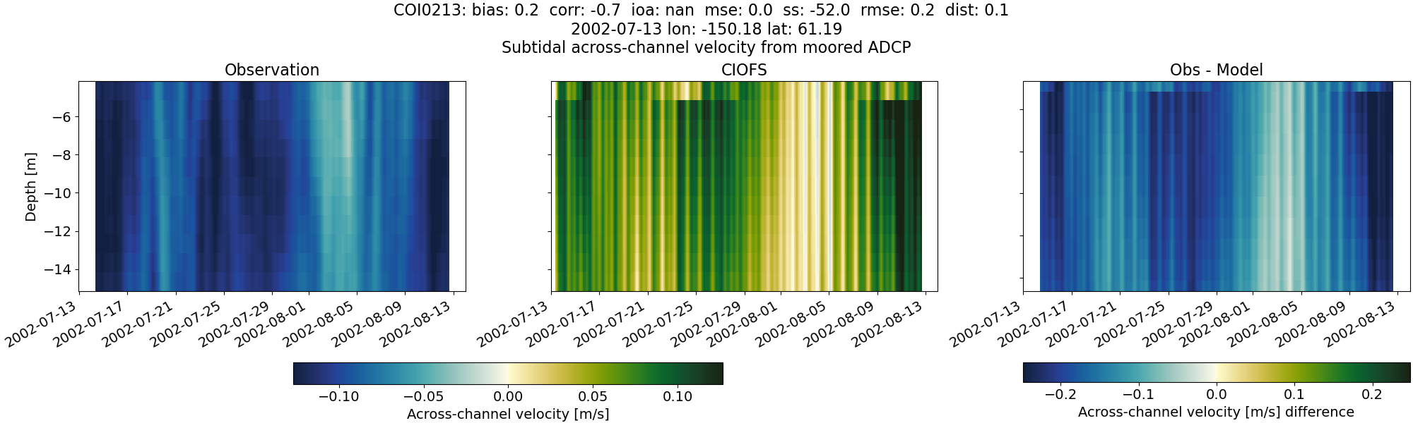
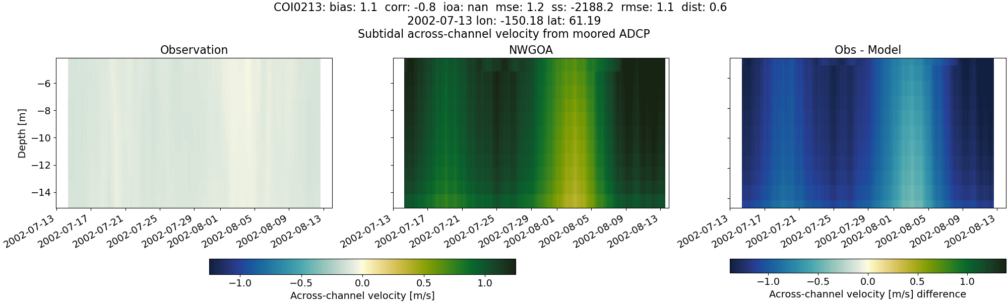
COI0213#
Tidal#
Horizontal speed#
CIOFS#
NWGOA#
Along-channel velocity#
CIOFS#
NWGOA#
Across-channel velocity#
CIOFS#
NWGOA#
Subtidal#
Horizontal speed#
CIOFS#
NWGOA#
Along-channel velocity#
CIOFS#
NWGOA#
Across-channel velocity#
CIOFS#
NWGOA#
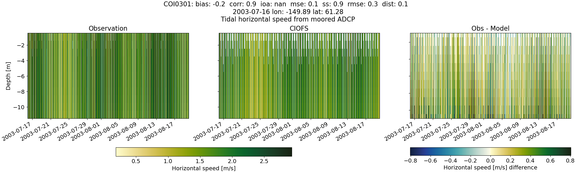
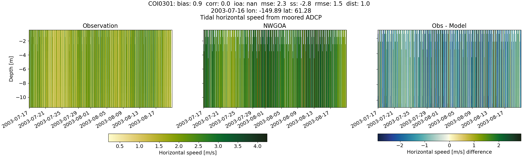
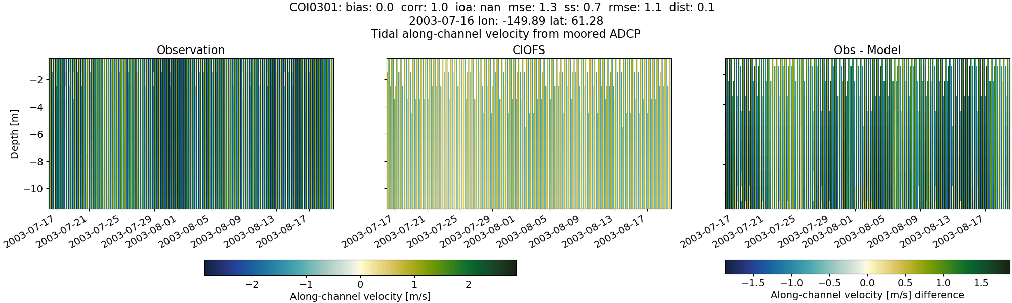
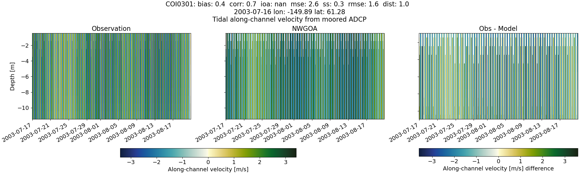
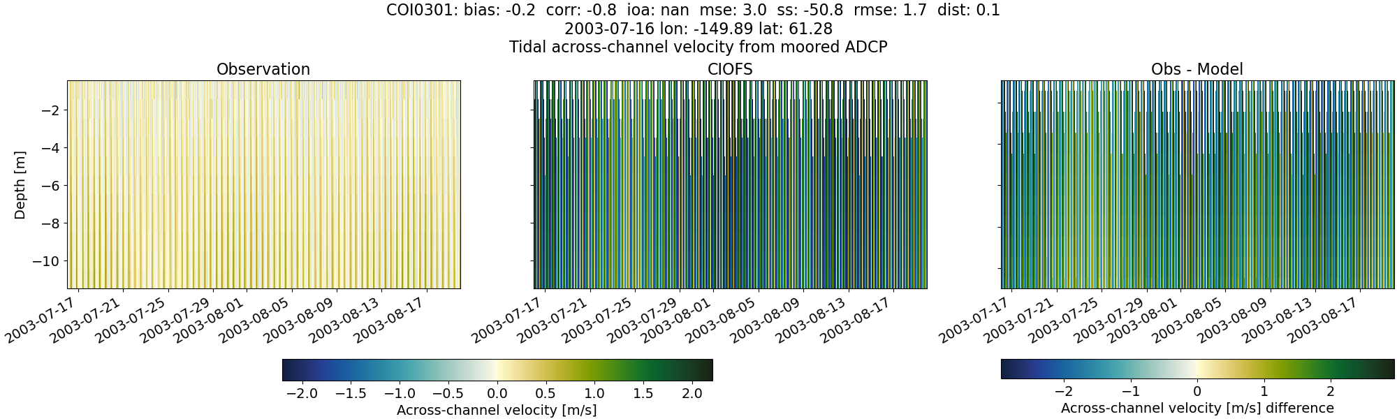
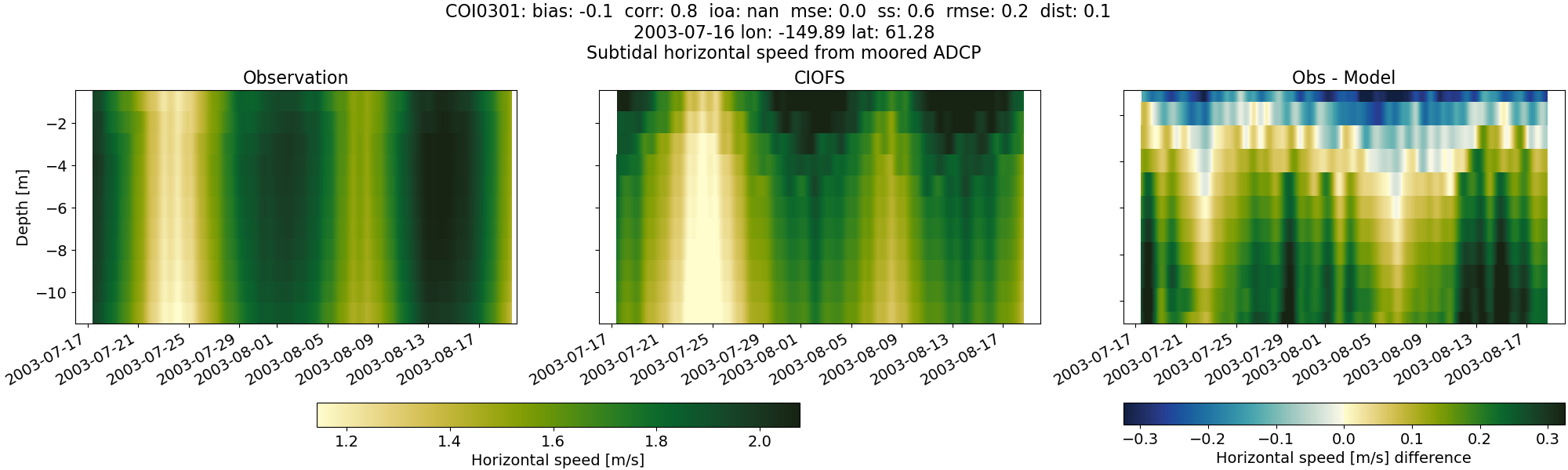
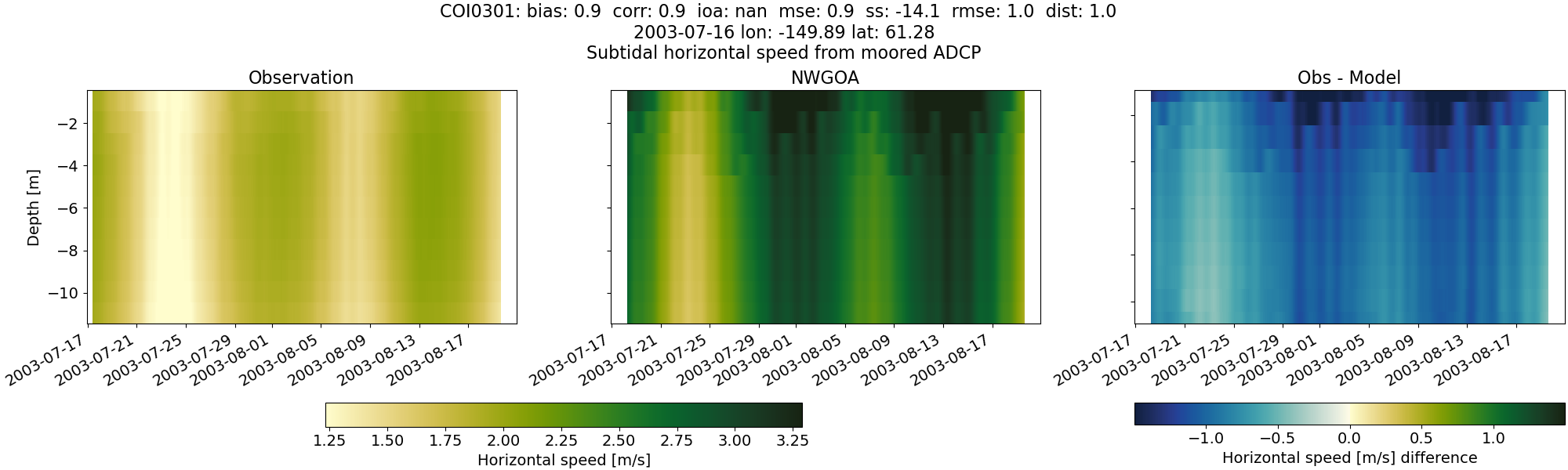
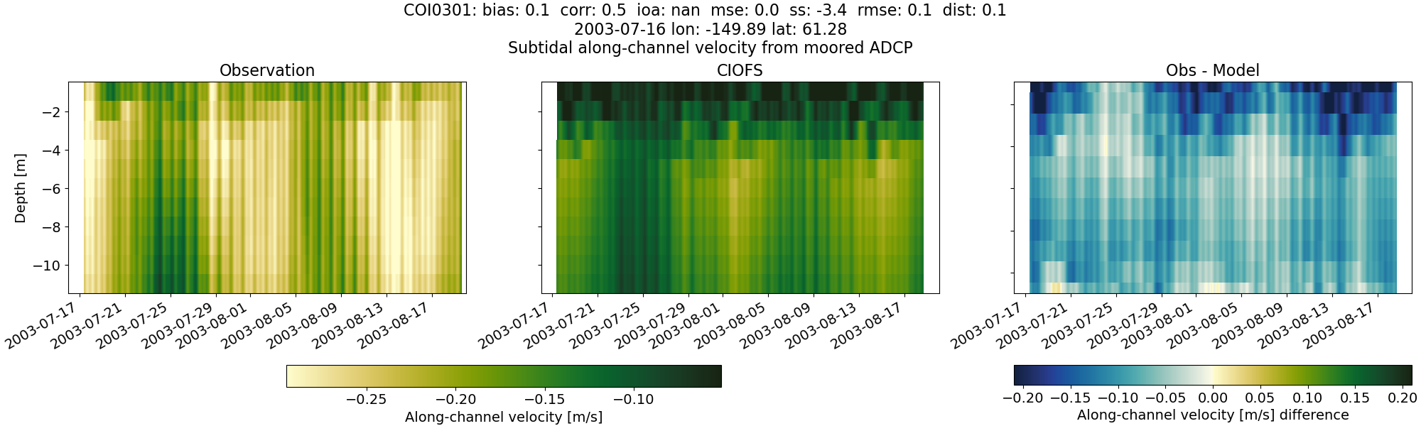
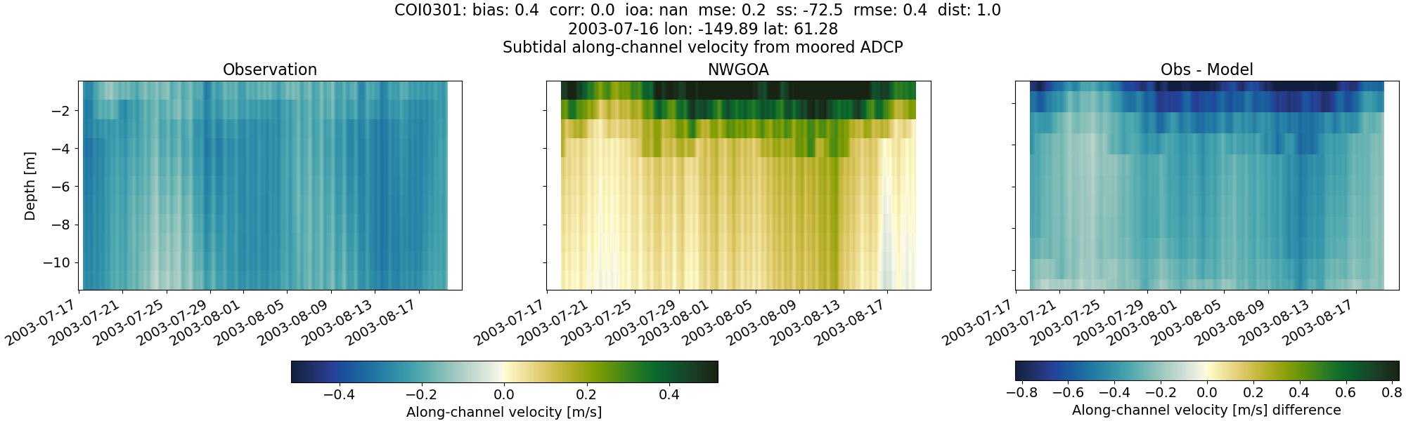
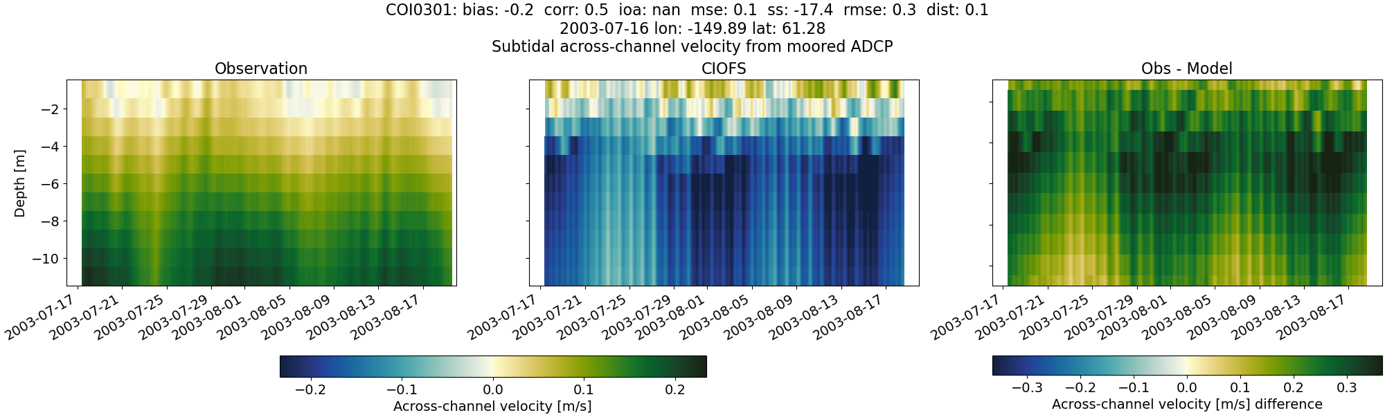
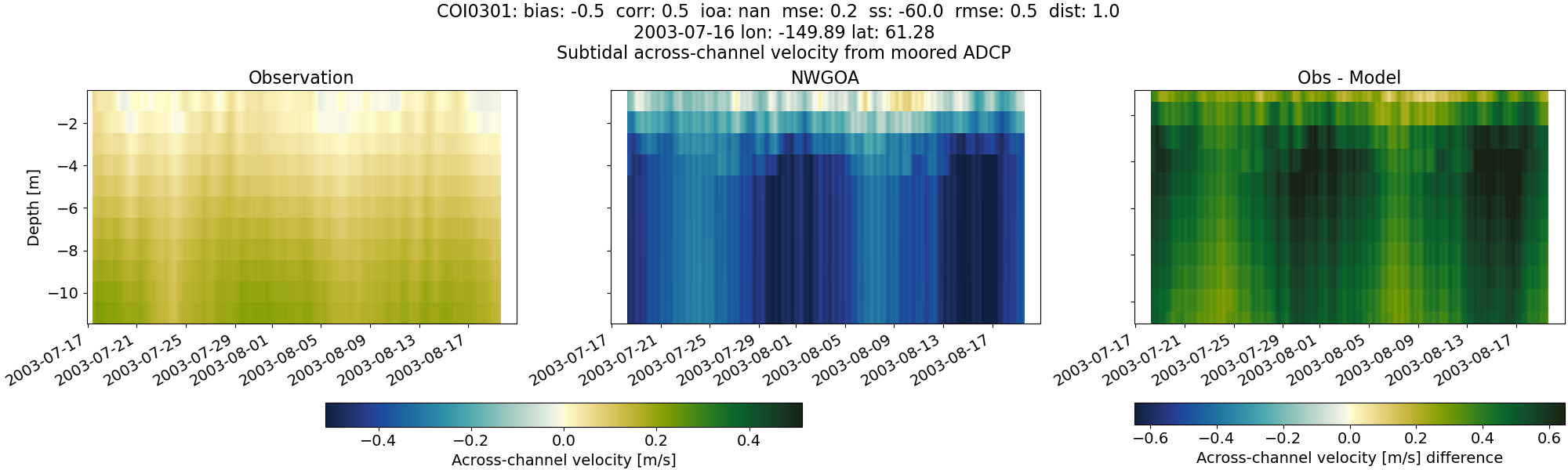
COI0301#
Tidal#
Horizontal speed#
CIOFS#
NWGOA#
Along-channel velocity#
CIOFS#
NWGOA#
Across-channel velocity#
CIOFS#
NWGOA#

Subtidal#
Horizontal speed#
CIOFS#
NWGOA#
Along-channel velocity#
CIOFS#
NWGOA#
Across-channel velocity#
CIOFS#
NWGOA#
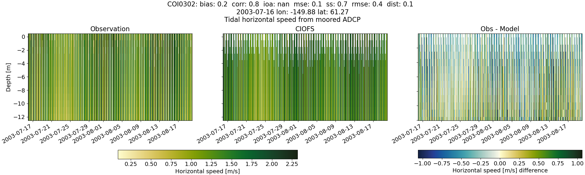
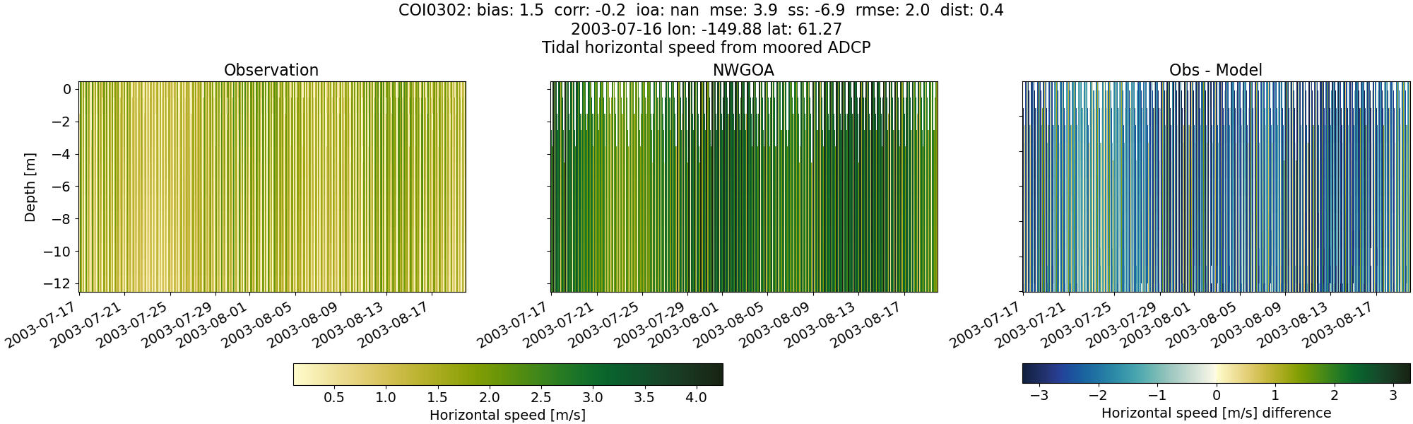
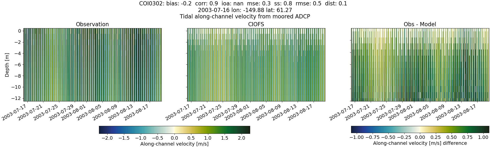
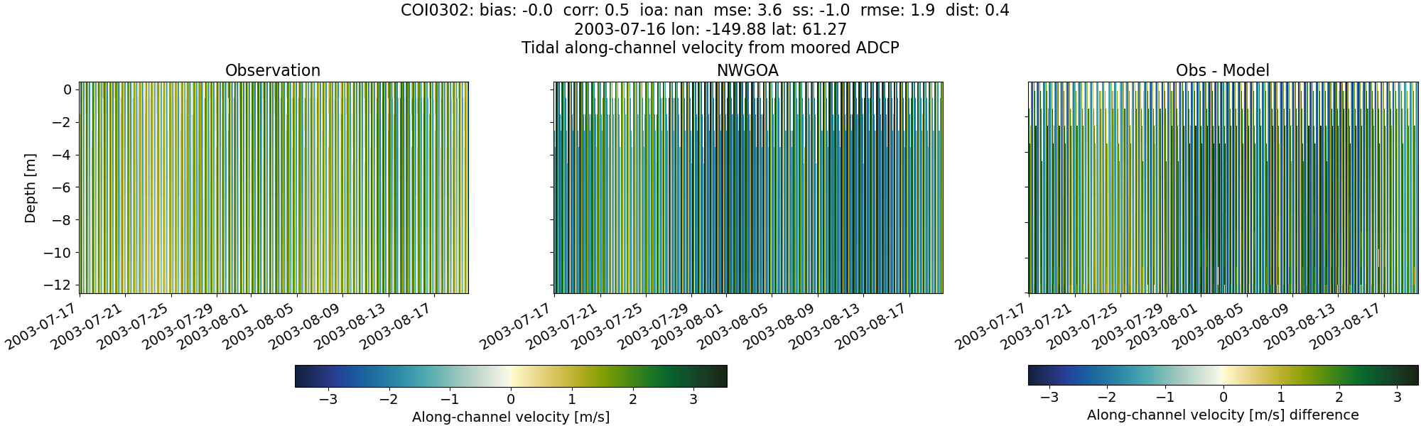
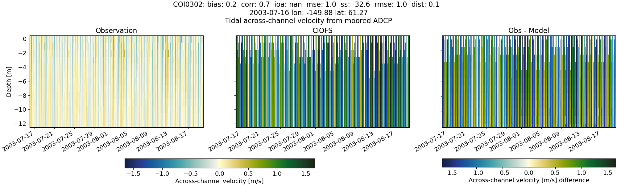
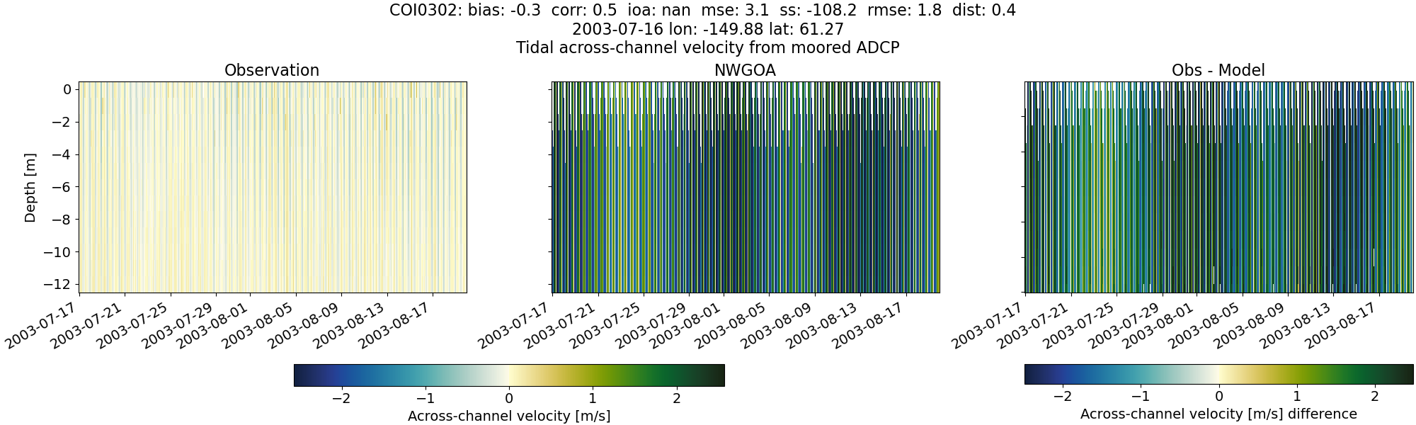
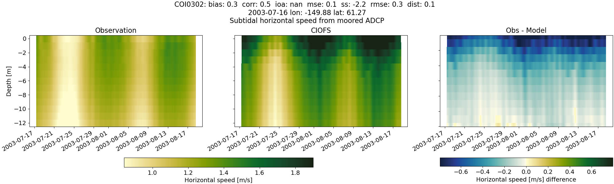
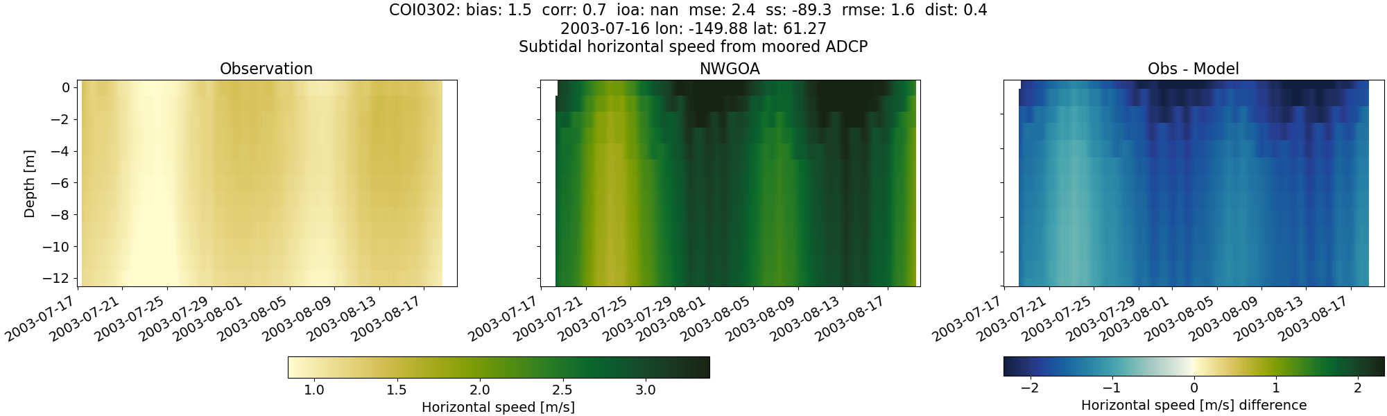
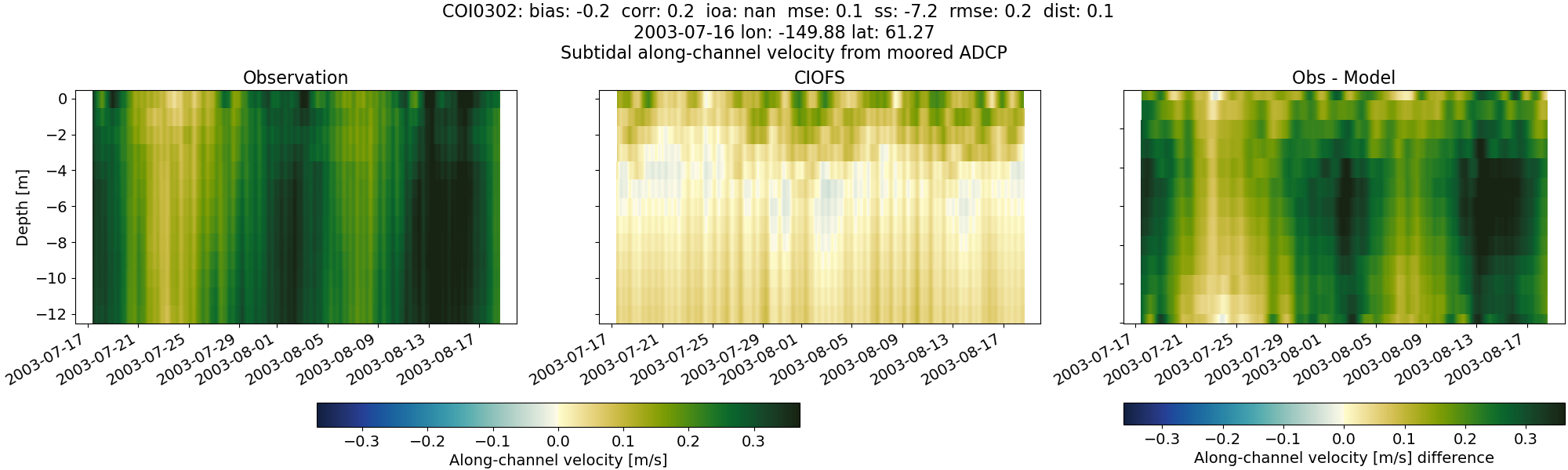
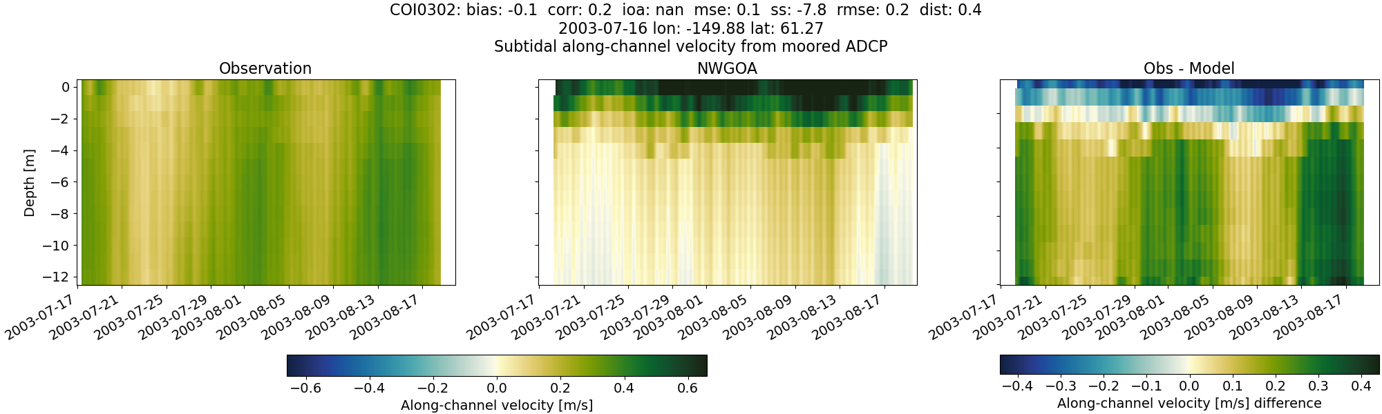
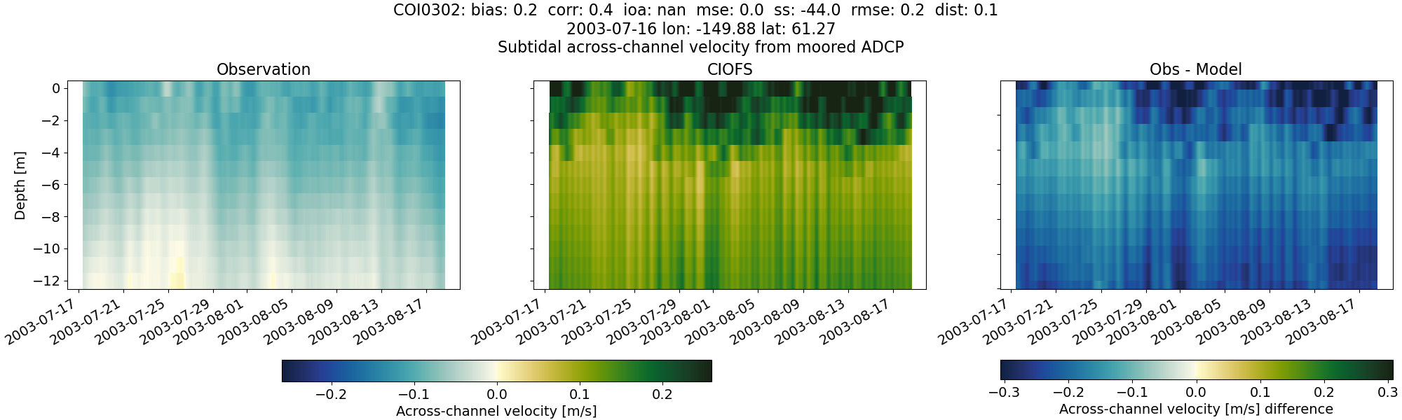
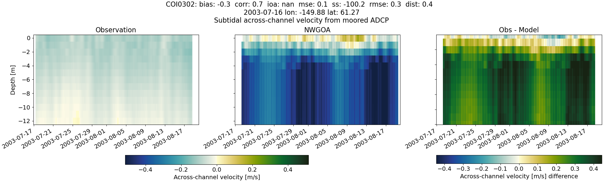
COI0302#
Tidal#
Horizontal speed#
CIOFS#
NWGOA#
Along-channel velocity#
CIOFS#
NWGOA#
Across-channel velocity#
CIOFS#
NWGOA#
Subtidal#
Horizontal speed#
CIOFS#
NWGOA#
Along-channel velocity#
CIOFS#
NWGOA#
Across-channel velocity#
CIOFS#
NWGOA#
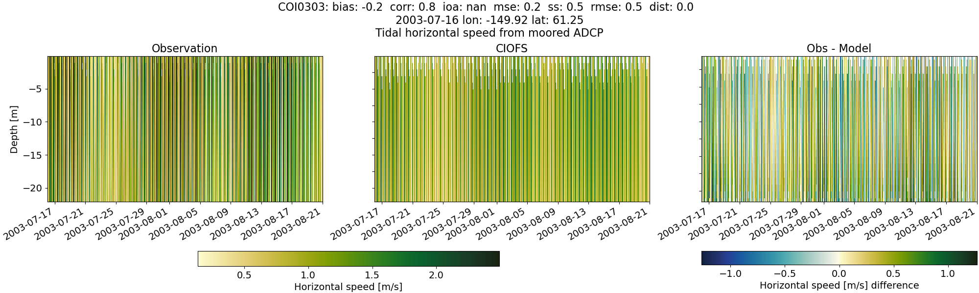
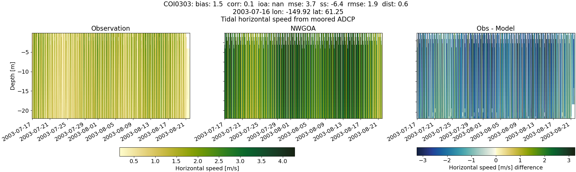
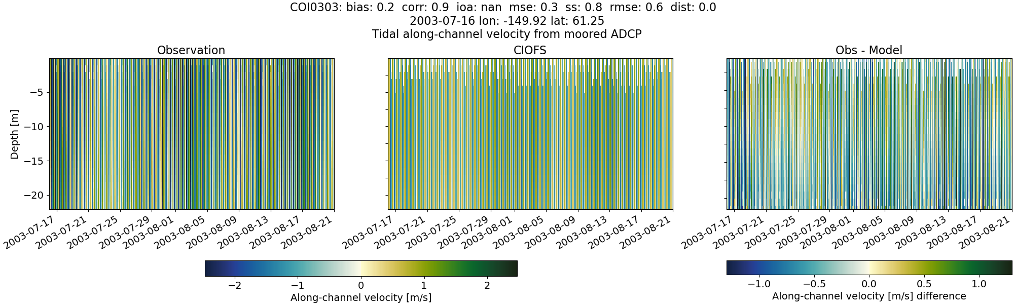
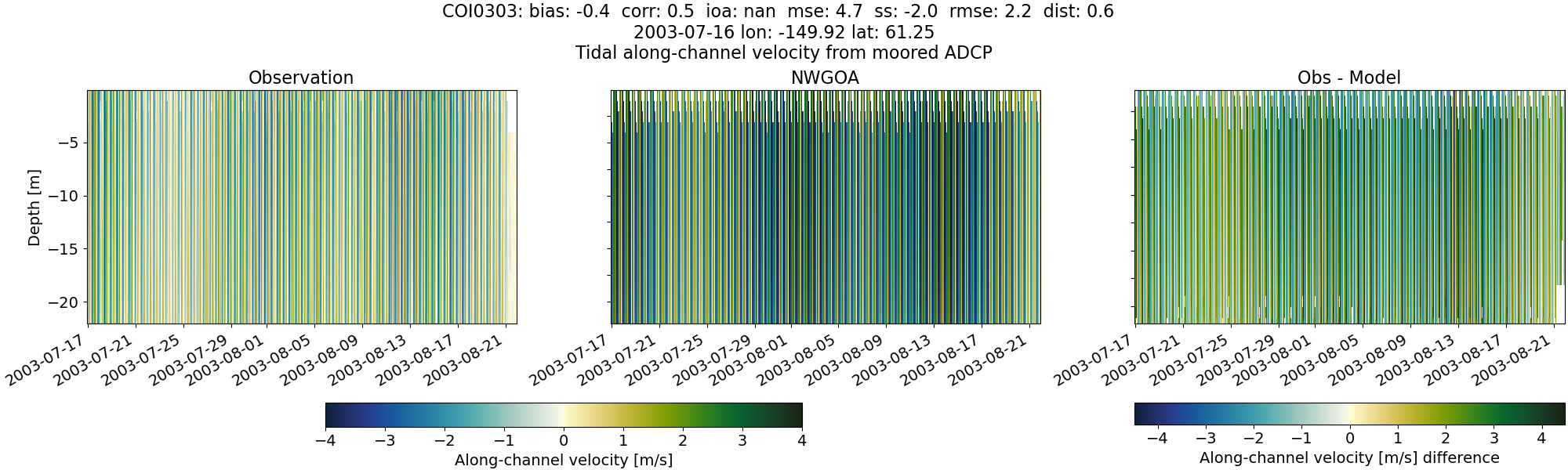
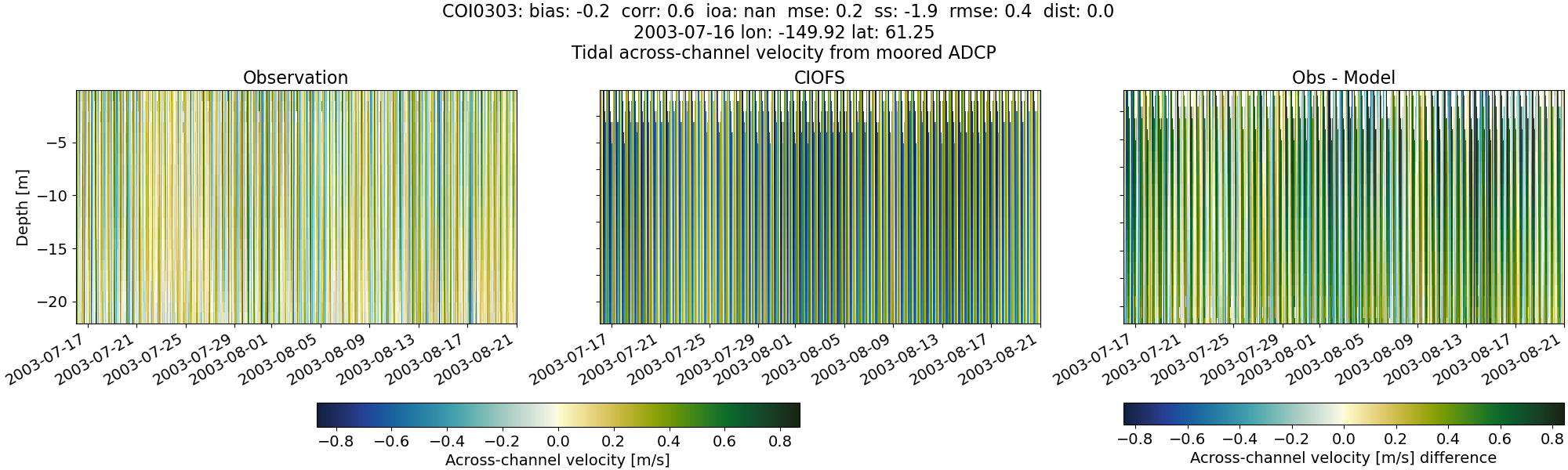
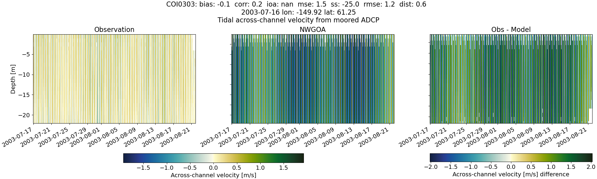
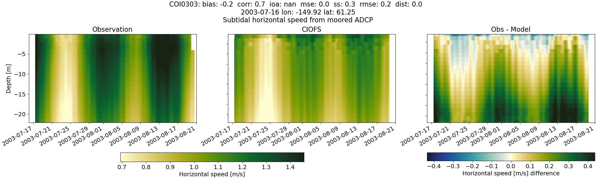
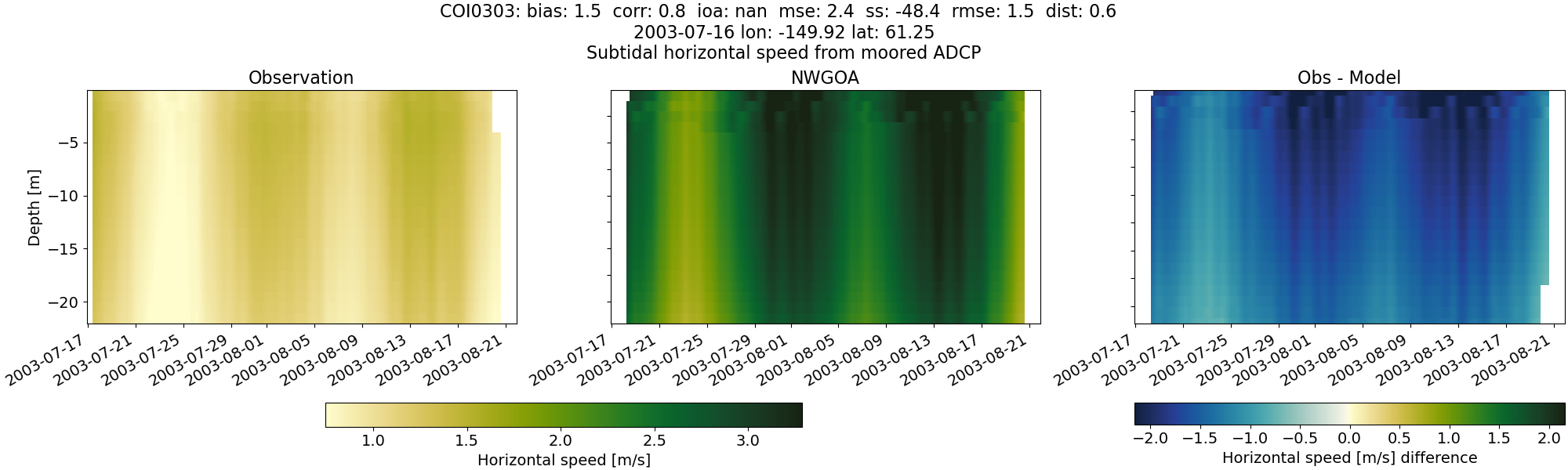
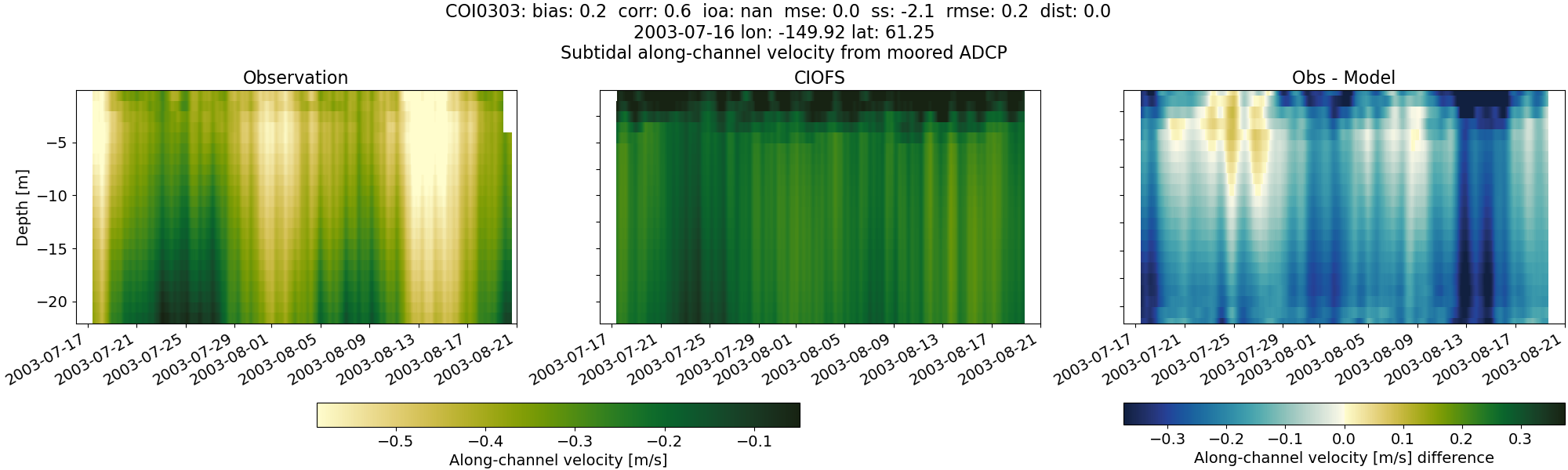
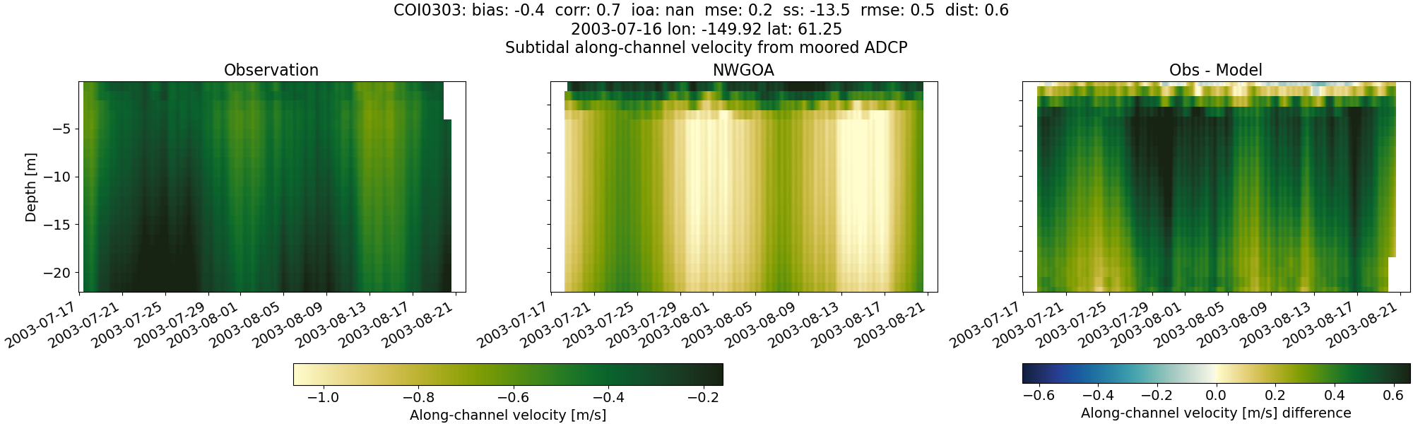
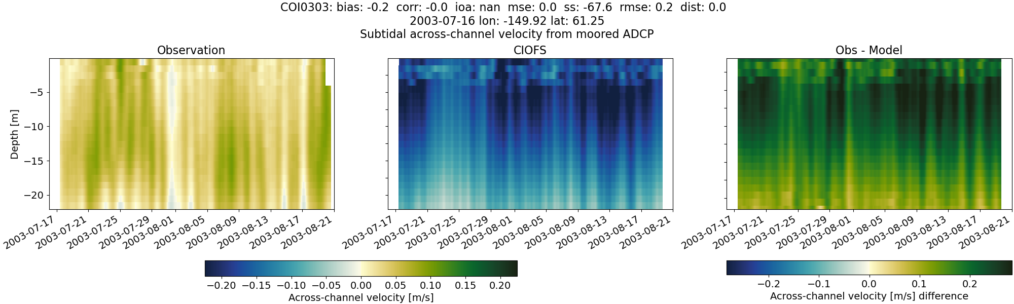
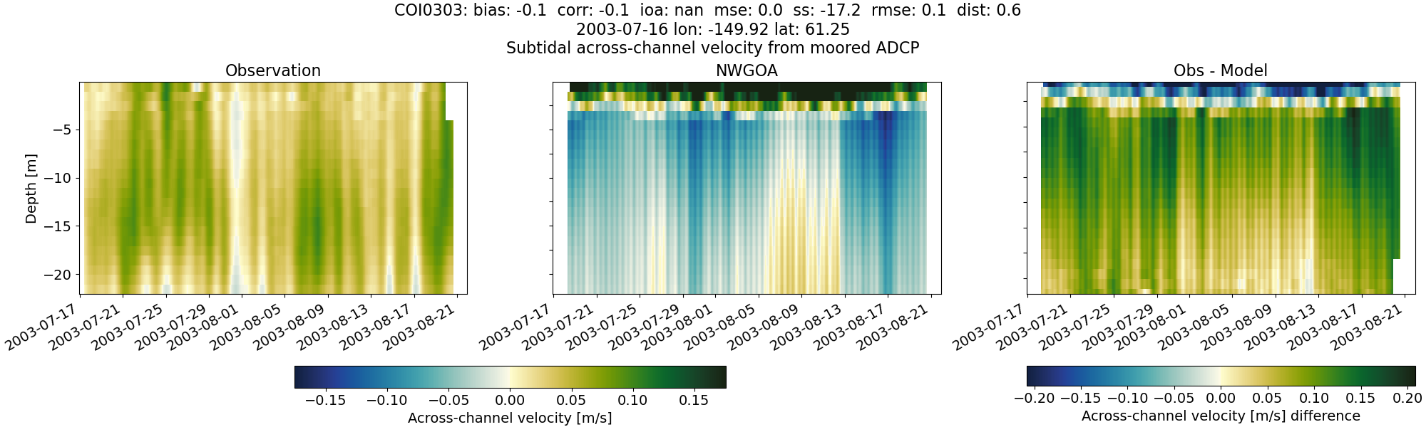
COI0303#
Tidal#
Horizontal speed#
CIOFS#
NWGOA#
Along-channel velocity#
CIOFS#
NWGOA#
Across-channel velocity#
CIOFS#
NWGOA#
Subtidal#
Horizontal speed#
CIOFS#
NWGOA#
Along-channel velocity#
CIOFS#
NWGOA#
Across-channel velocity#
CIOFS#
NWGOA#
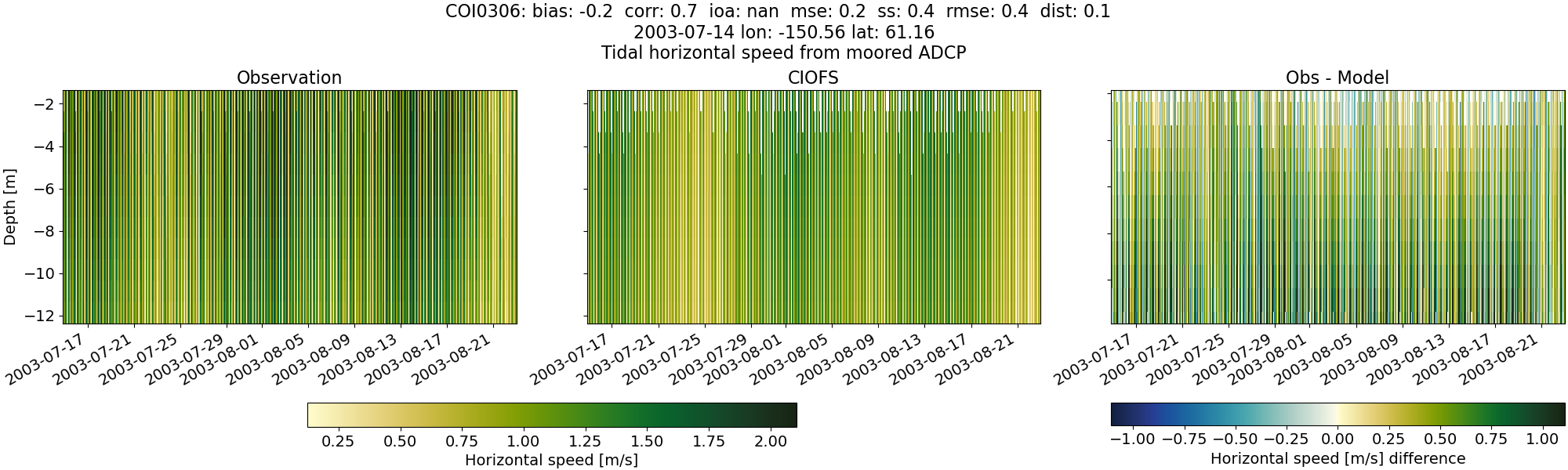
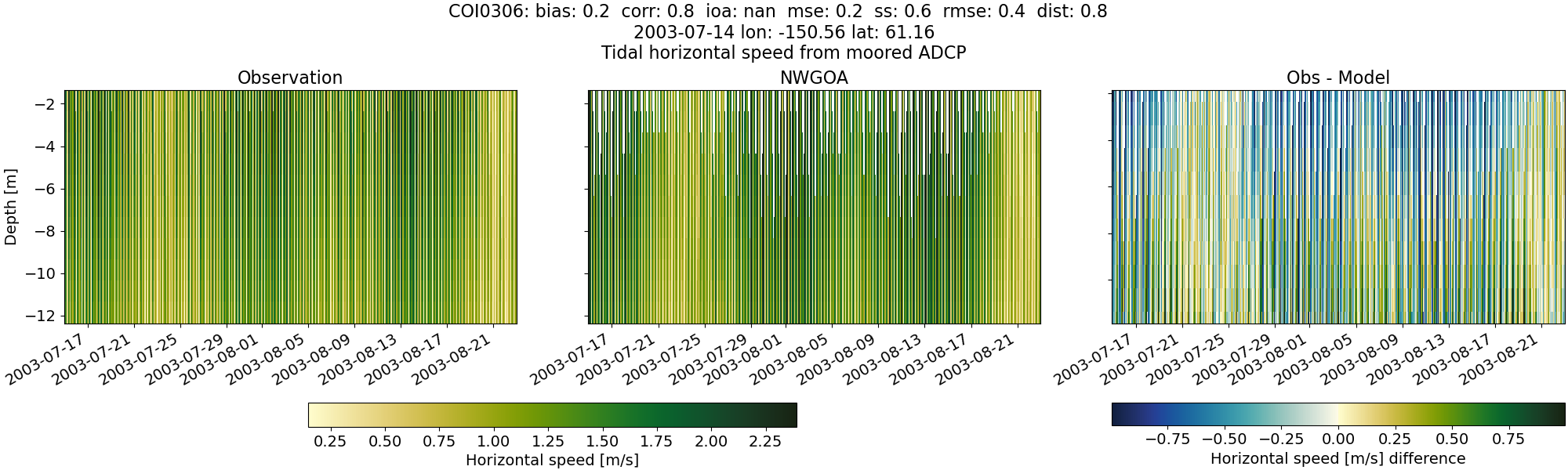
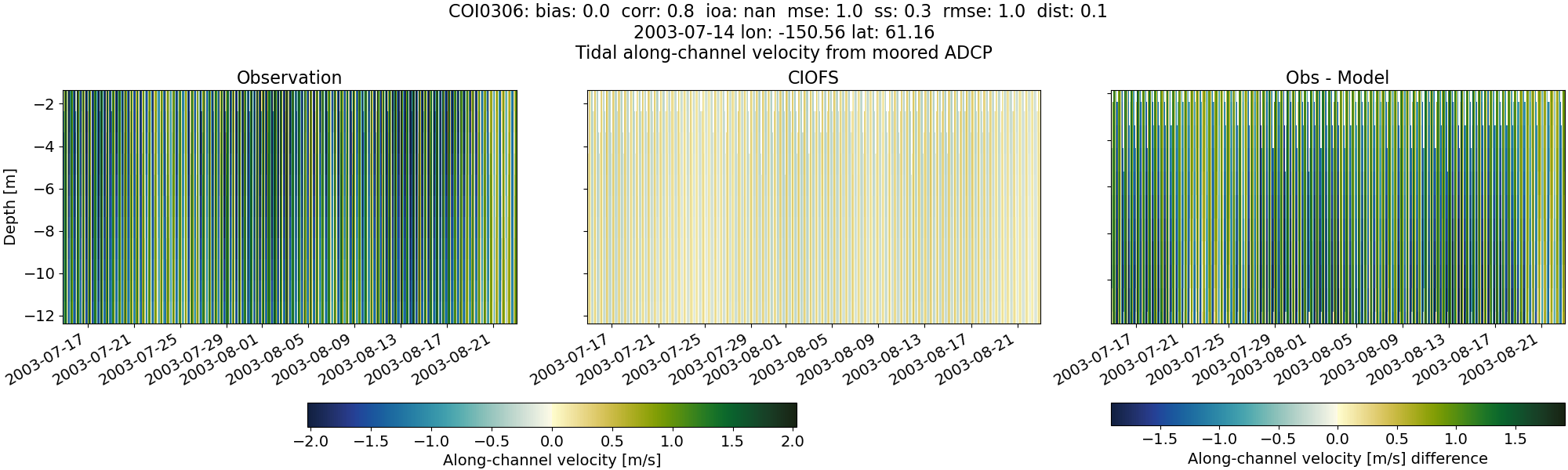
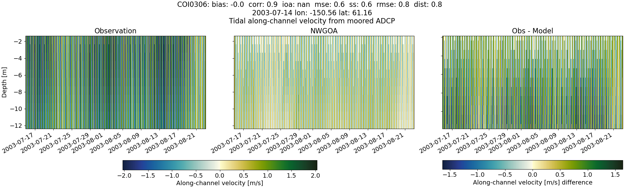
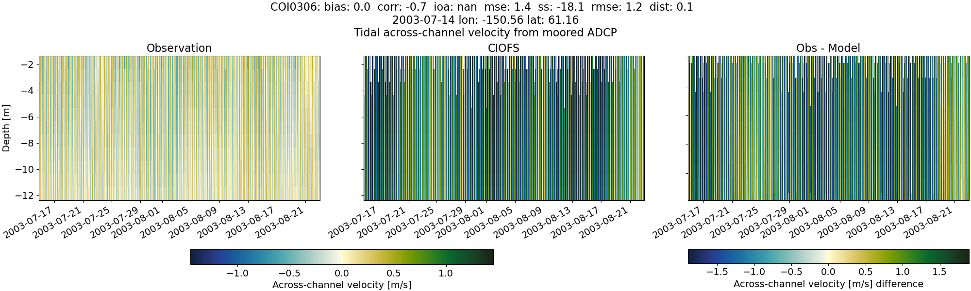
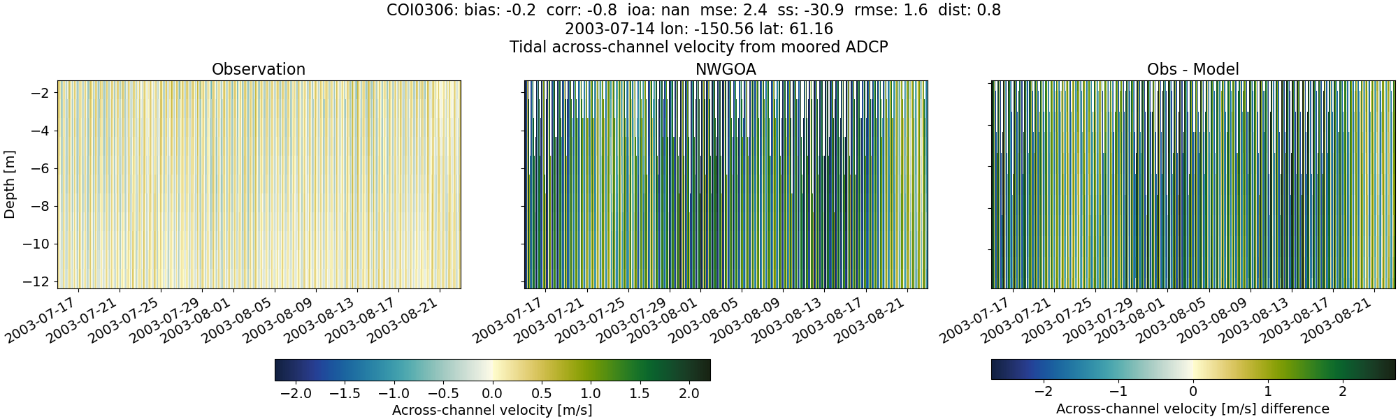
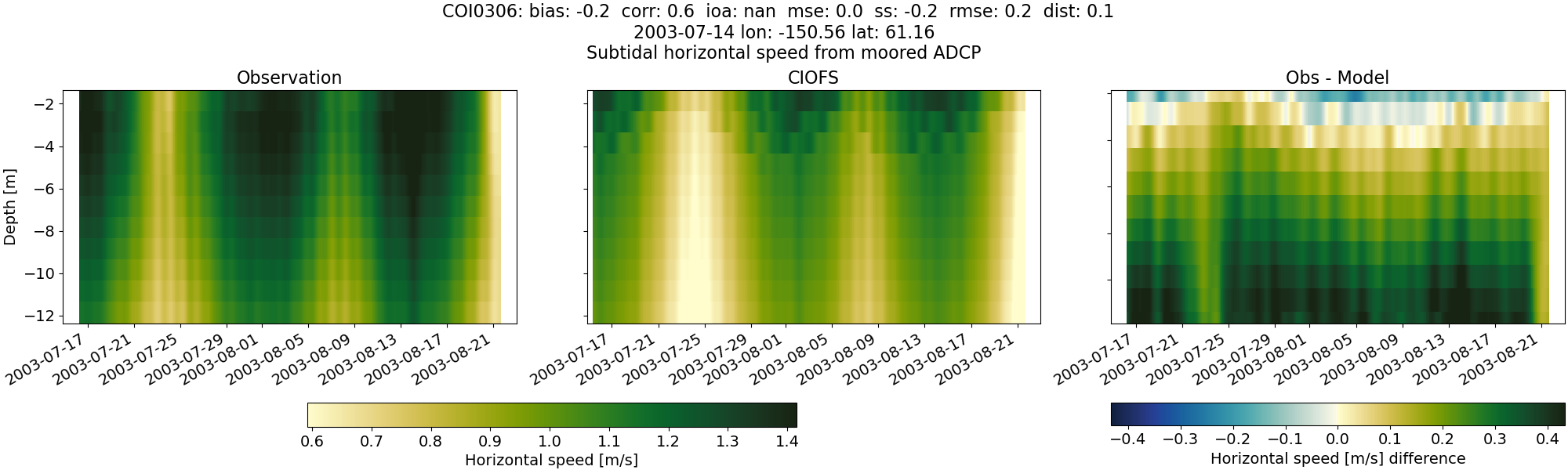
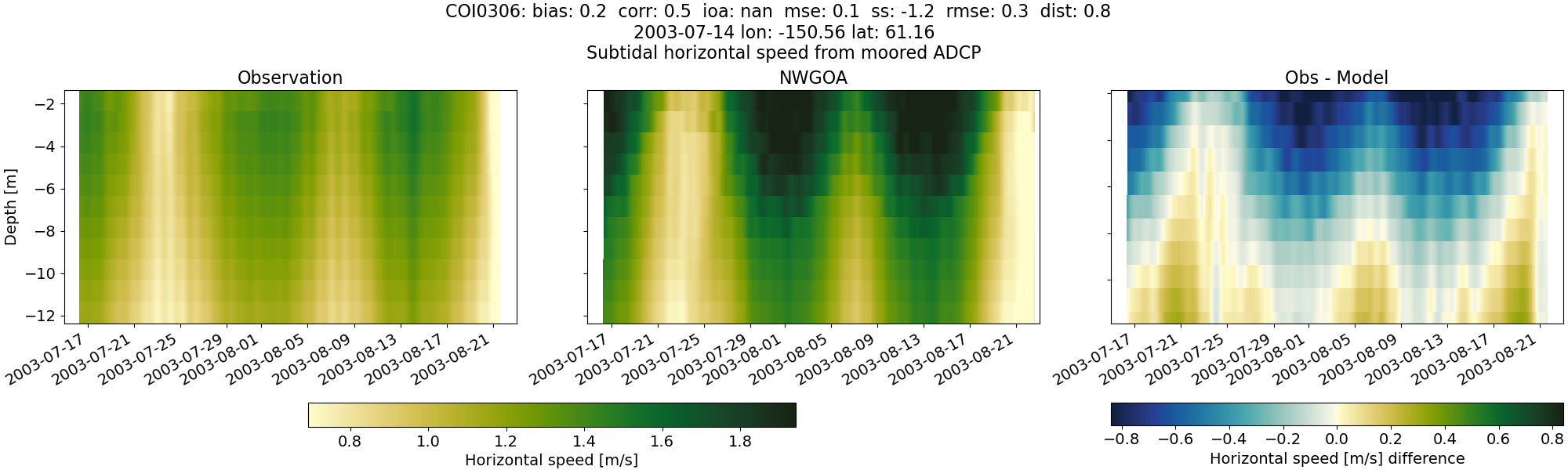
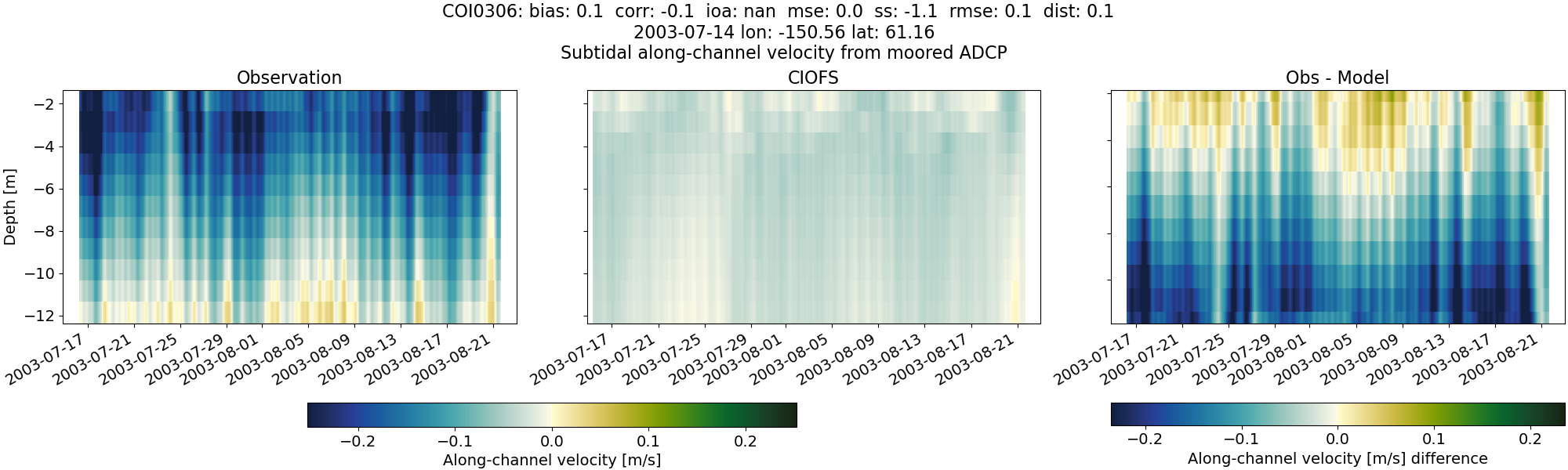
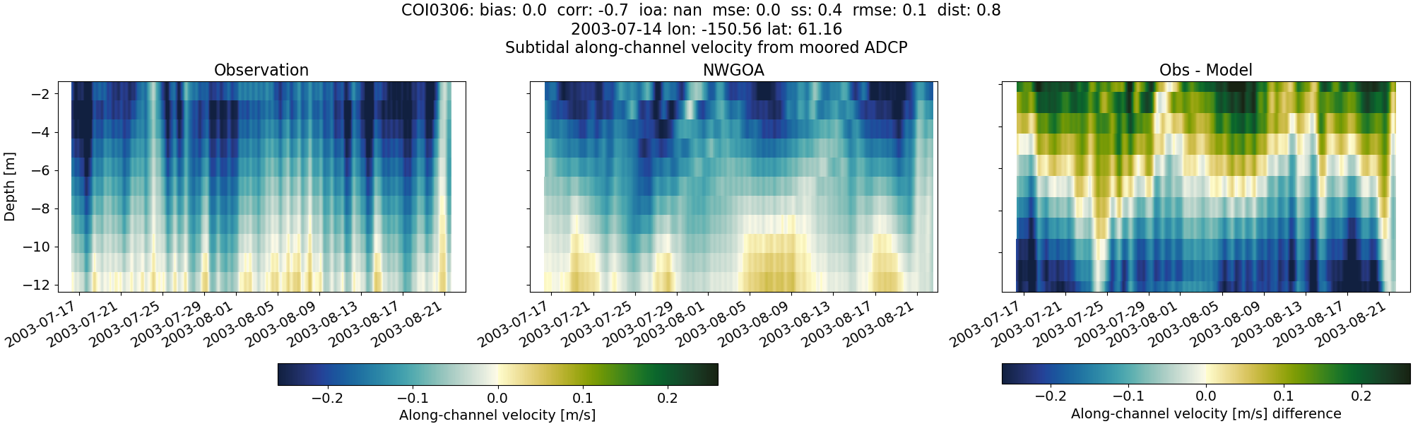
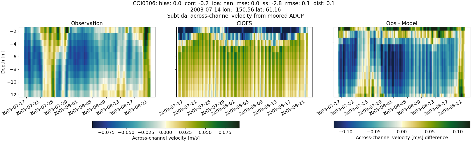
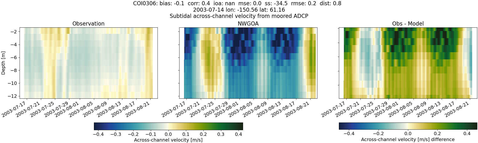
COI0306#
Tidal#
Horizontal speed#
CIOFS#
NWGOA#
Along-channel velocity#
CIOFS#
NWGOA#
Across-channel velocity#
CIOFS#
NWGOA#
Subtidal#
Horizontal speed#
CIOFS#
NWGOA#
Along-channel velocity#
CIOFS#
NWGOA#
Across-channel velocity#
CIOFS#
NWGOA#
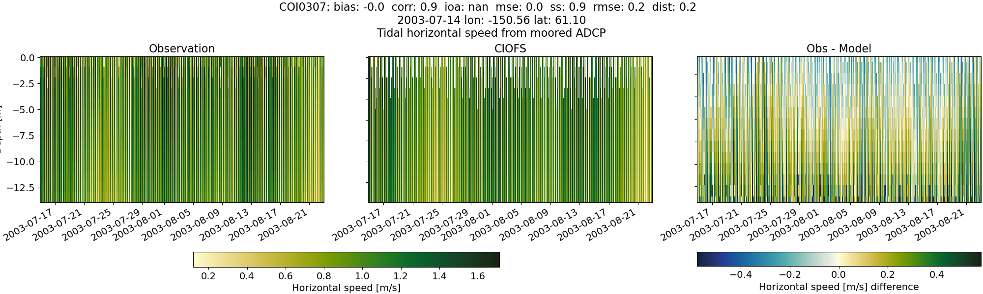
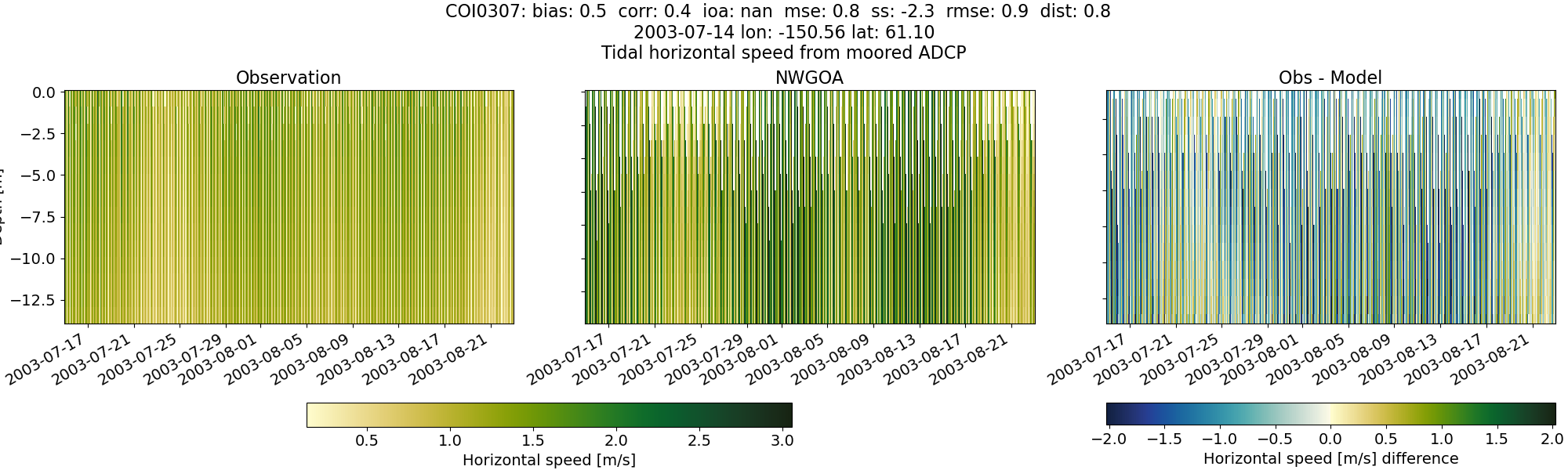
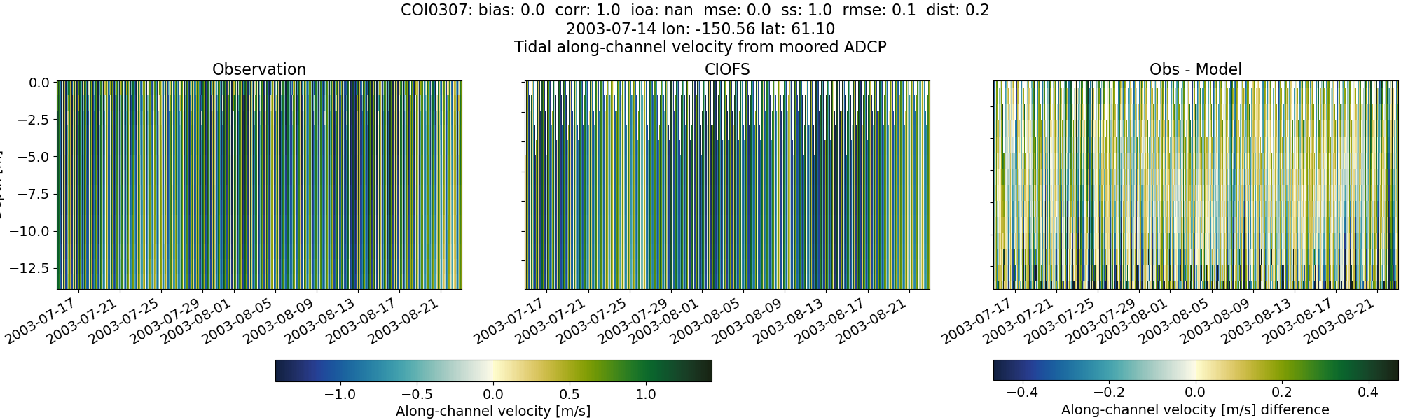
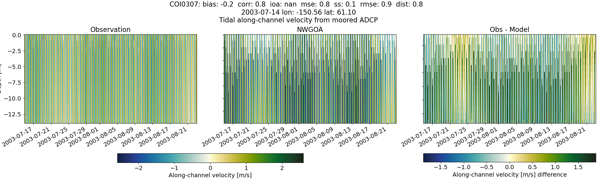
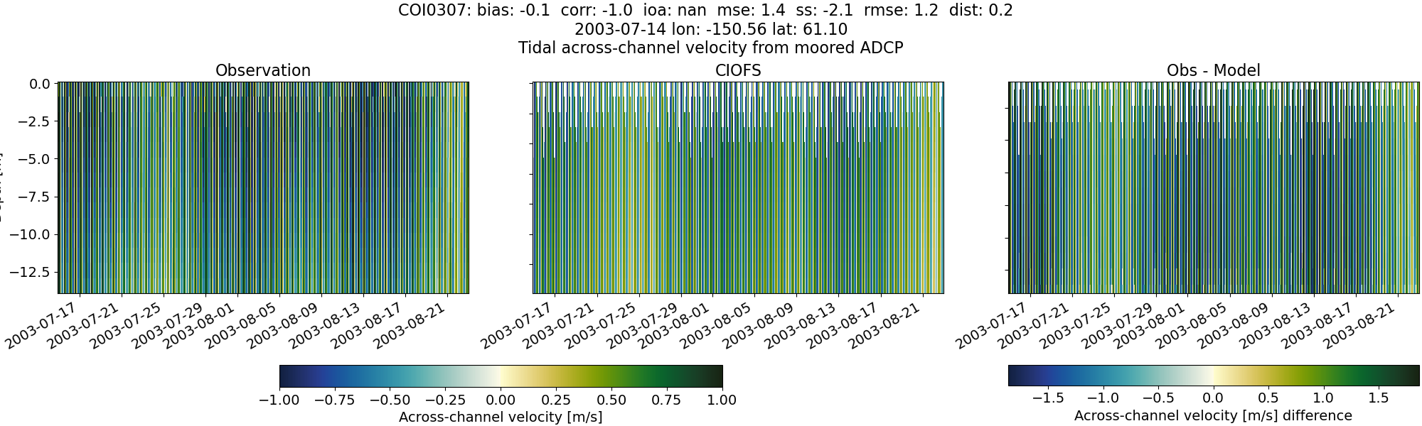
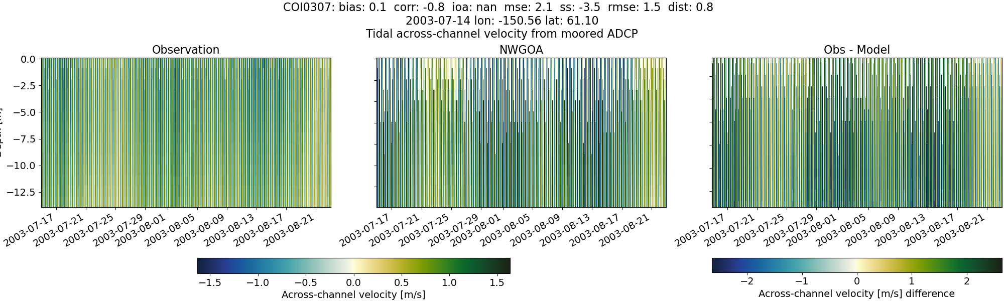
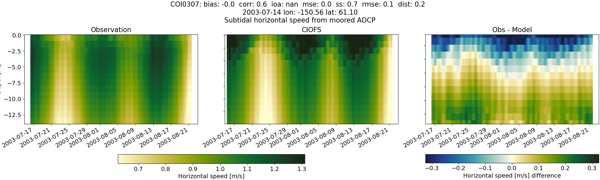
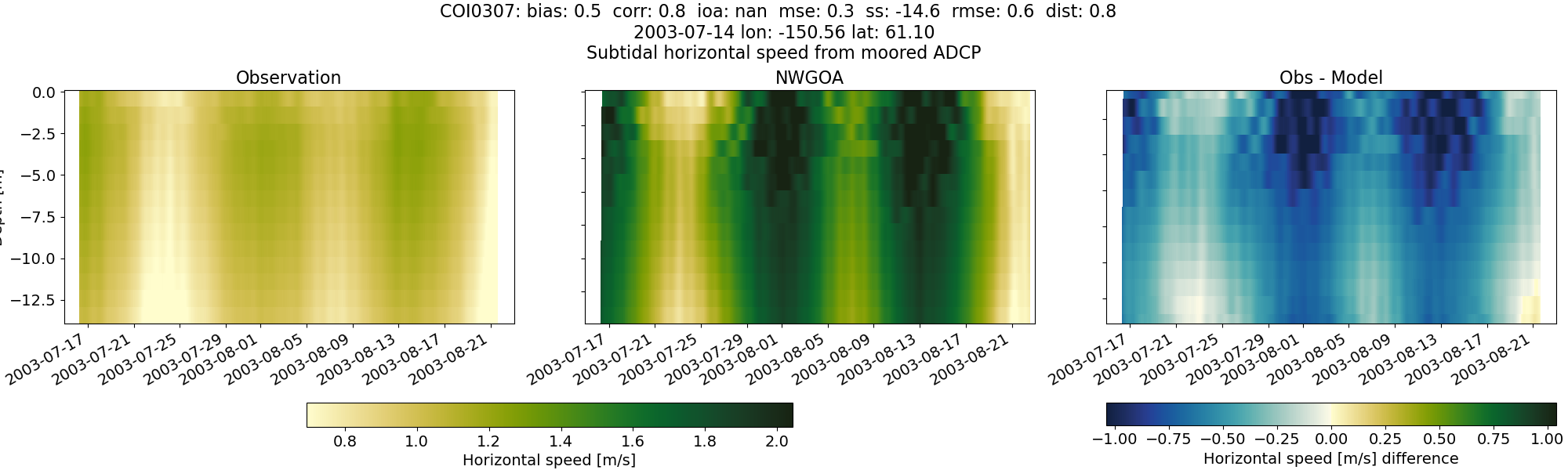
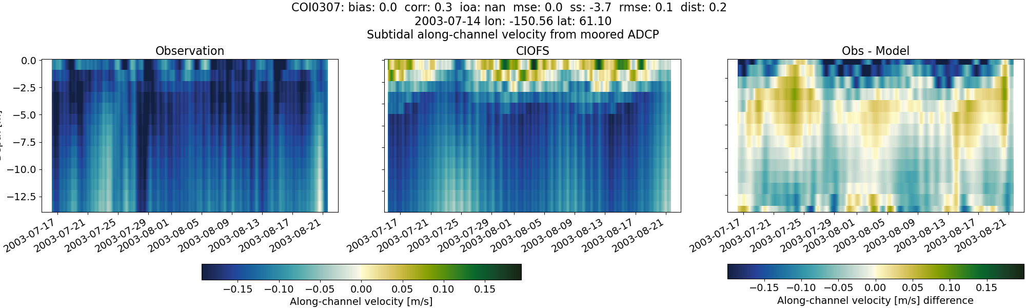
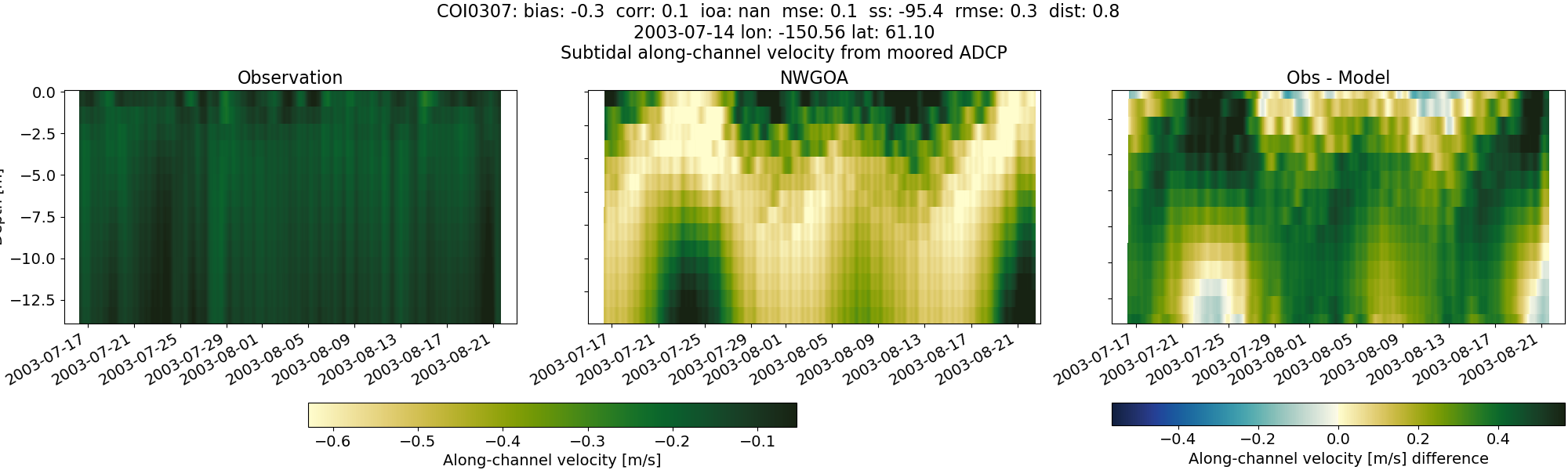
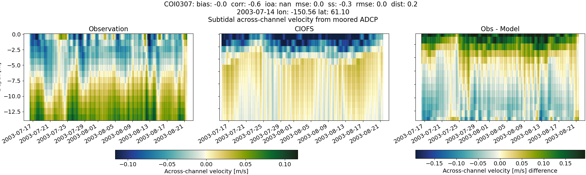
COI0307#
Tidal#
Horizontal speed#
CIOFS#
NWGOA#
Along-channel velocity#
CIOFS#
NWGOA#
Across-channel velocity#
CIOFS#
NWGOA#
Subtidal#
Horizontal speed#
CIOFS#
NWGOA#
Along-channel velocity#
CIOFS#
NWGOA#
Across-channel velocity#
CIOFS#
NWGOA#

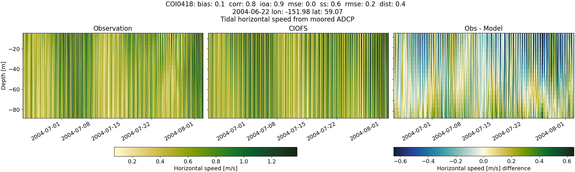
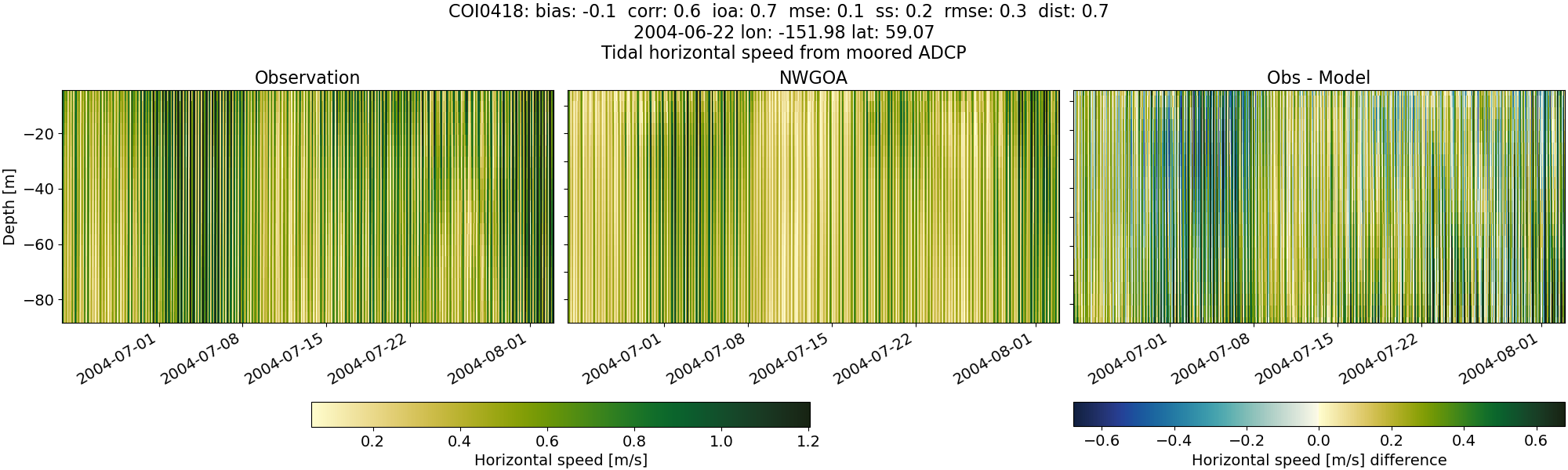
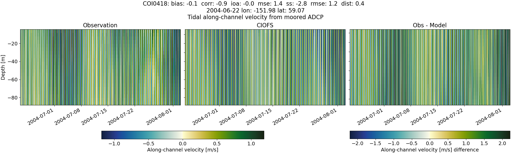
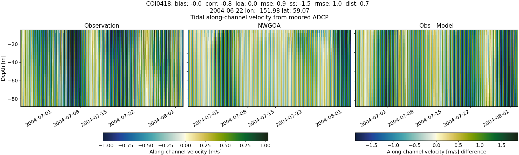
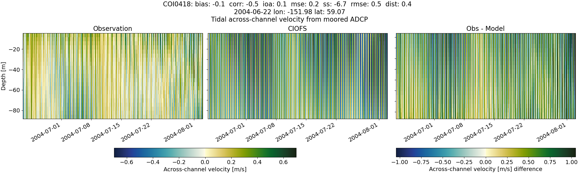
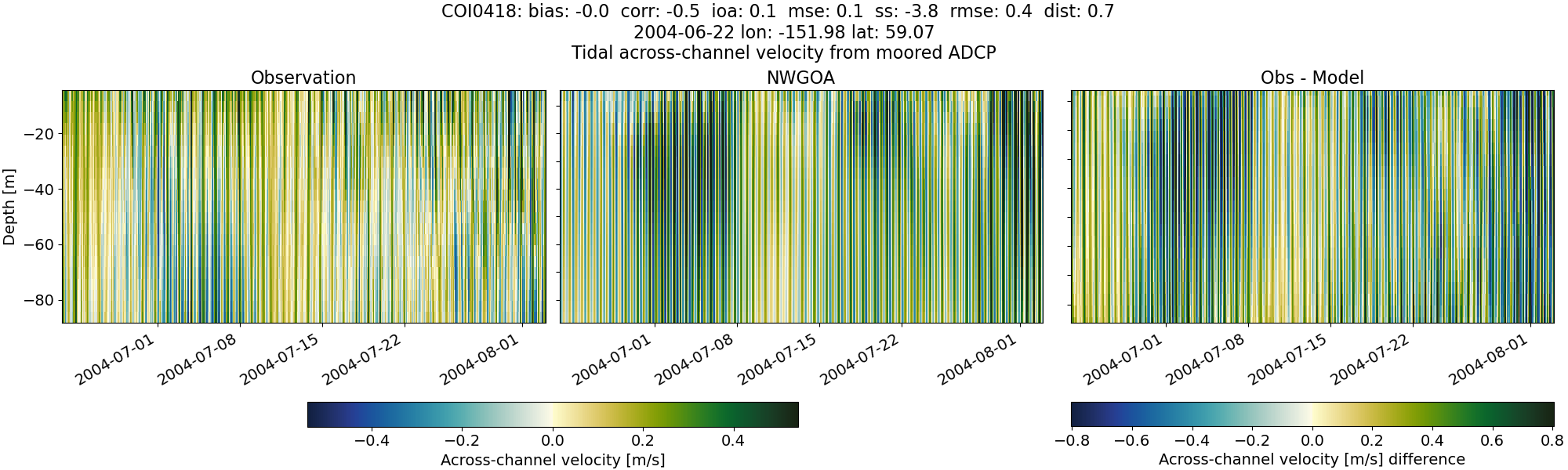
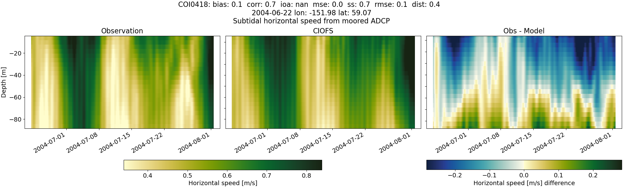
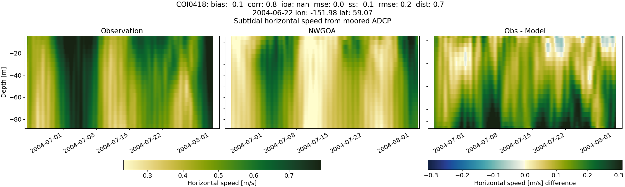
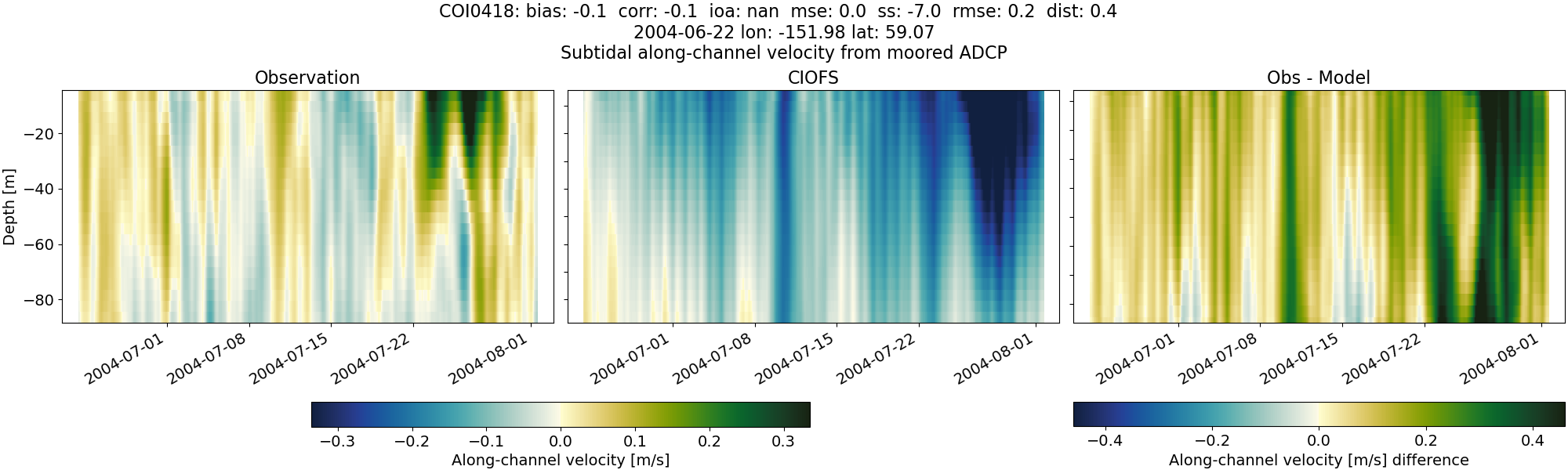
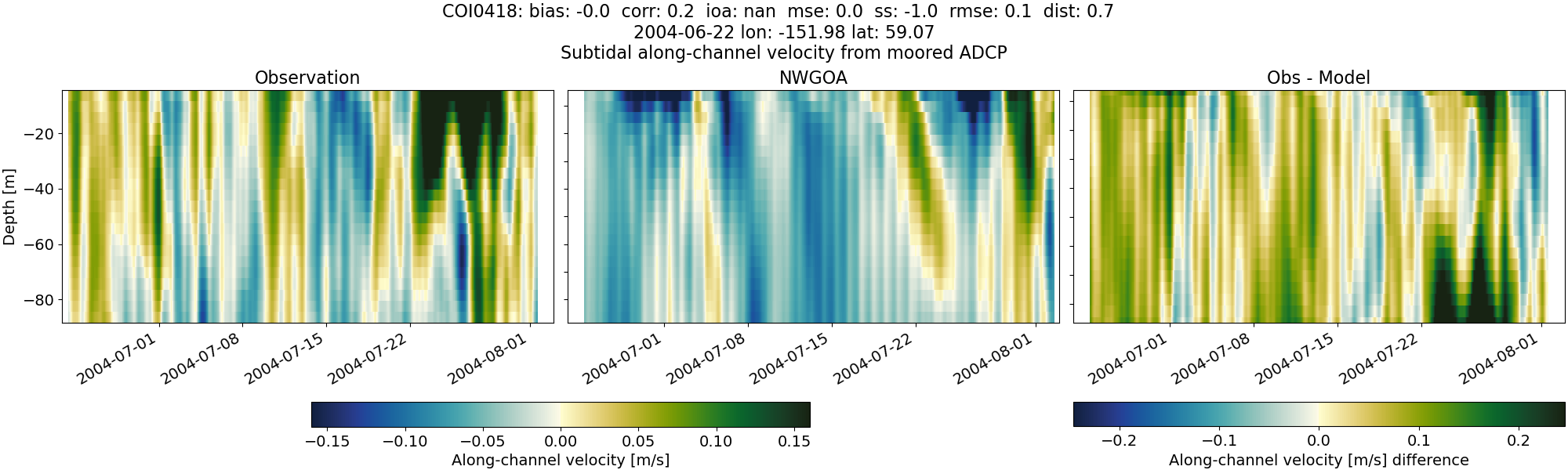
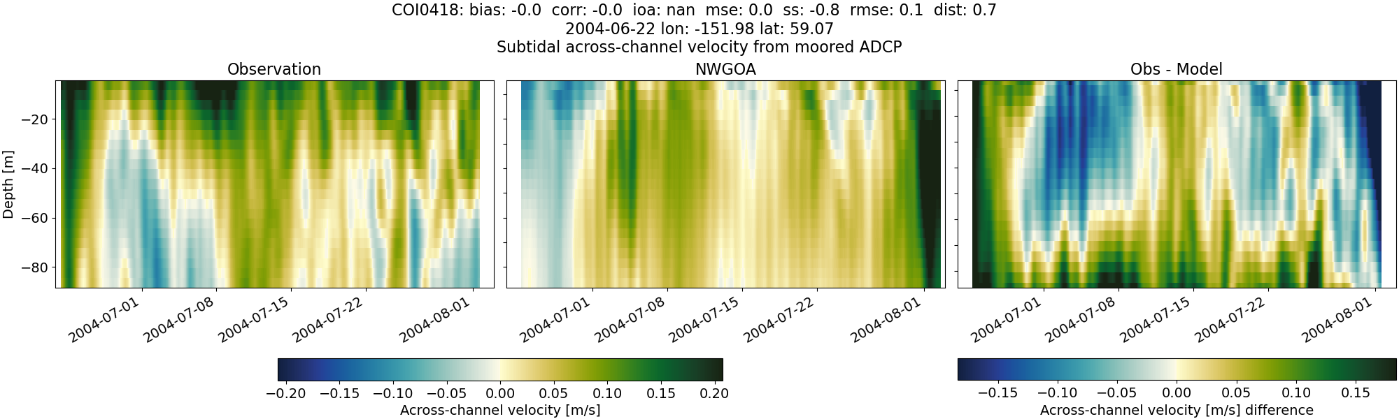
COI0418#
Tidal#
Horizontal speed#
CIOFS#
NWGOA#
Along-channel velocity#
CIOFS#
NWGOA#
Across-channel velocity#
CIOFS#
NWGOA#
Subtidal#
Horizontal speed#
CIOFS#
NWGOA#
Along-channel velocity#
CIOFS#
NWGOA#
Across-channel velocity#
CIOFS#
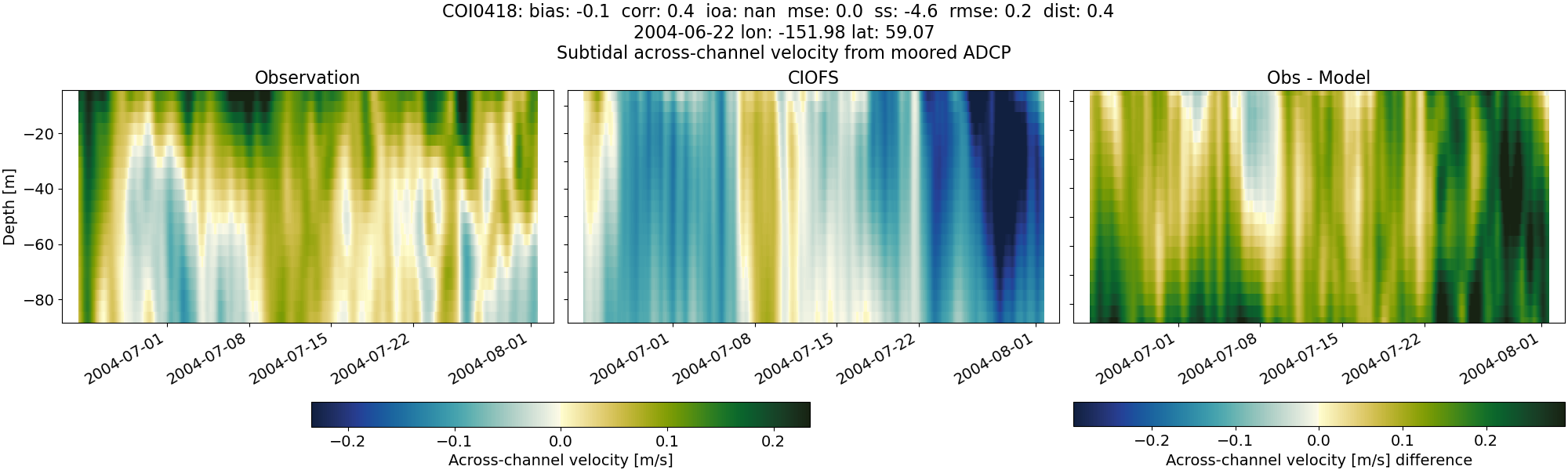
NWGOA#
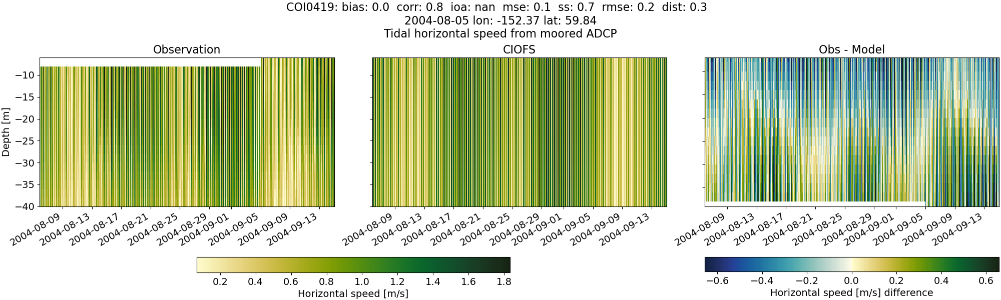
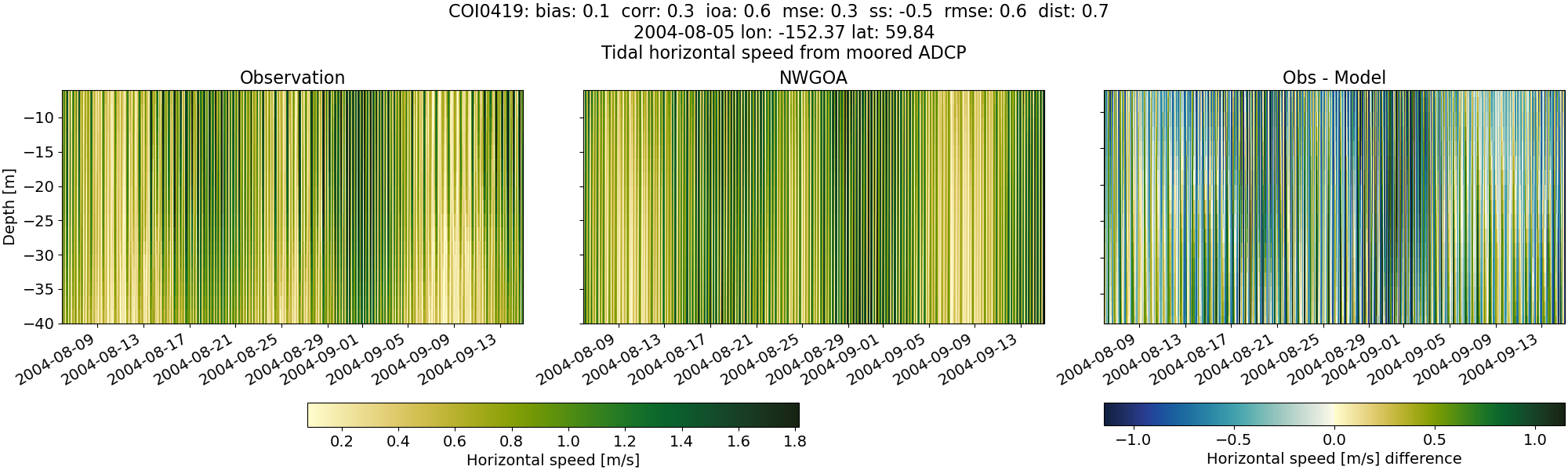
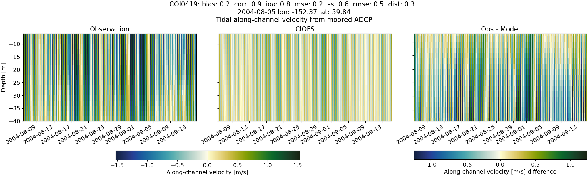
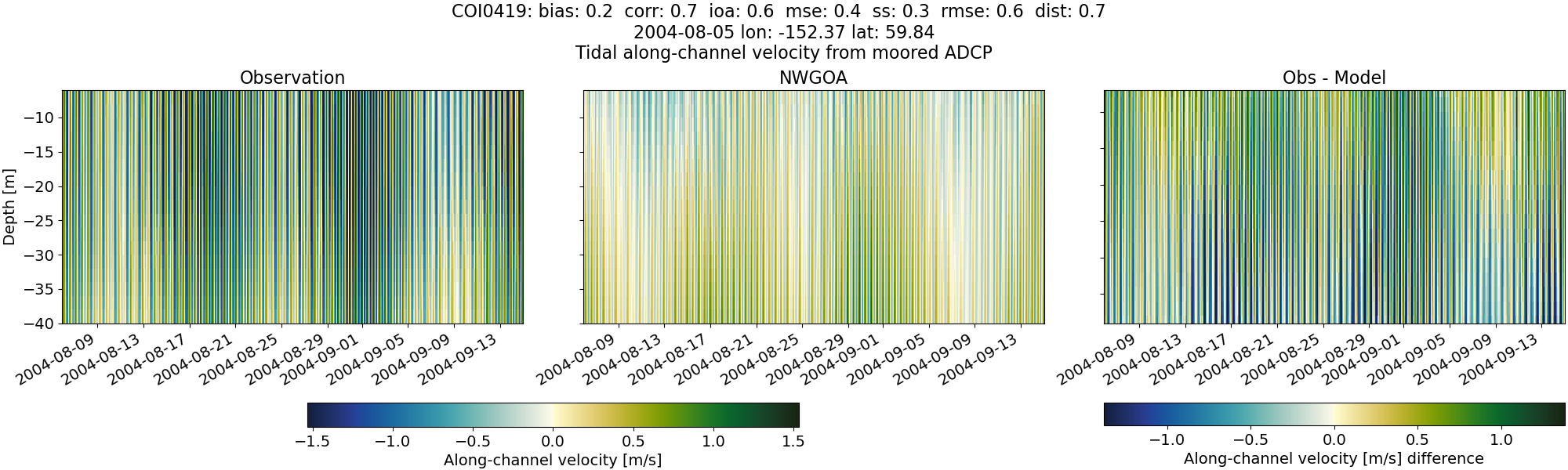
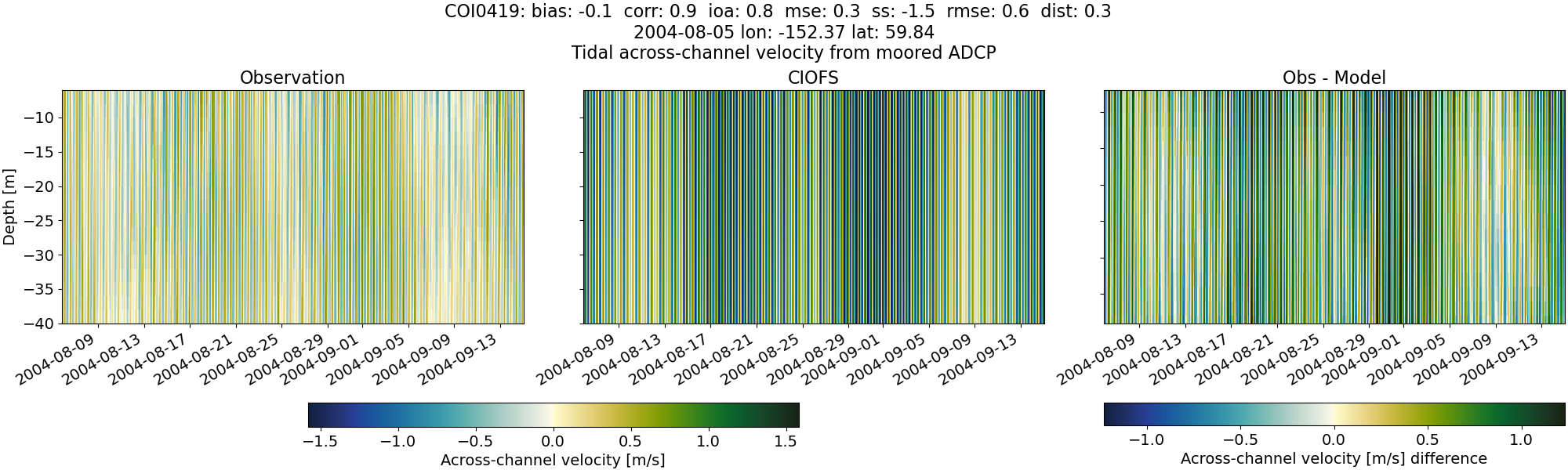
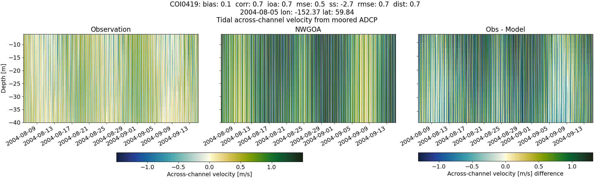
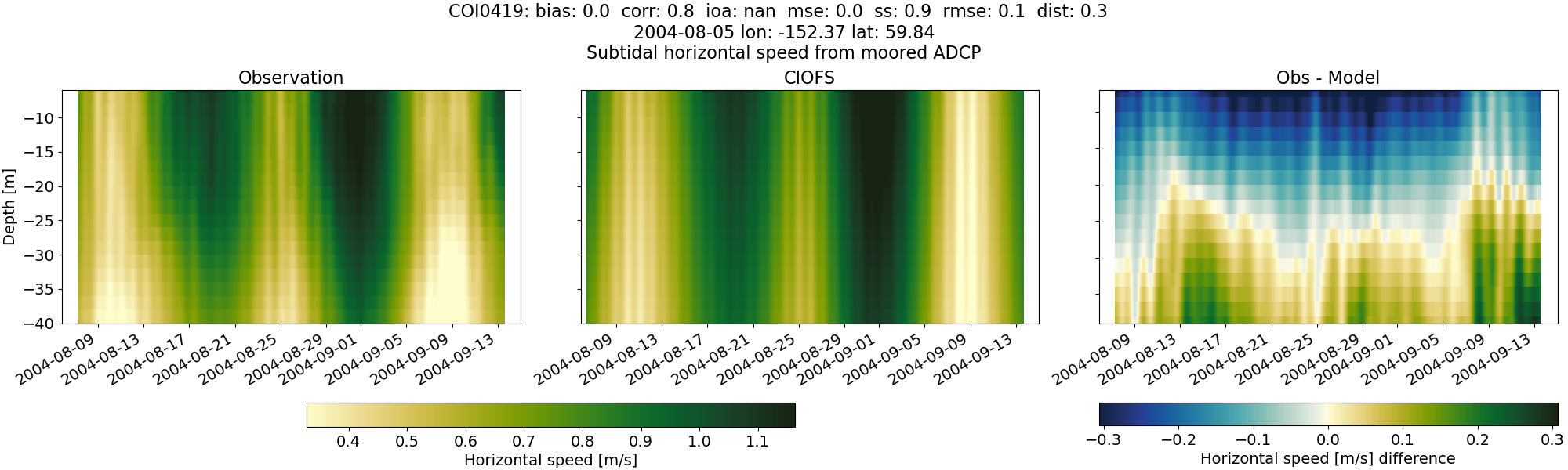
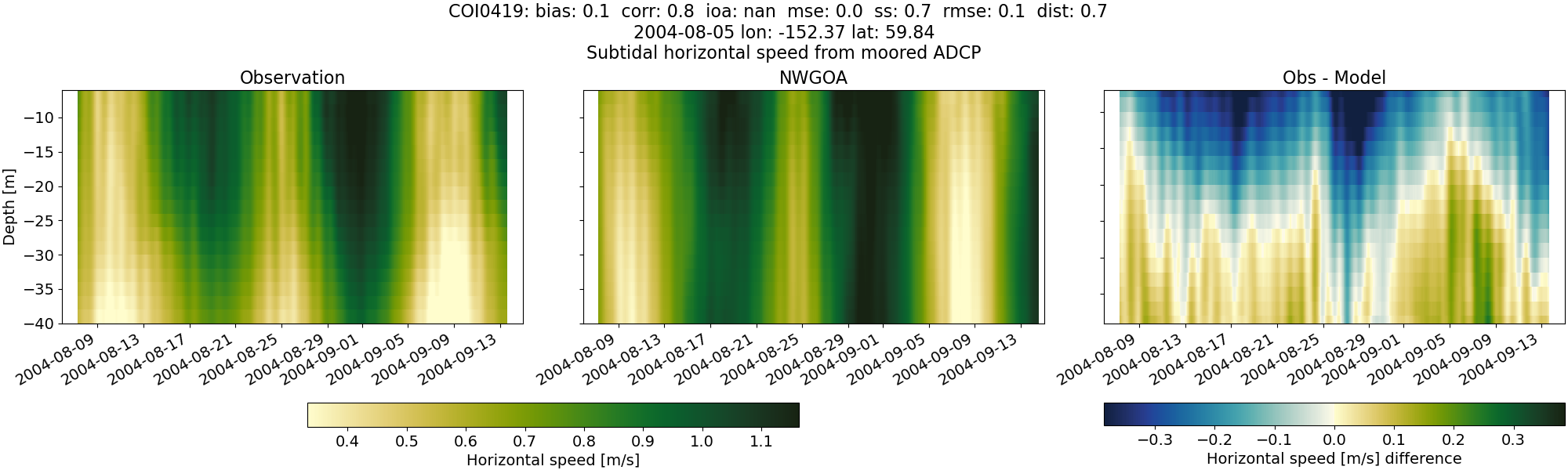
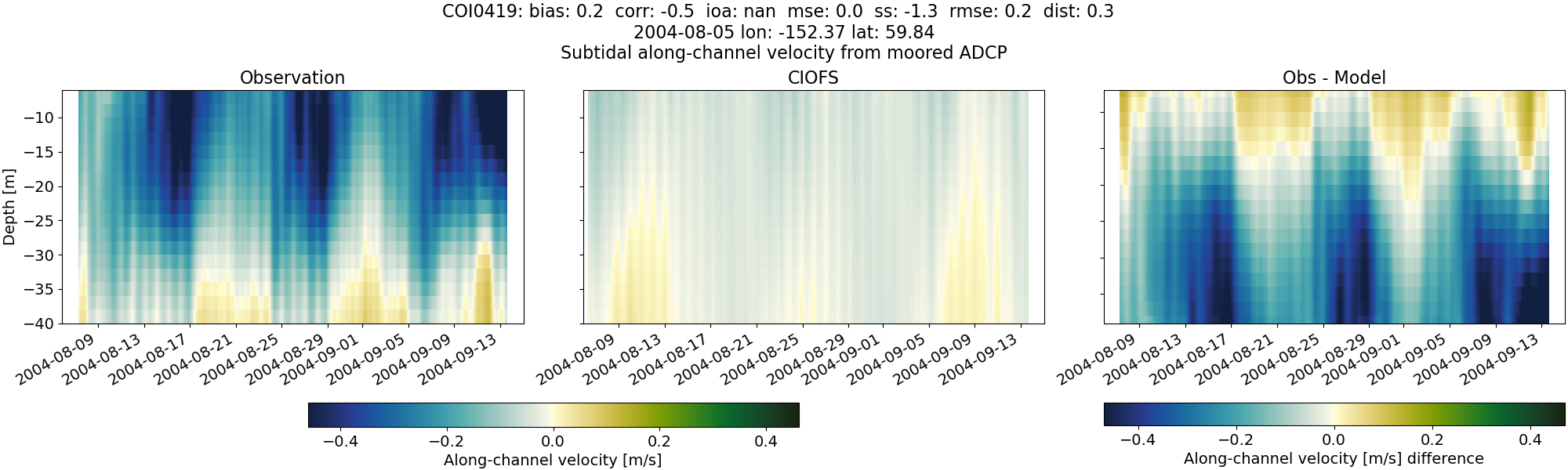
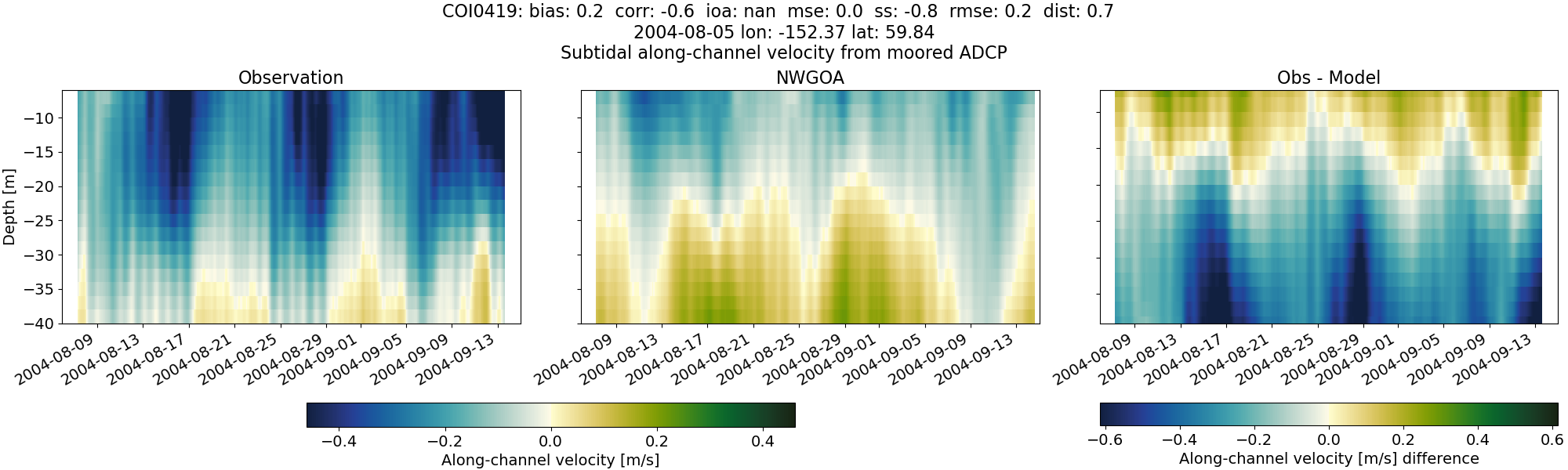
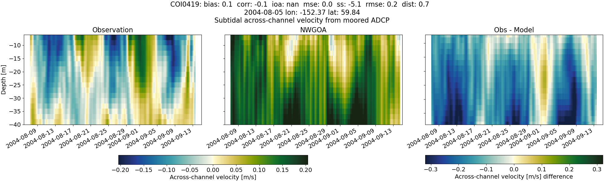
COI0419#
Tidal#
Horizontal speed#
CIOFS#
NWGOA#
Along-channel velocity#
CIOFS#
NWGOA#
Across-channel velocity#
CIOFS#
NWGOA#
Subtidal#
Horizontal speed#
CIOFS#
NWGOA#
Along-channel velocity#
CIOFS#
NWGOA#
Across-channel velocity#
CIOFS#
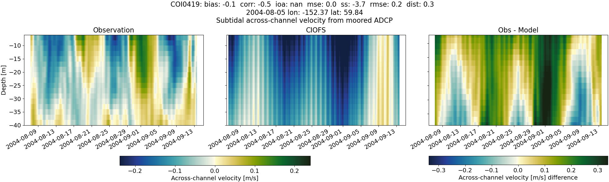
NWGOA#
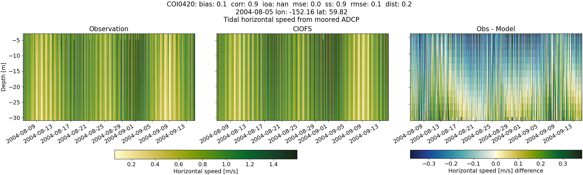
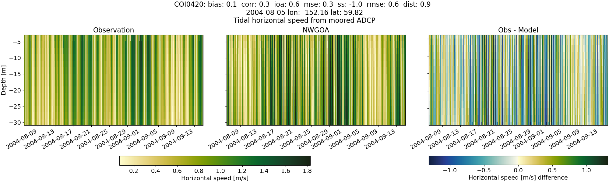
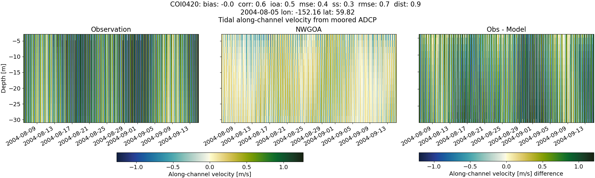
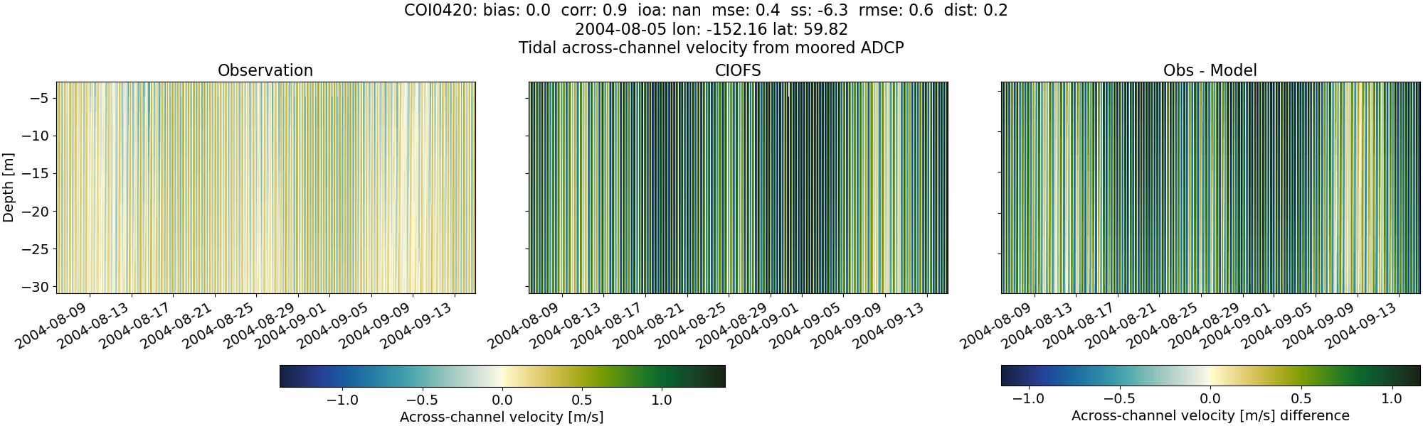
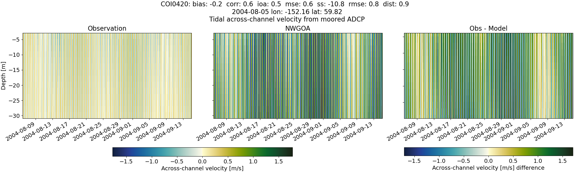
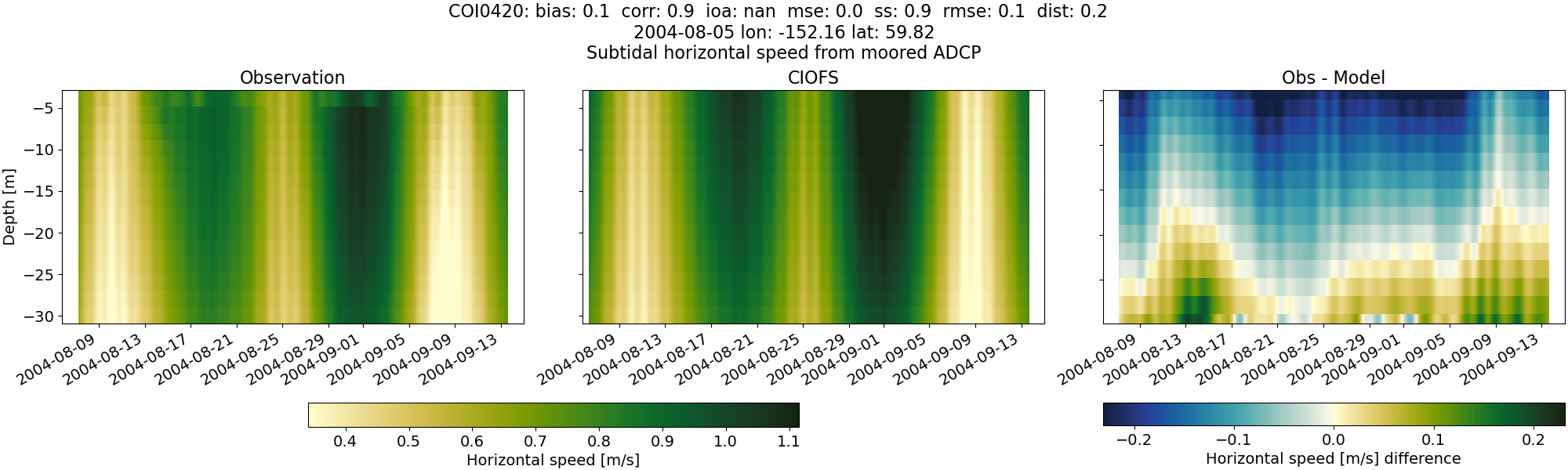
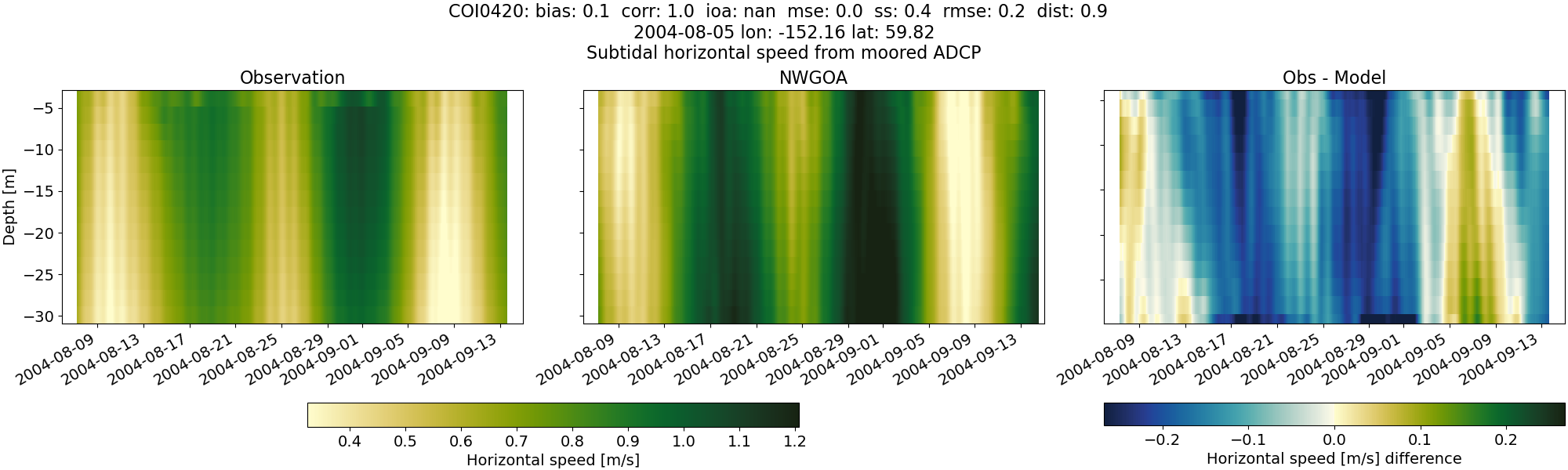
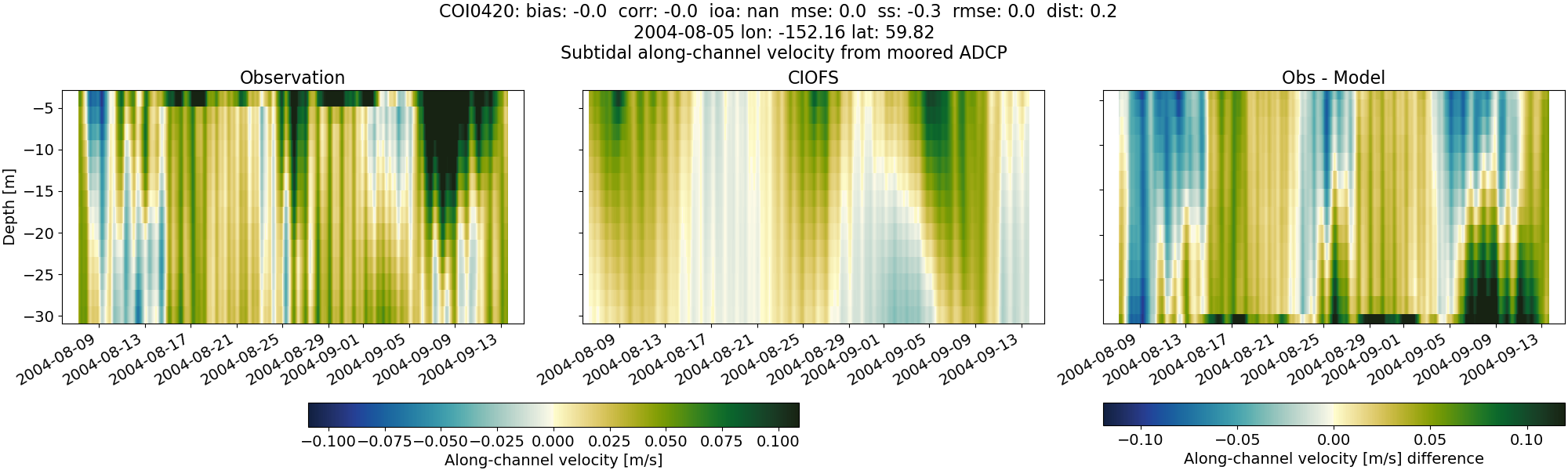
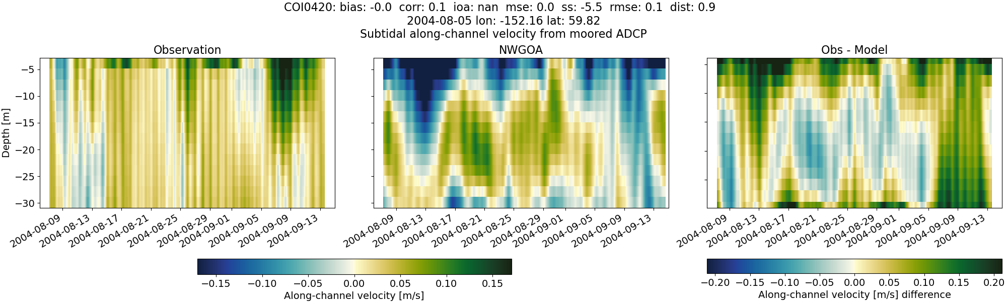
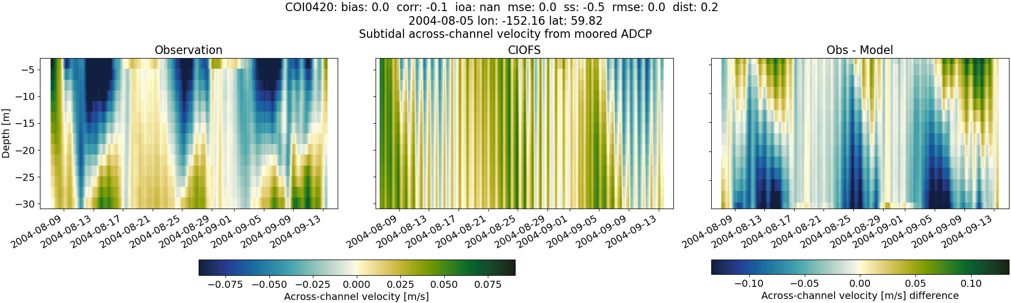
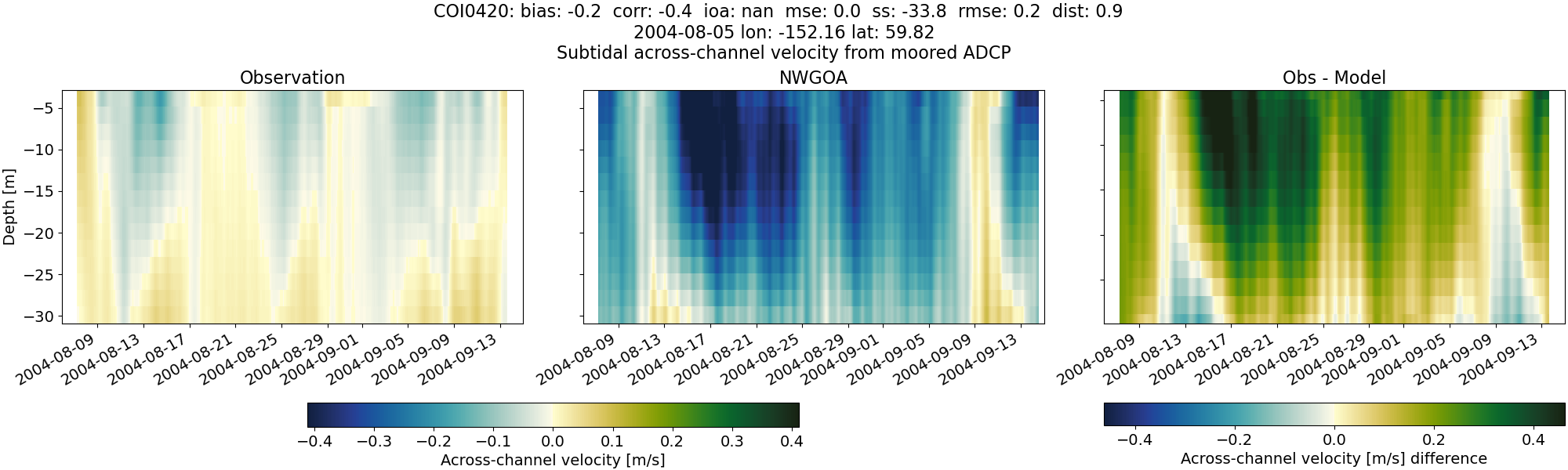
COI0420#
Tidal#
Horizontal speed#
CIOFS#
NWGOA#
Along-channel velocity#
CIOFS#

NWGOA#
Across-channel velocity#
CIOFS#
NWGOA#
Subtidal#
Horizontal speed#
CIOFS#
NWGOA#
Along-channel velocity#
CIOFS#
NWGOA#
Across-channel velocity#
CIOFS#
NWGOA#
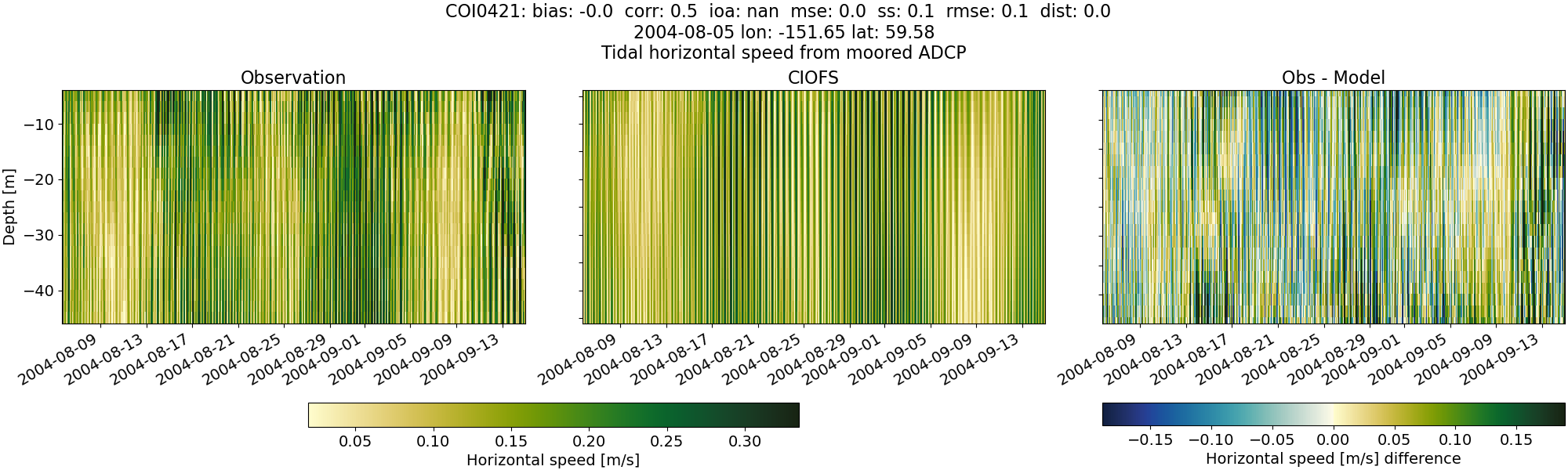
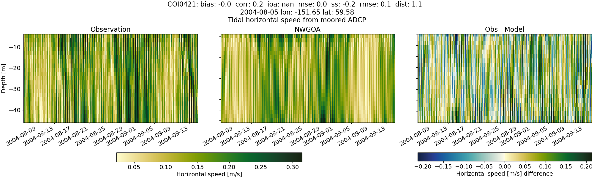
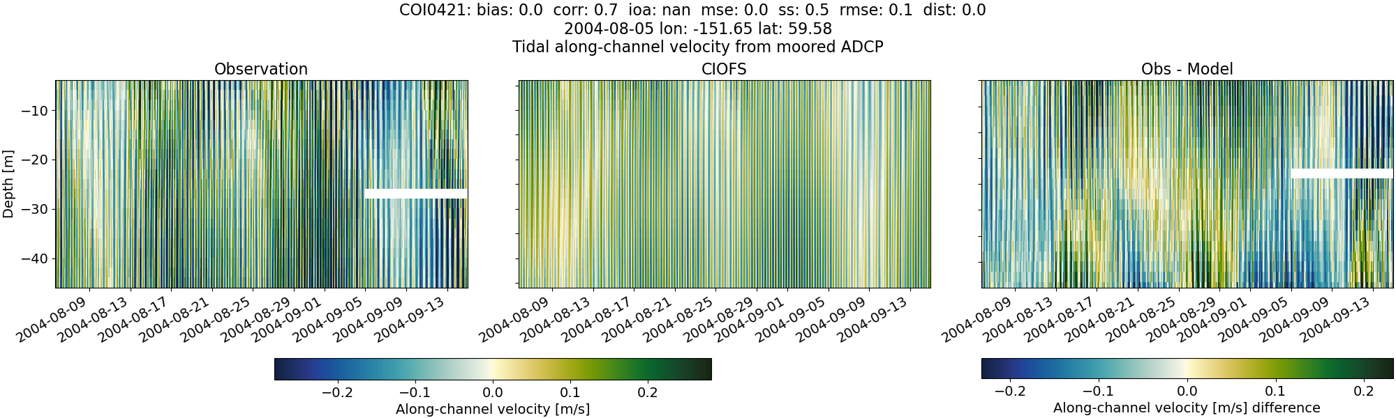
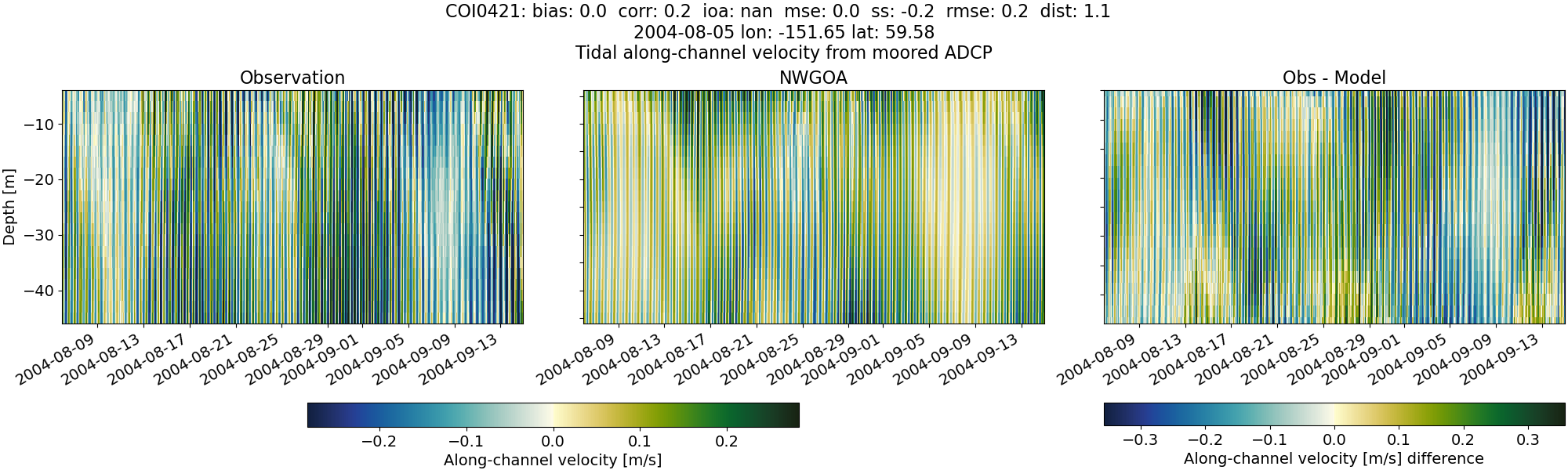
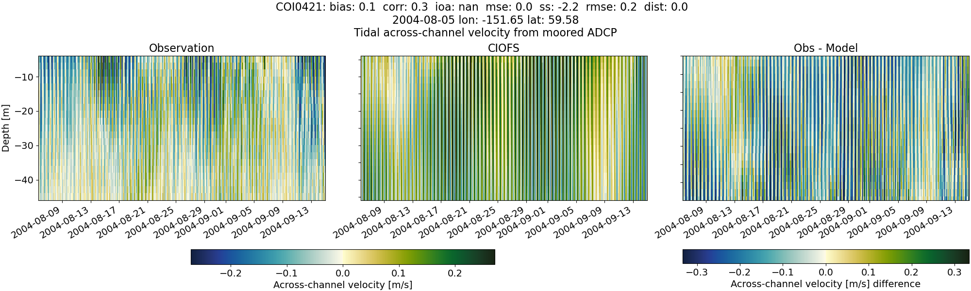
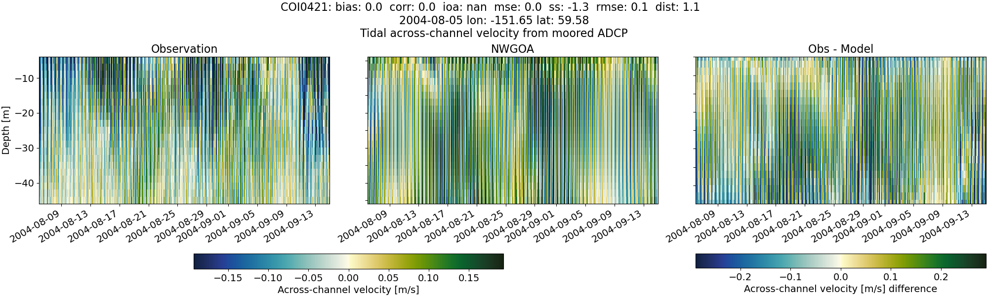
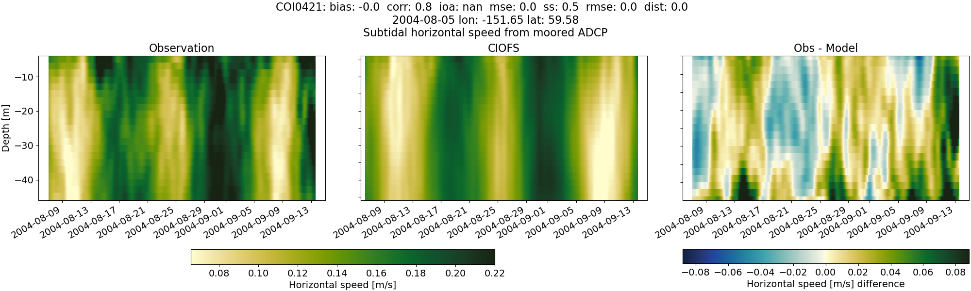
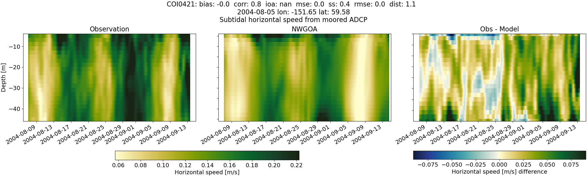
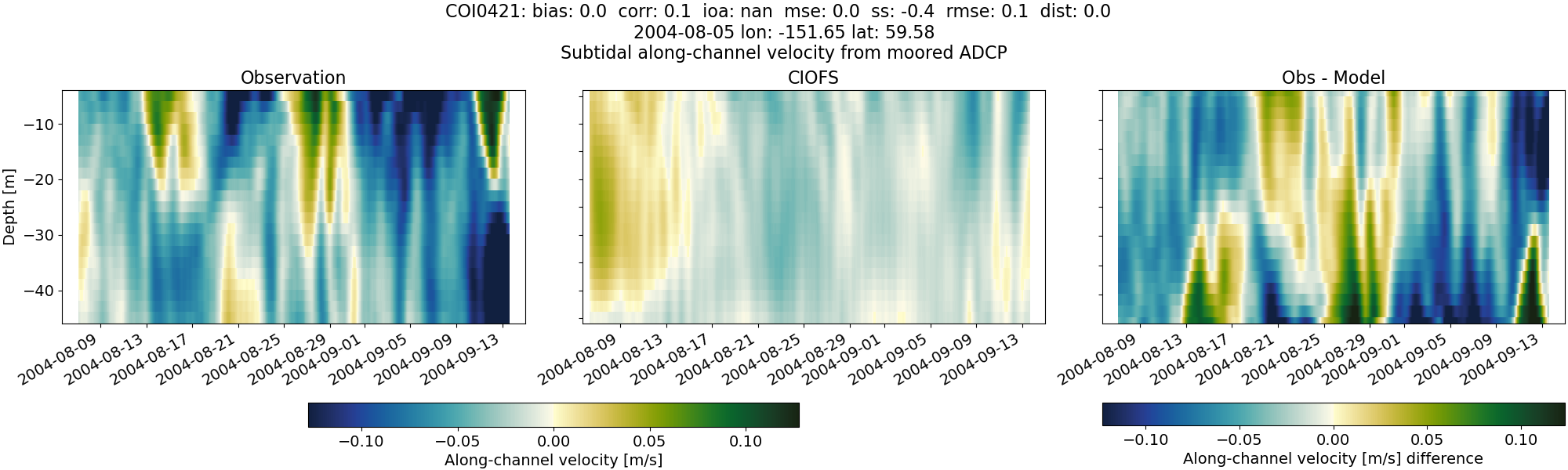
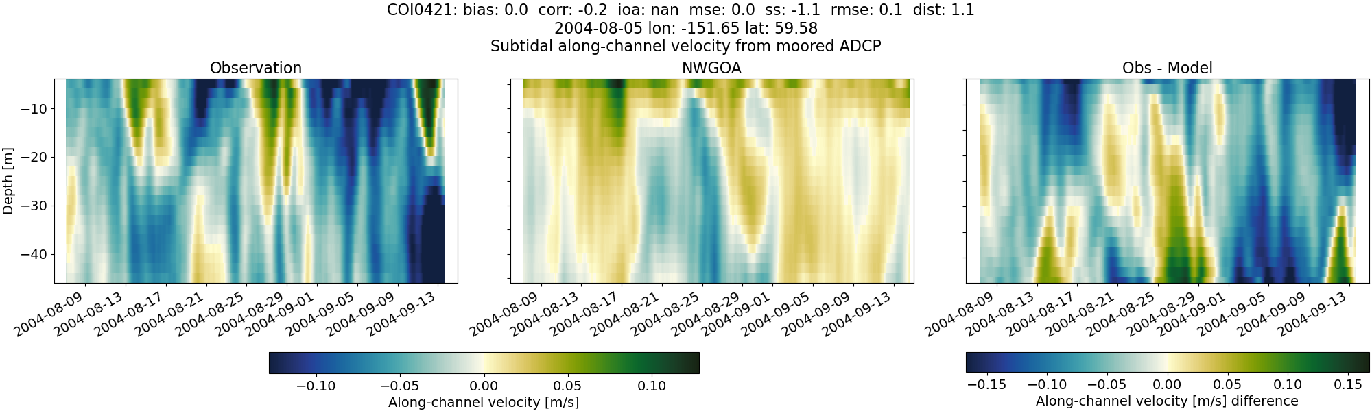
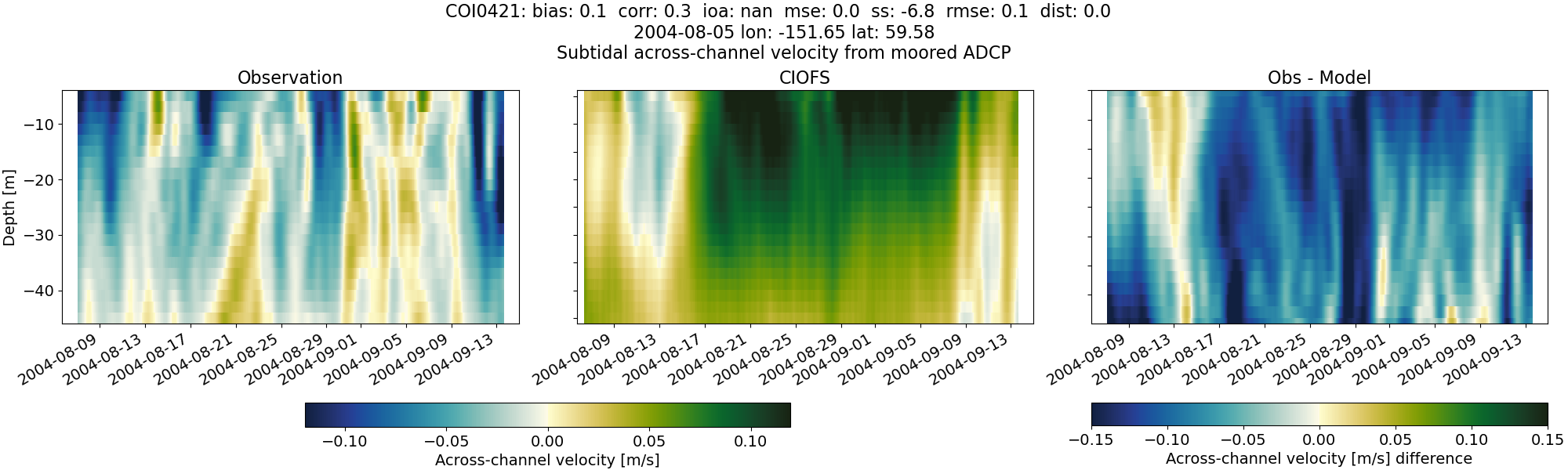
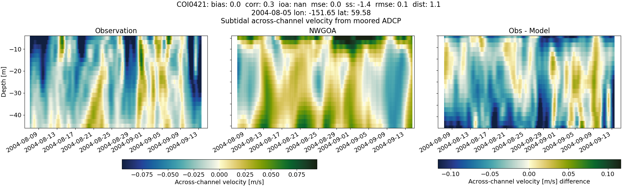
COI0421#
Tidal#
Horizontal speed#
CIOFS#
NWGOA#
Along-channel velocity#
CIOFS#
NWGOA#
Across-channel velocity#
CIOFS#
NWGOA#
Subtidal#
Horizontal speed#
CIOFS#
NWGOA#
Along-channel velocity#
CIOFS#
NWGOA#
Across-channel velocity#
CIOFS#
NWGOA#
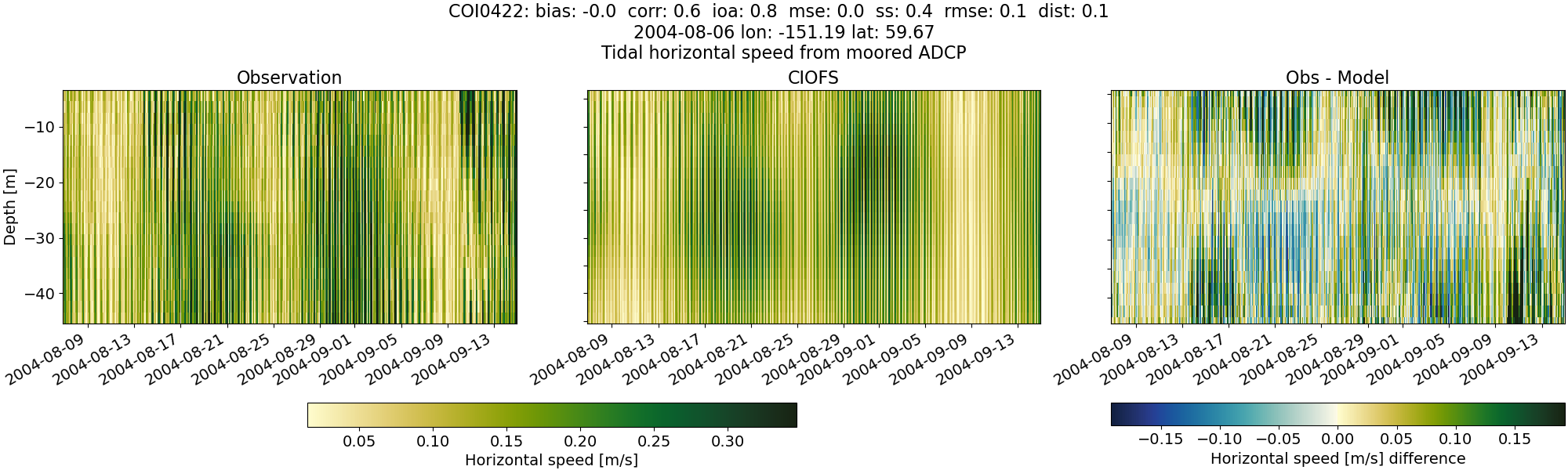
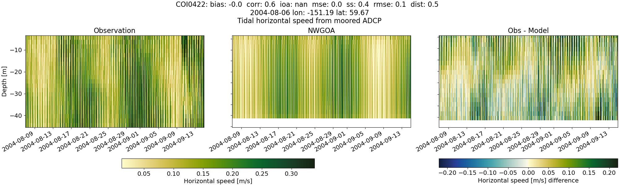
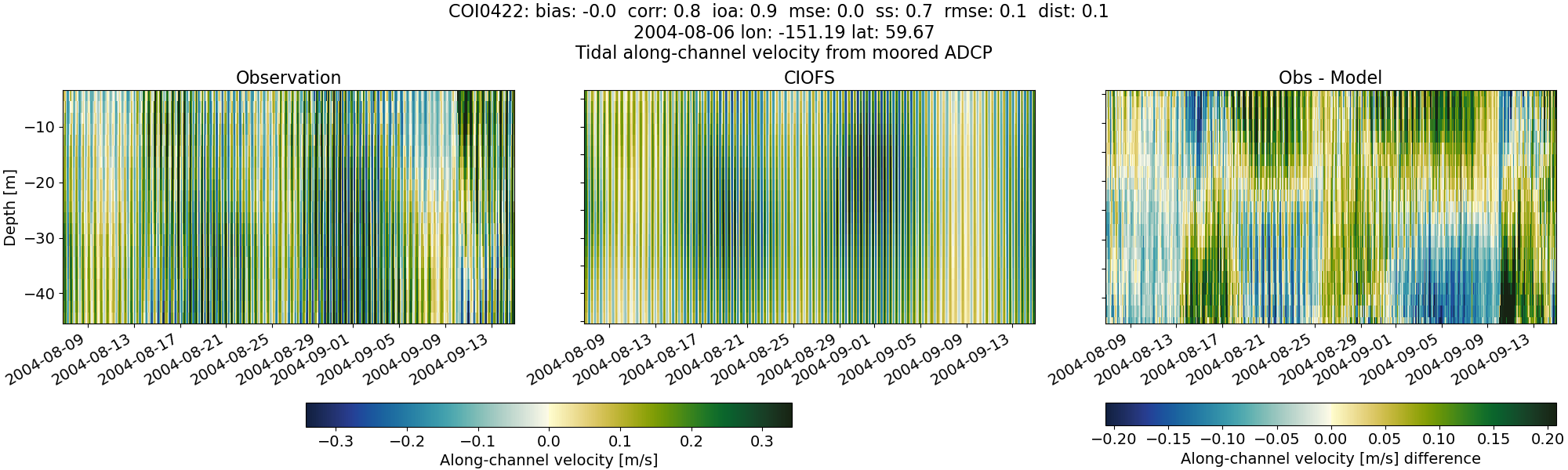
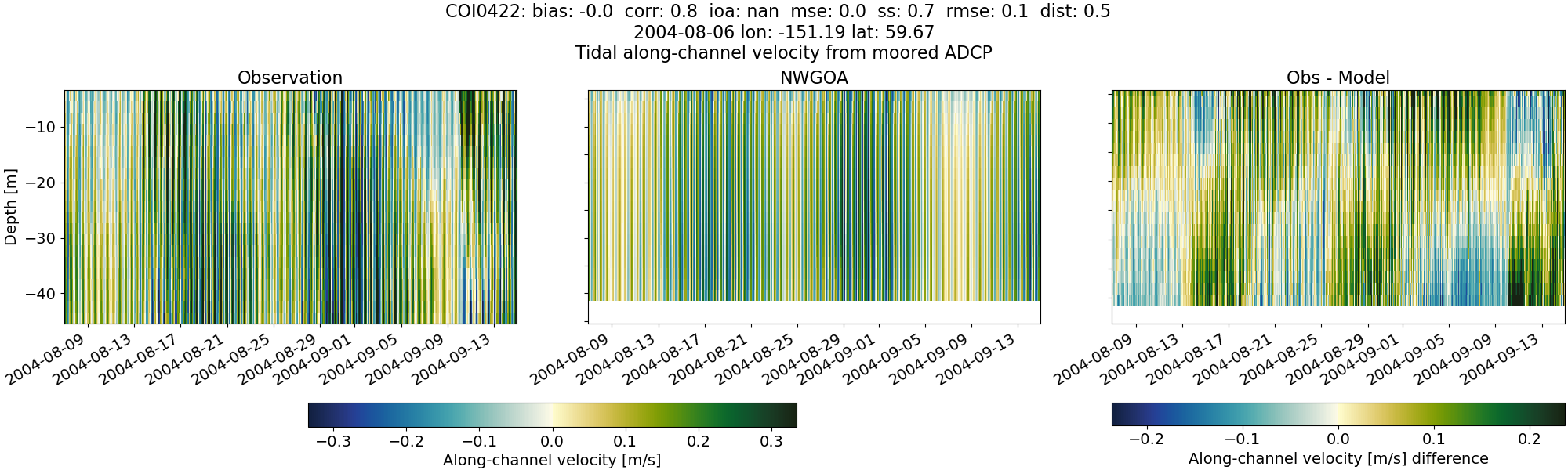
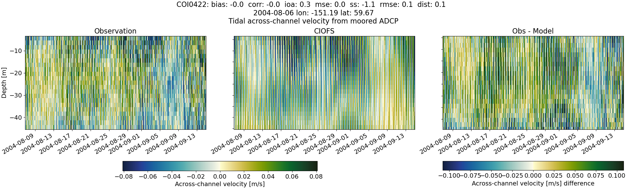
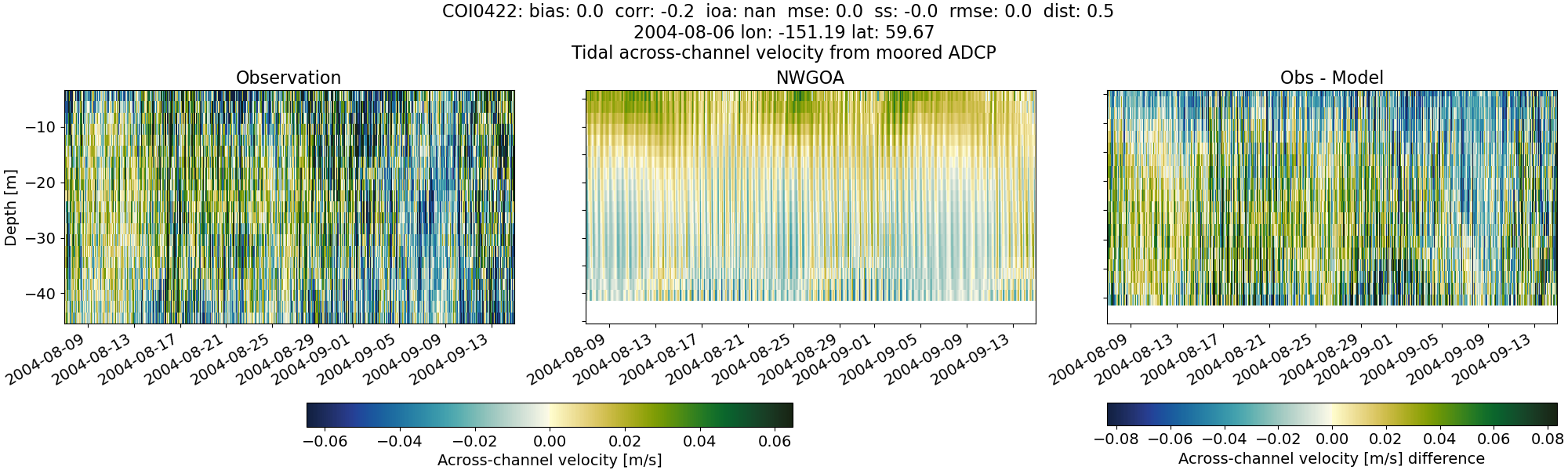
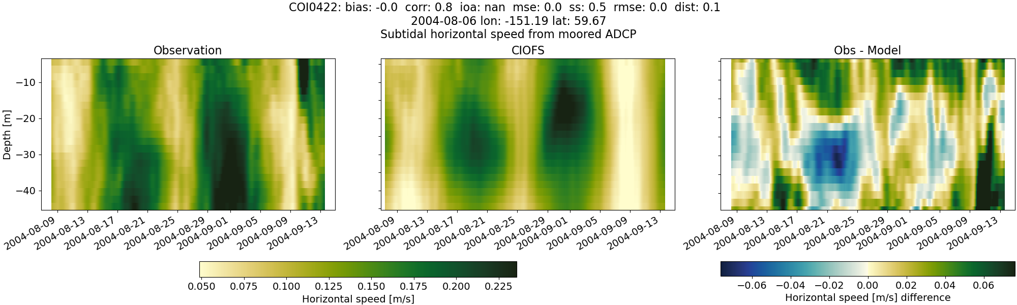
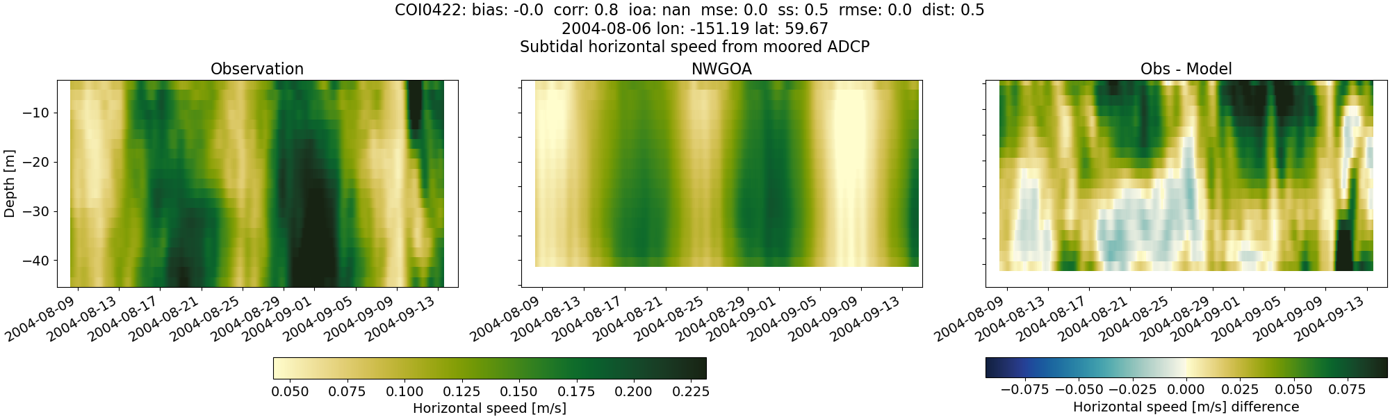
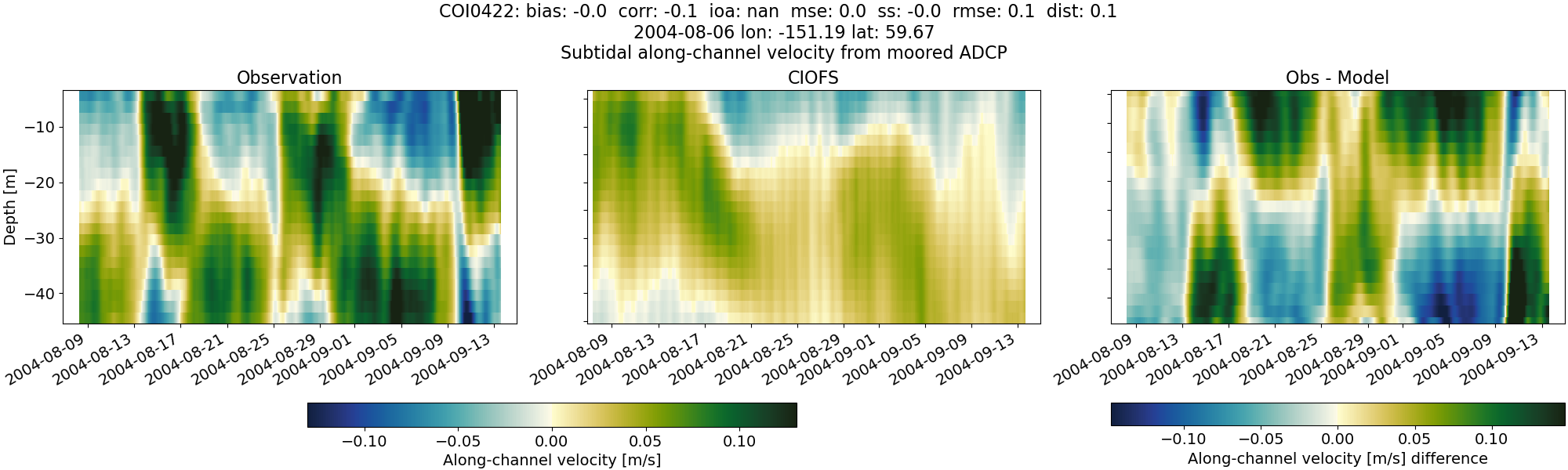
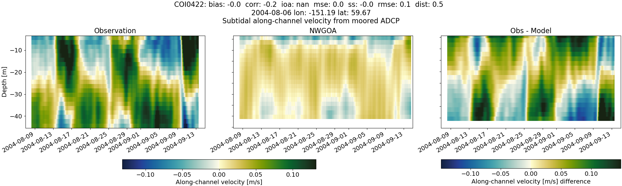
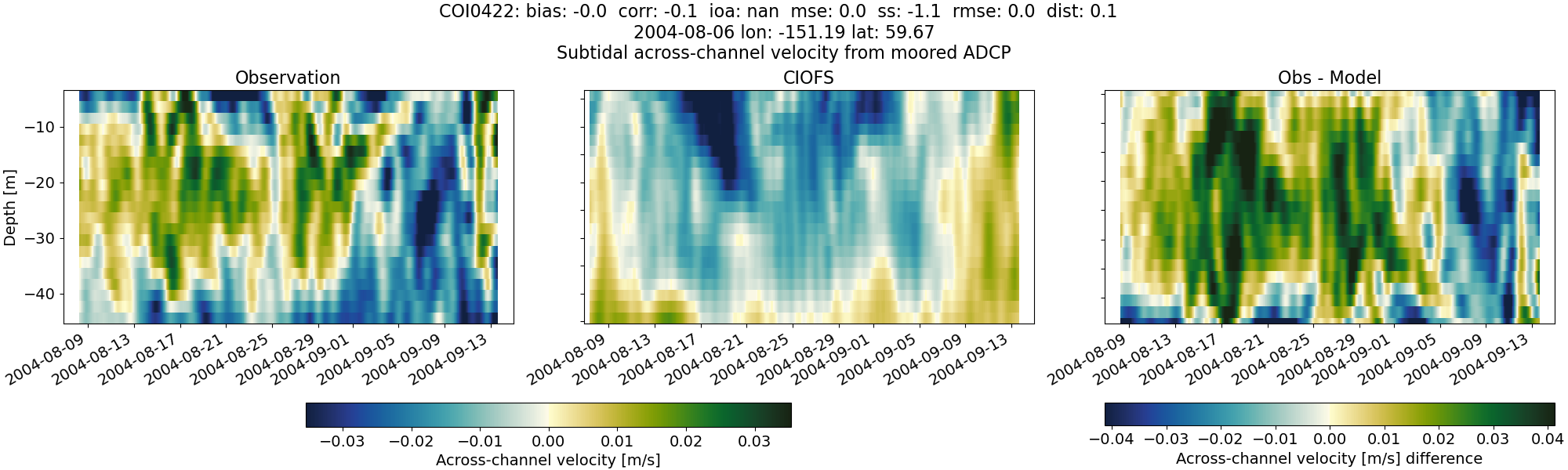
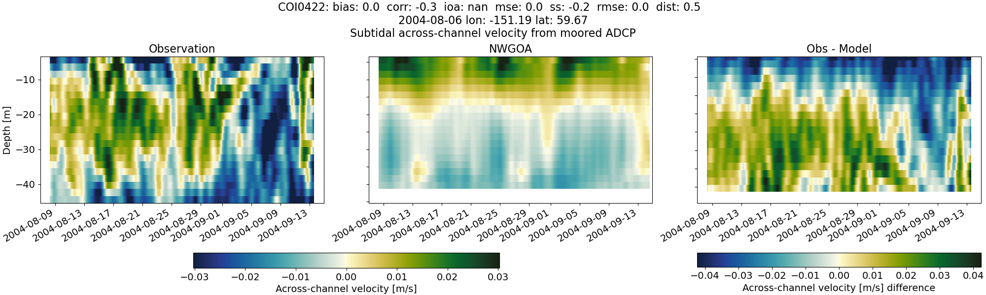
COI0422#
Tidal#
Horizontal speed#
CIOFS#
NWGOA#
Along-channel velocity#
CIOFS#
NWGOA#
Across-channel velocity#
CIOFS#
NWGOA#
Subtidal#
Horizontal speed#
CIOFS#
NWGOA#
Along-channel velocity#
CIOFS#
NWGOA#
Across-channel velocity#
CIOFS#
NWGOA#
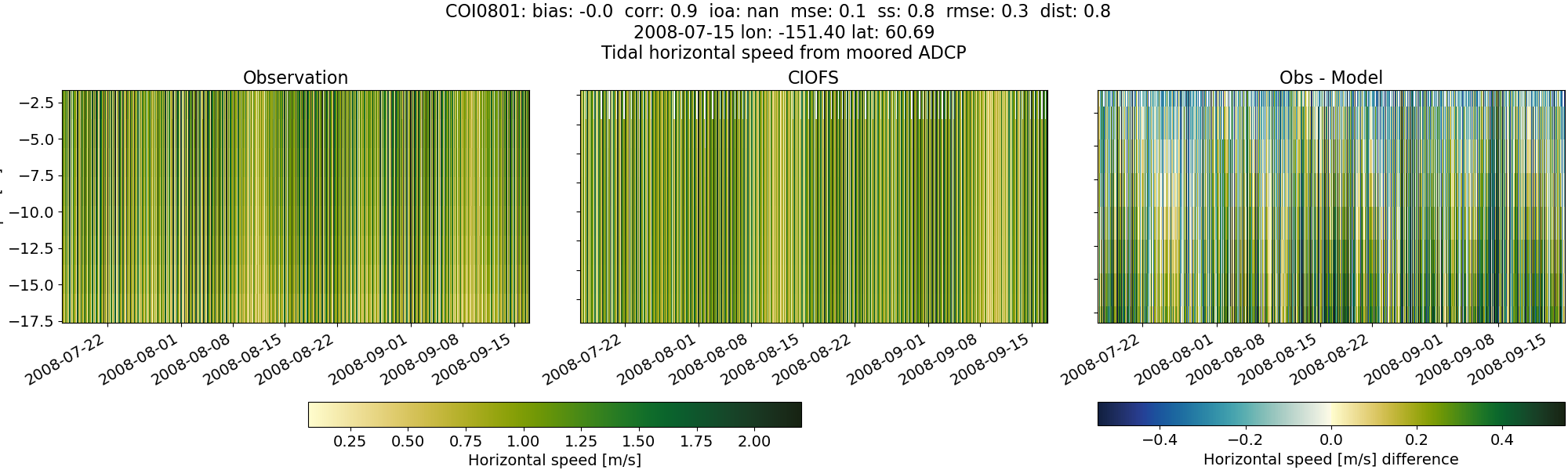
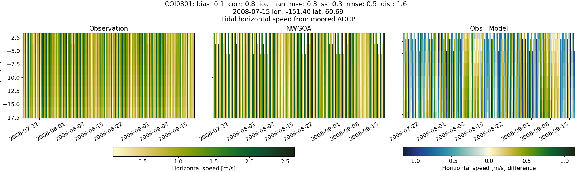
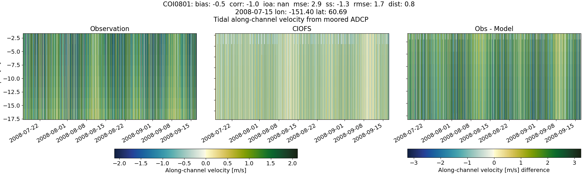
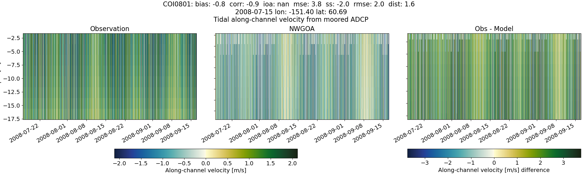
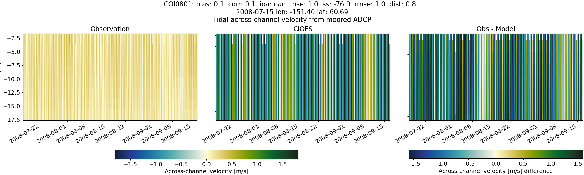
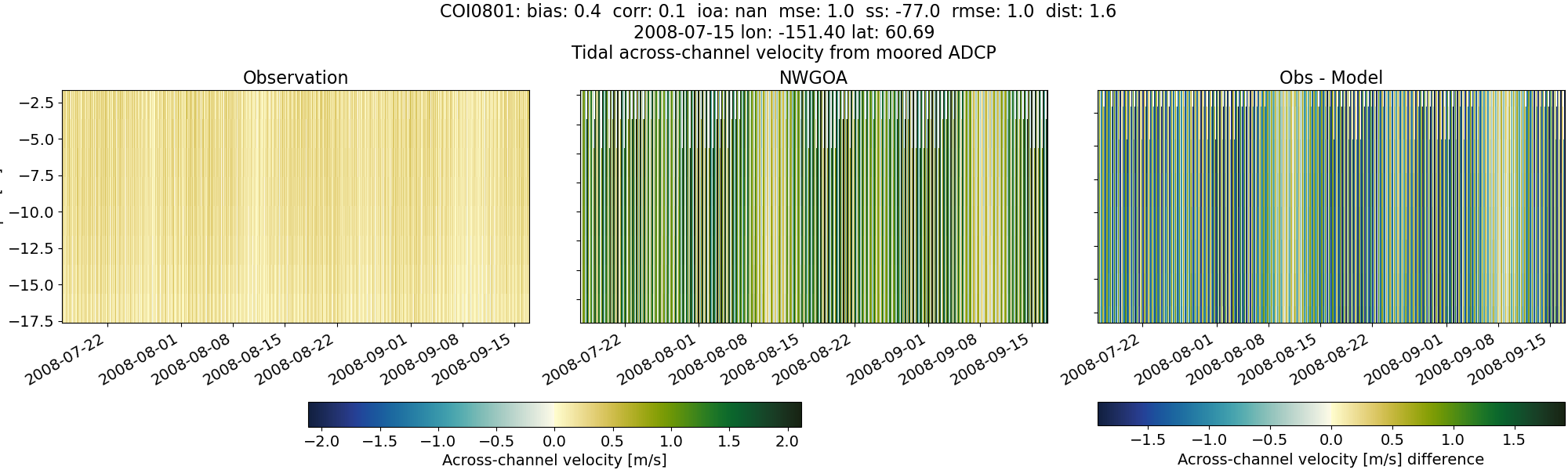
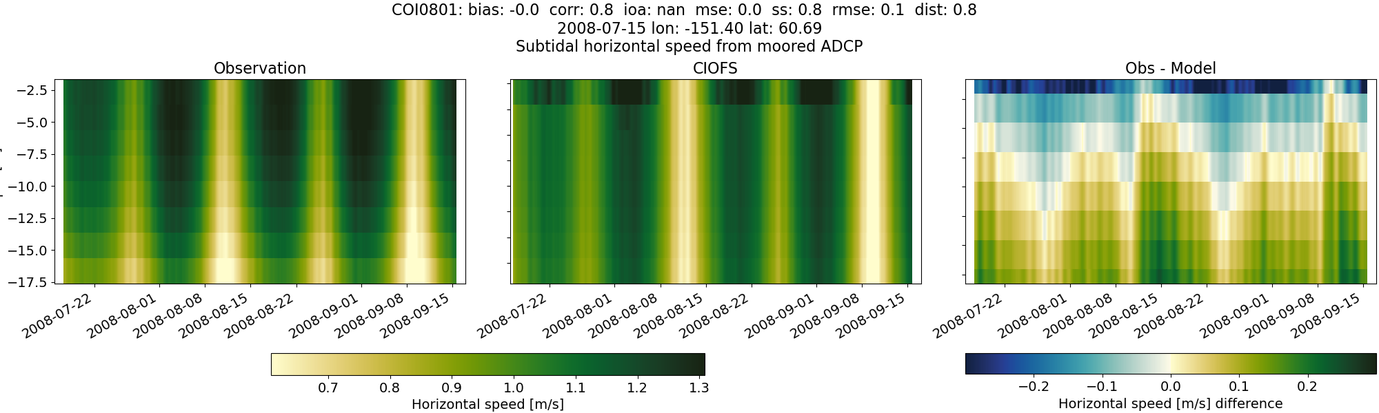
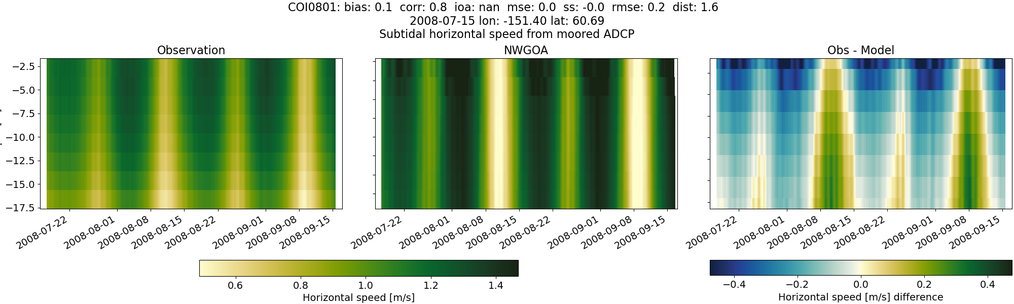
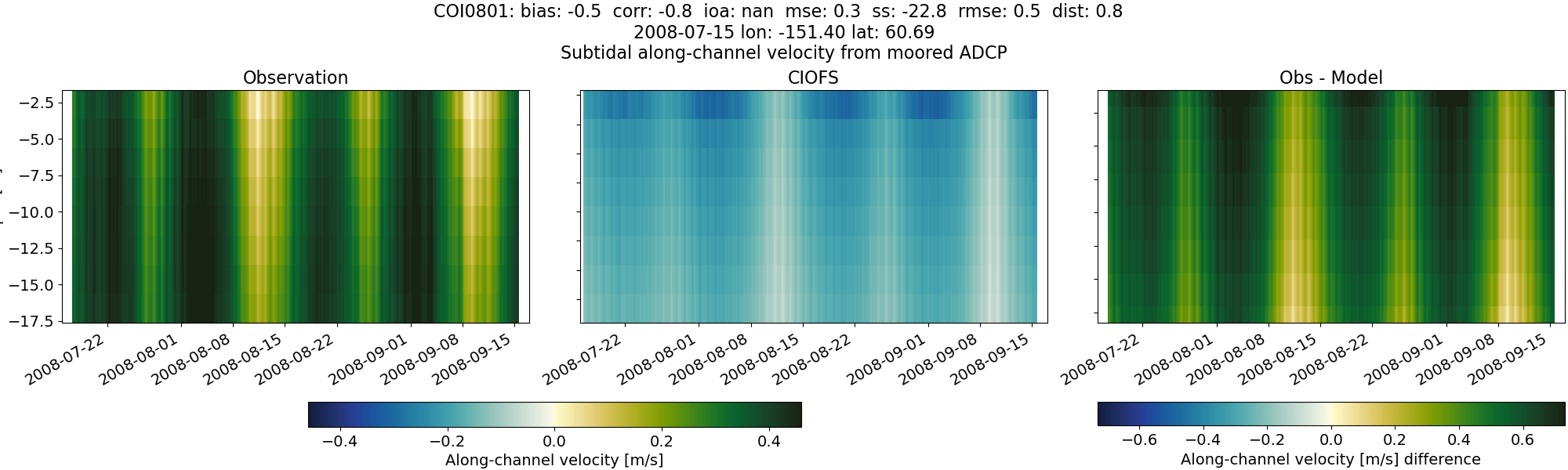
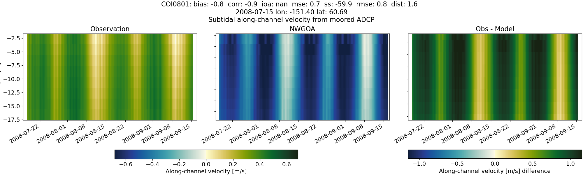
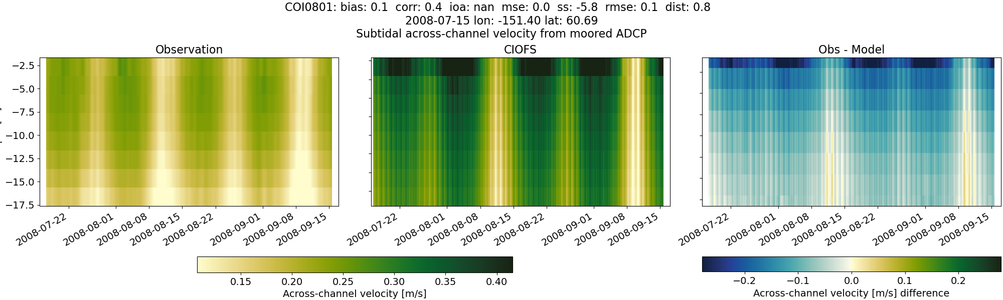
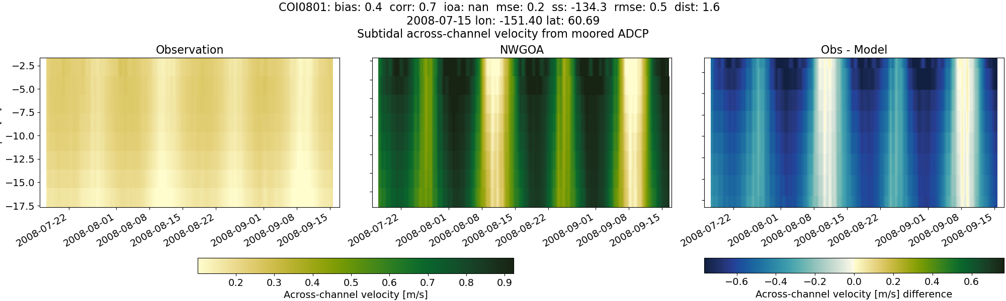
COI0801#
Tidal#
Horizontal speed#
CIOFS#
NWGOA#
Along-channel velocity#
CIOFS#
NWGOA#
Across-channel velocity#
CIOFS#
NWGOA#
Subtidal#
Horizontal speed#
CIOFS#
NWGOA#
Along-channel velocity#
CIOFS#
NWGOA#
Across-channel velocity#
CIOFS#
NWGOA#
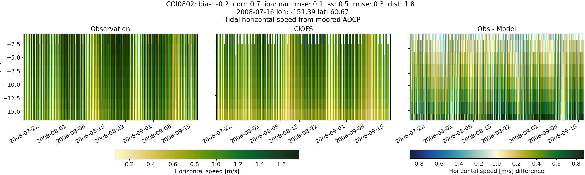
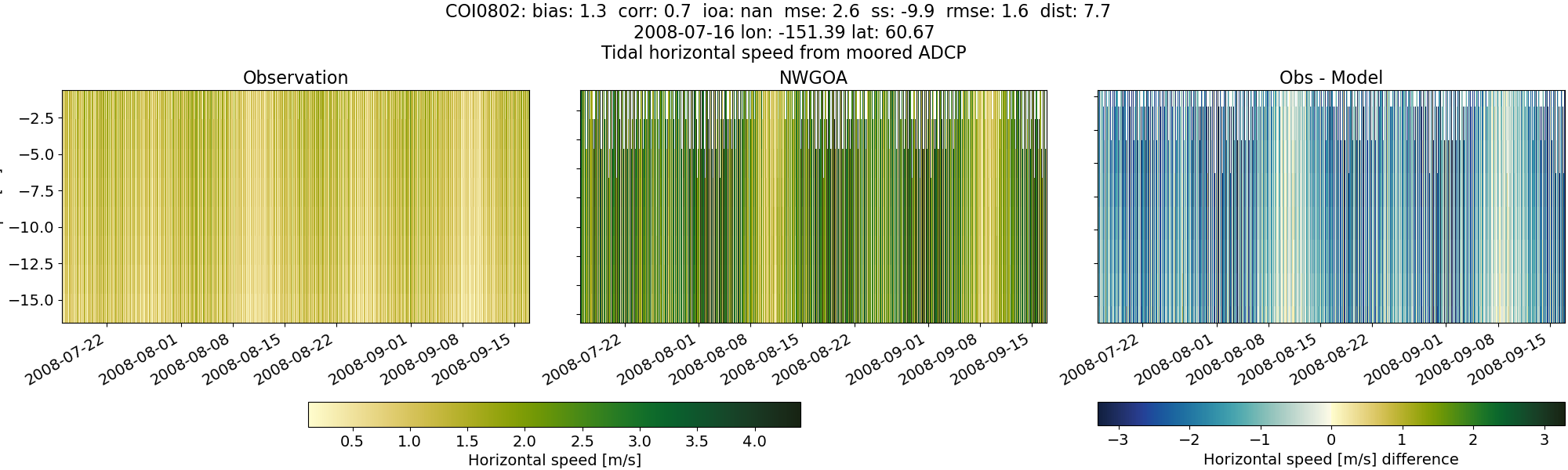
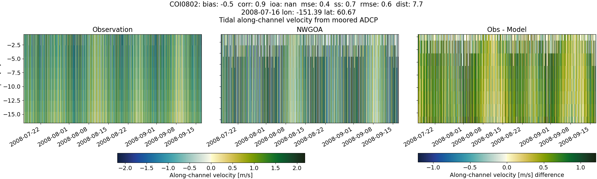
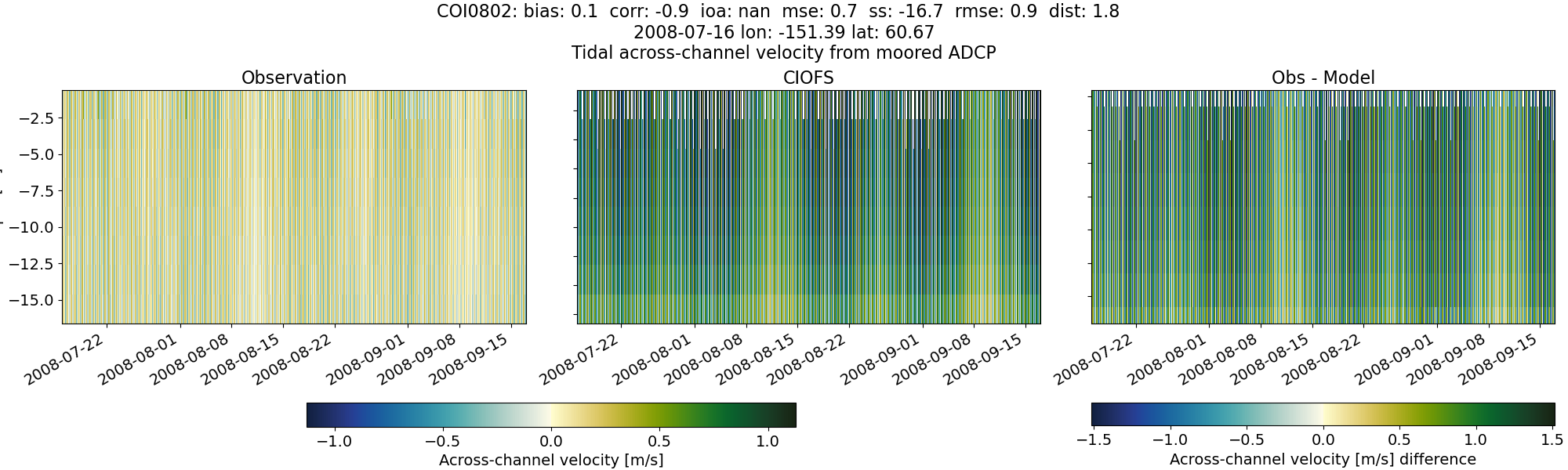
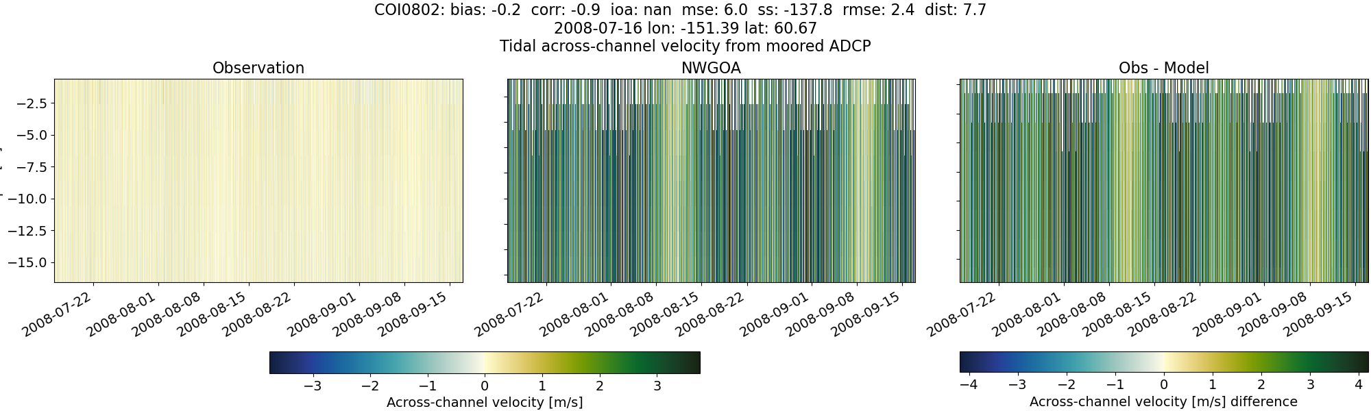
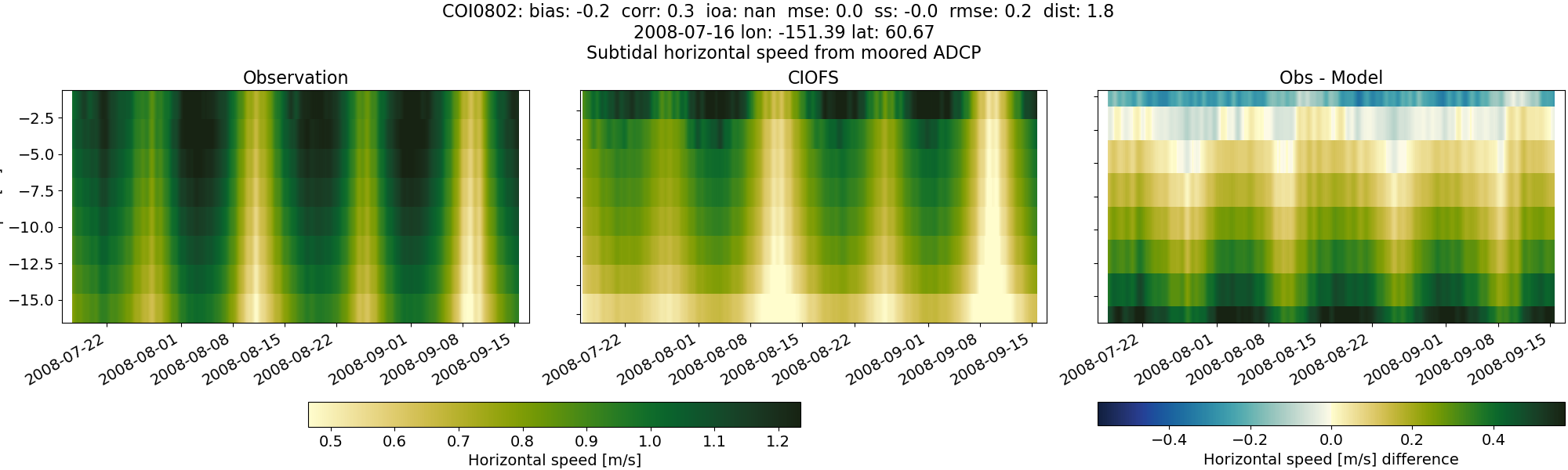
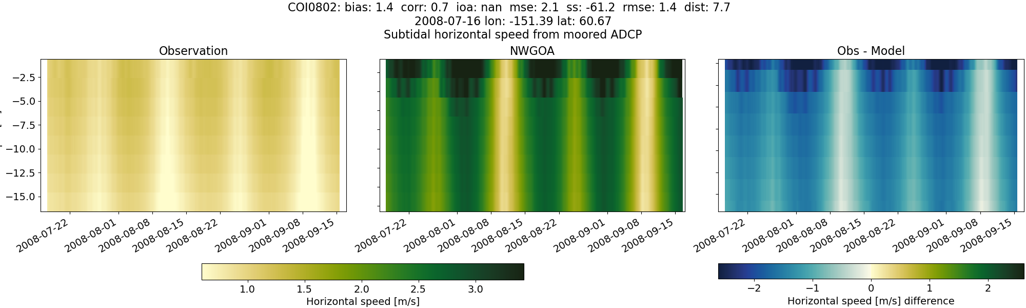
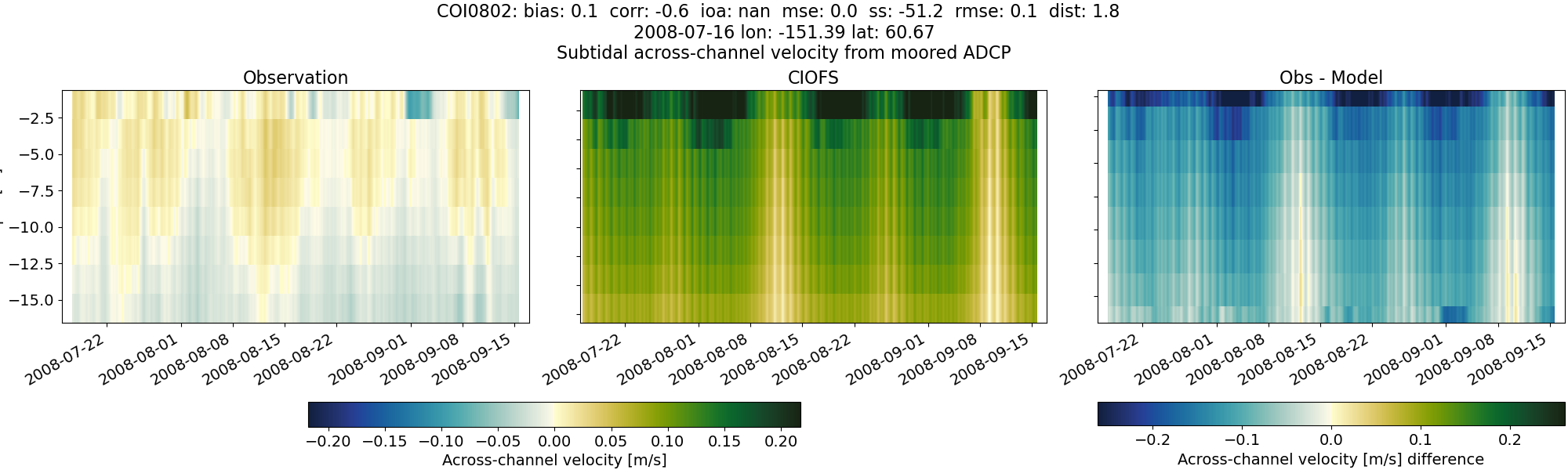
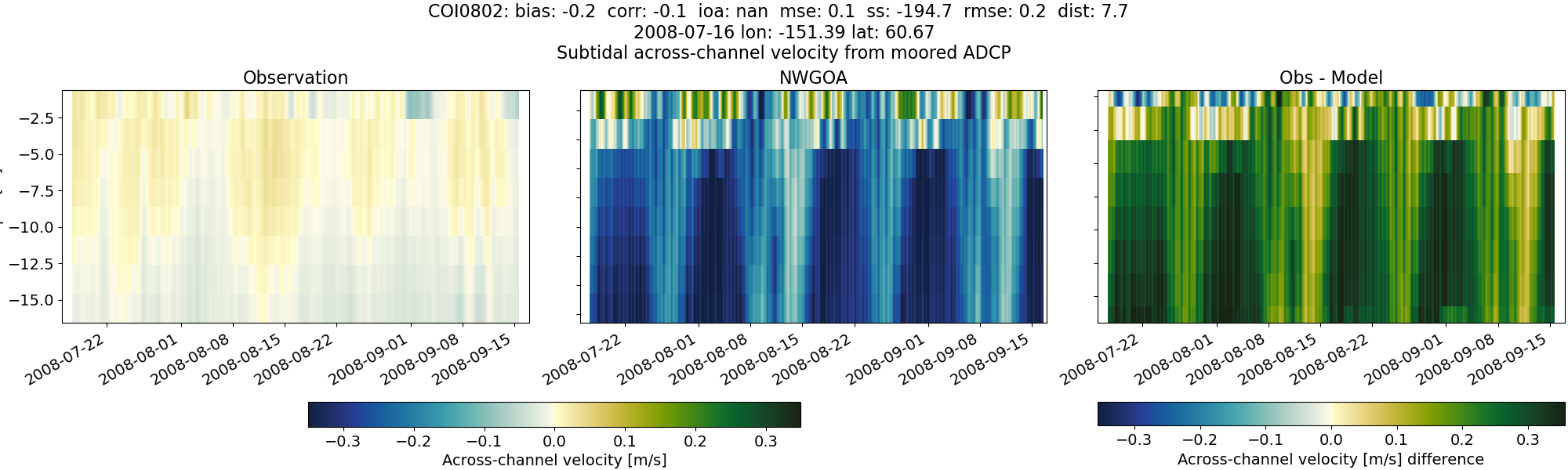
COI0802#
Tidal#
Horizontal speed#
CIOFS#
NWGOA#
Along-channel velocity#
CIOFS#
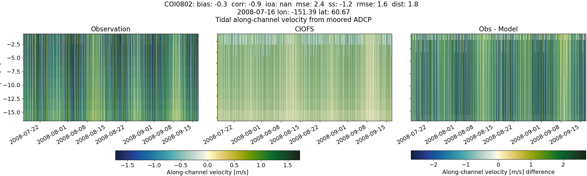
NWGOA#
Across-channel velocity#
CIOFS#
NWGOA#
Subtidal#
Horizontal speed#
CIOFS#
NWGOA#
Along-channel velocity#
CIOFS#
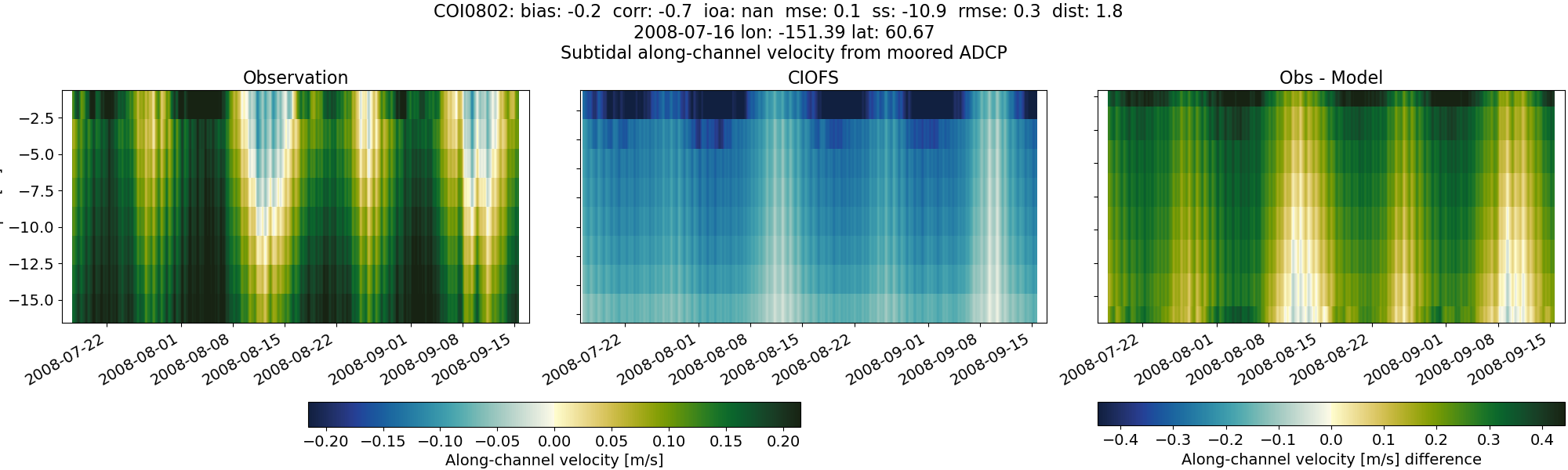
NWGOA#
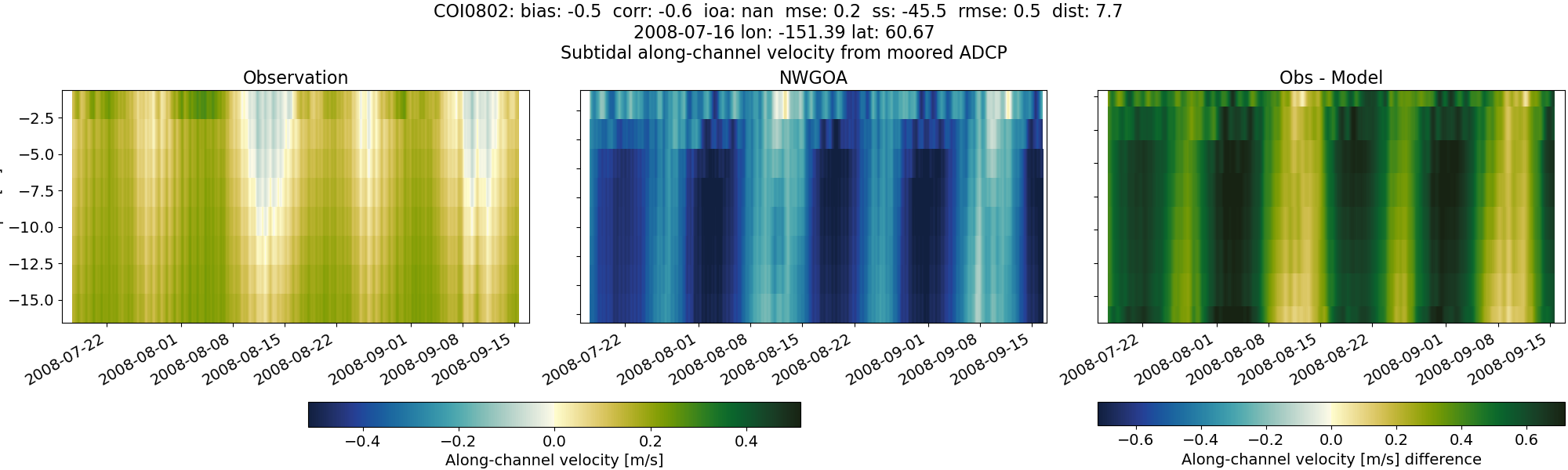
Across-channel velocity#
CIOFS#
NWGOA#
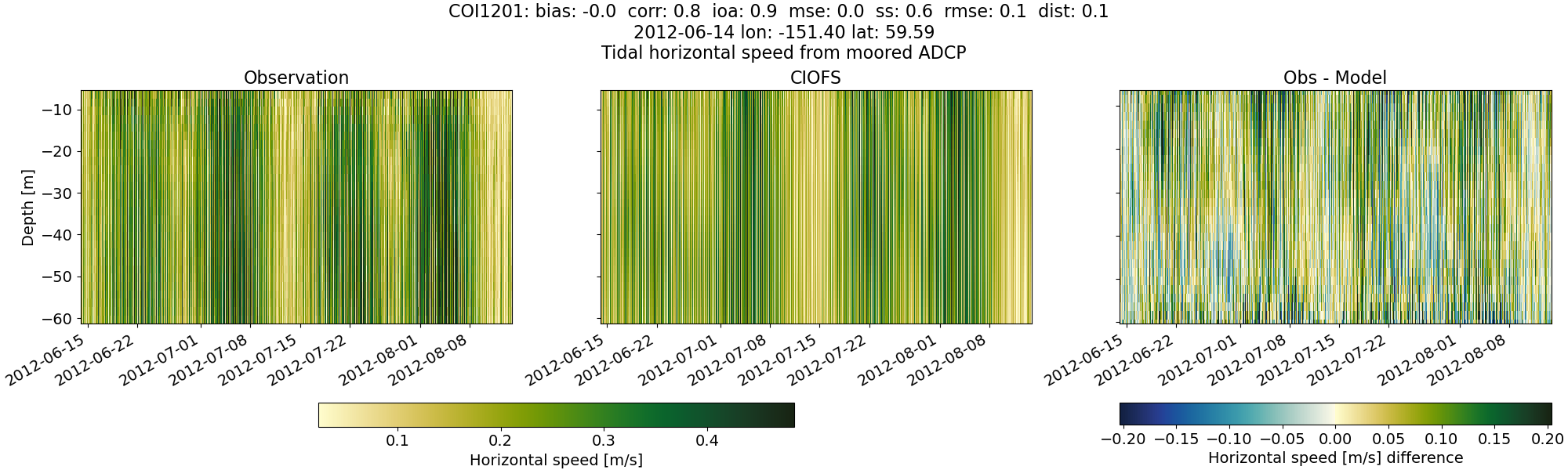
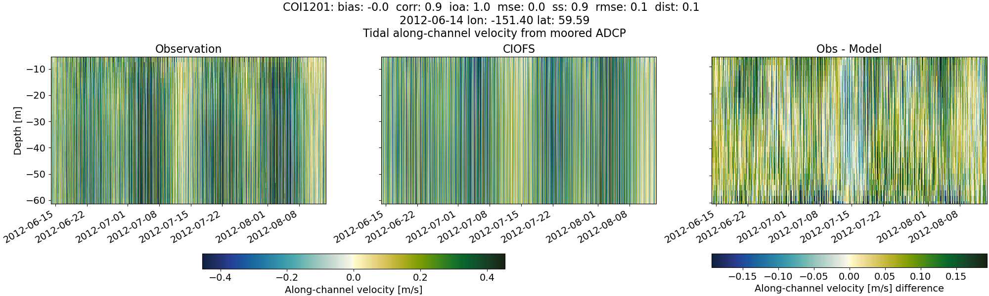
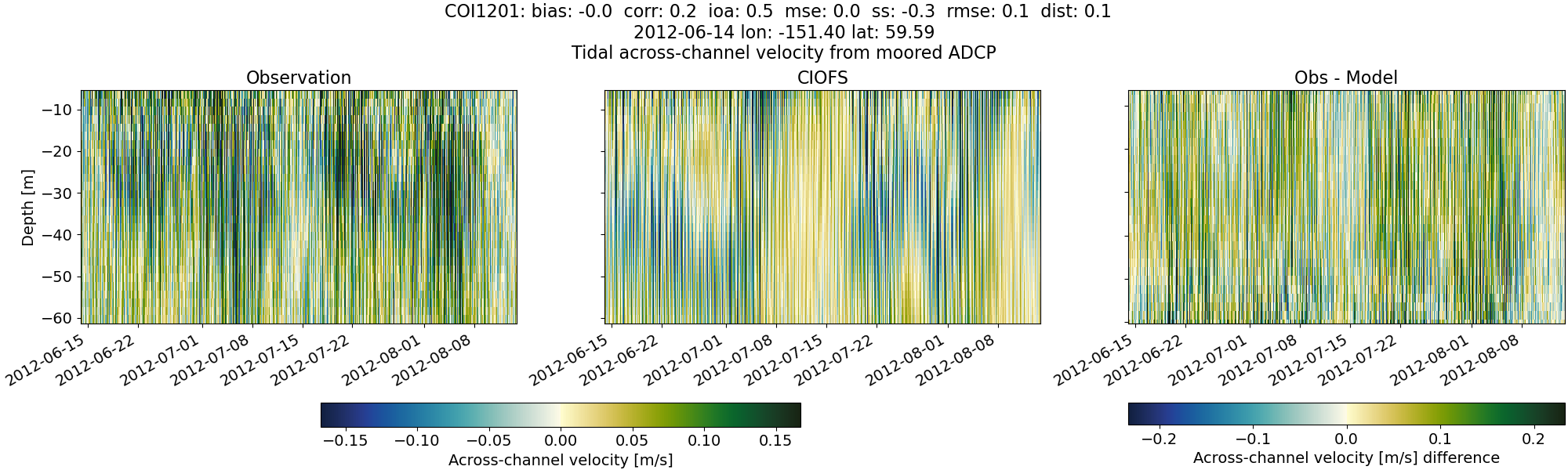
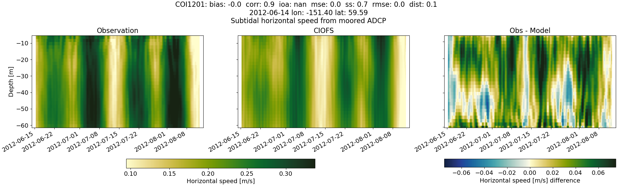
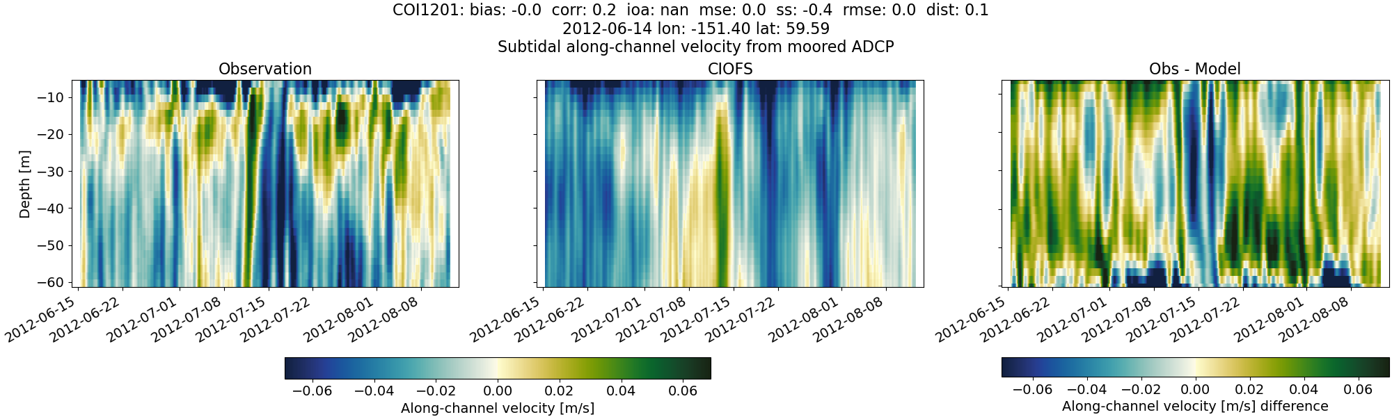
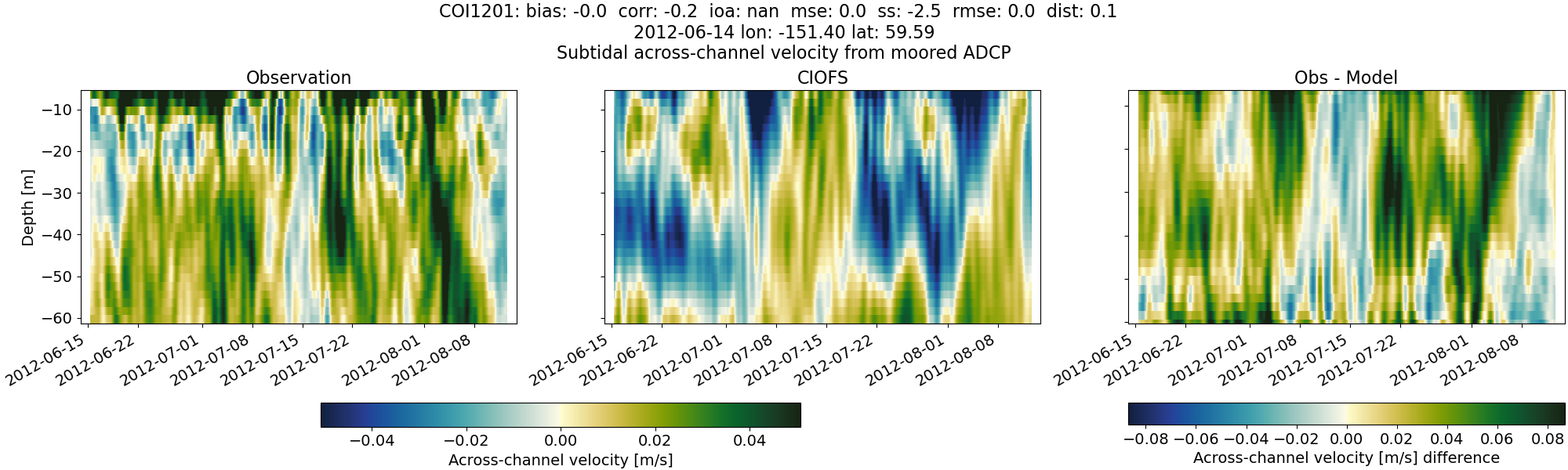
COI1201#
Tidal#
Horizontal speed#
CIOFS#
NWGOA#
NWGOA: Data time range is 2012-06-14 to 2012-08-14 but model ends 2009-01-01.
Along-channel velocity#
CIOFS#
NWGOA#
NWGOA: Data time range is 2012-06-14 to 2012-08-14 but model ends 2009-01-01.
Across-channel velocity#
CIOFS#
NWGOA#
NWGOA: Data time range is 2012-06-14 to 2012-08-14 but model ends 2009-01-01.
Subtidal#
Horizontal speed#
CIOFS#
NWGOA#
NWGOA: Data time range is 2012-06-14 to 2012-08-14 but model ends 2009-01-01.
Along-channel velocity#
CIOFS#
NWGOA#
NWGOA: Data time range is 2012-06-14 to 2012-08-14 but model ends 2009-01-01.
Across-channel velocity#
CIOFS#
NWGOA#
NWGOA: Data time range is 2012-06-14 to 2012-08-14 but model ends 2009-01-01.
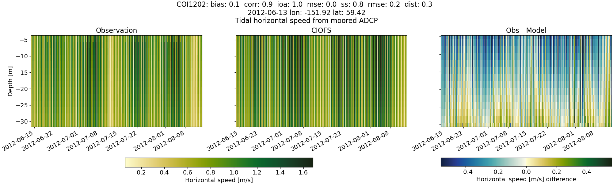
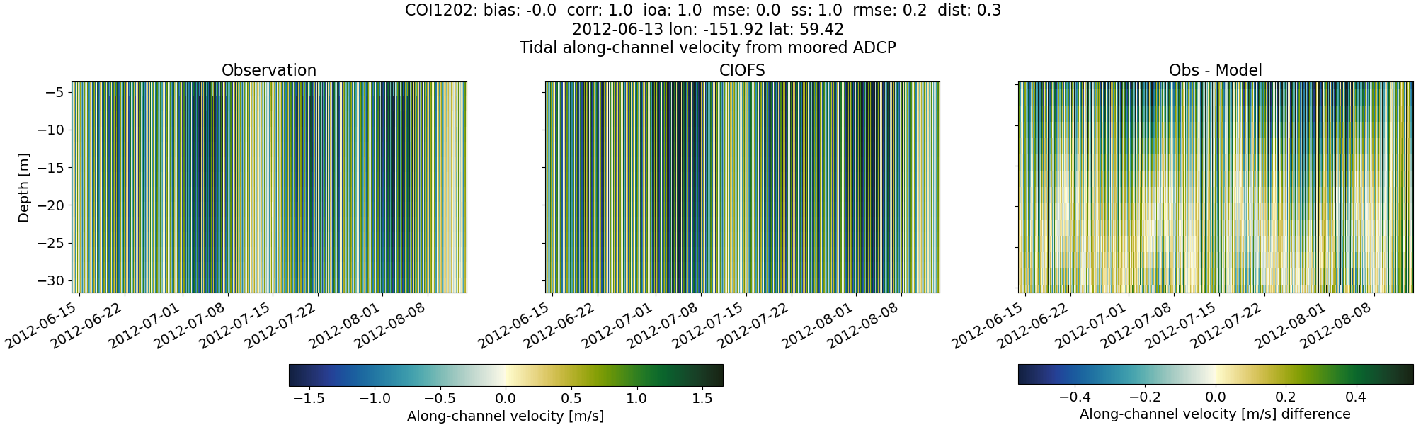
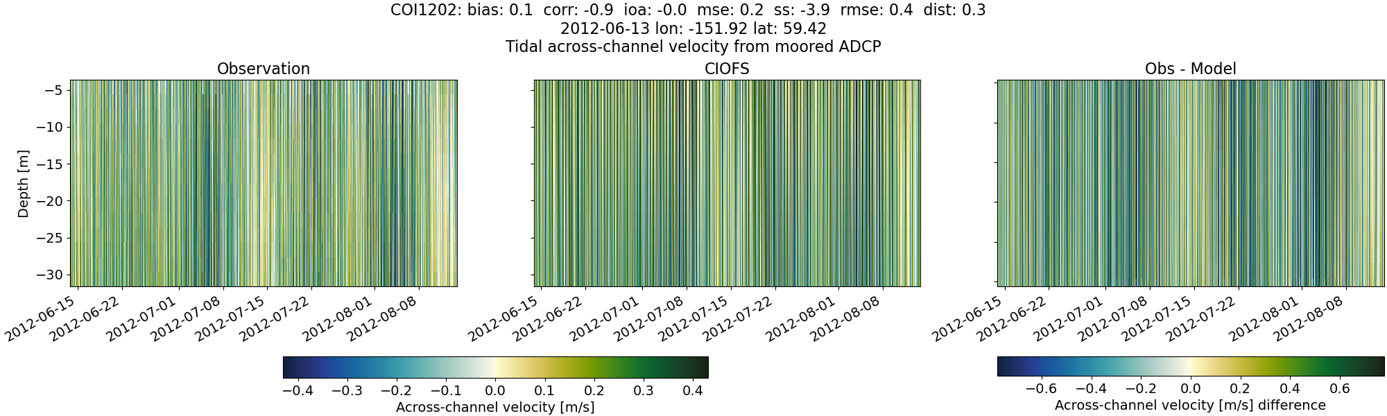
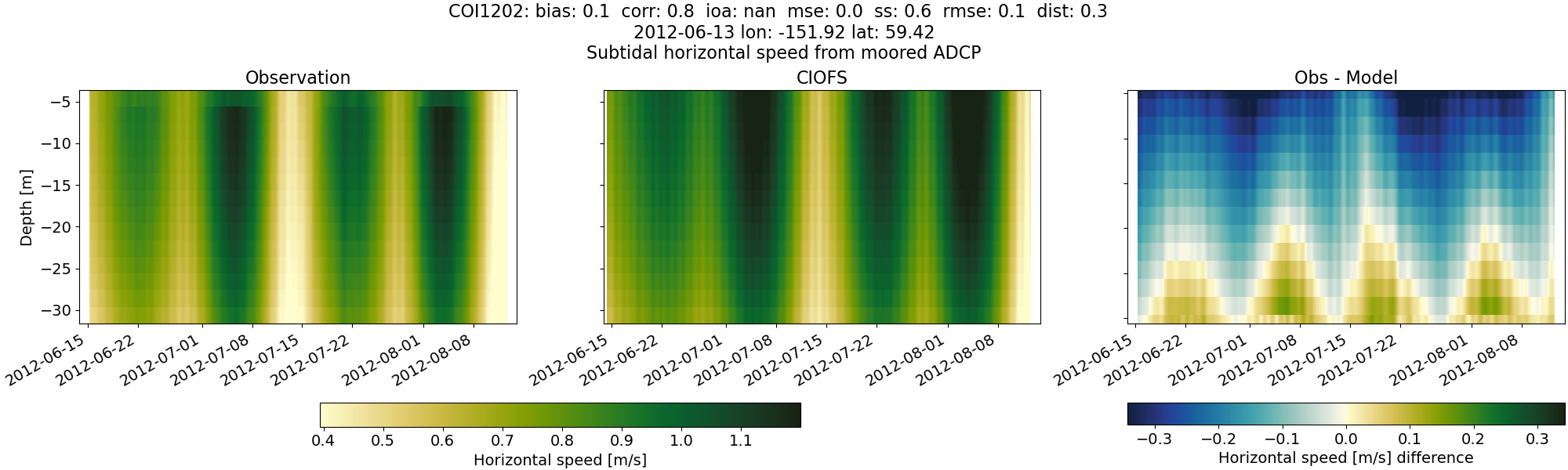
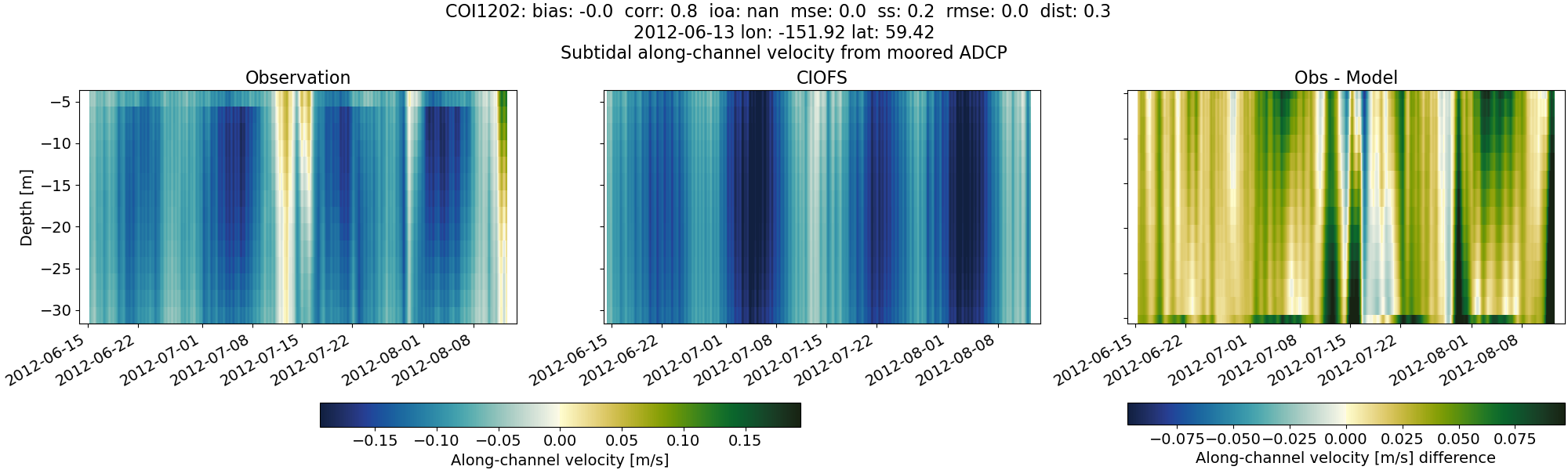
COI1202#
Tidal#
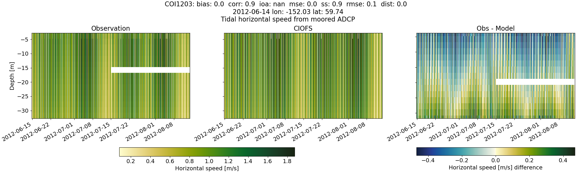
Horizontal speed#
CIOFS#
NWGOA#
NWGOA: Data time range is 2012-06-13 to 2012-08-14 but model ends 2009-01-01.
Along-channel velocity#
CIOFS#
NWGOA#
NWGOA: Data time range is 2012-06-13 to 2012-08-14 but model ends 2009-01-01.
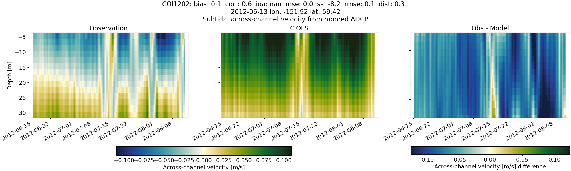
Across-channel velocity#
CIOFS#
NWGOA#
NWGOA: Data time range is 2012-06-13 to 2012-08-14 but model ends 2009-01-01.
Subtidal#
Horizontal speed#
CIOFS#
NWGOA#
NWGOA: Data time range is 2012-06-13 to 2012-08-14 but model ends 2009-01-01.
Along-channel velocity#
CIOFS#
NWGOA#
NWGOA: Data time range is 2012-06-13 to 2012-08-14 but model ends 2009-01-01.
Across-channel velocity#
CIOFS#
NWGOA#
NWGOA: Data time range is 2012-06-13 to 2012-08-14 but model ends 2009-01-01.
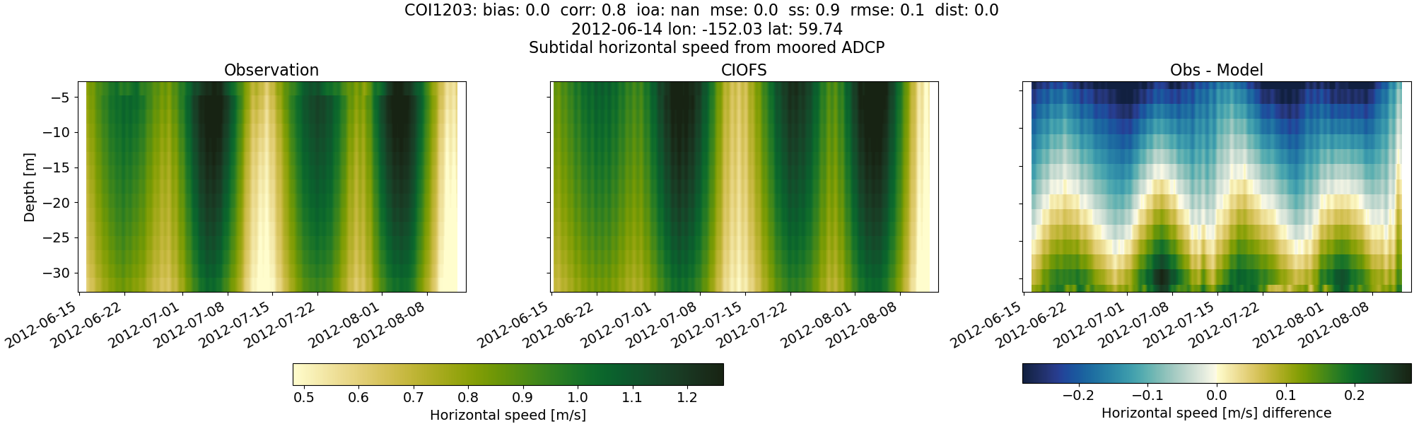
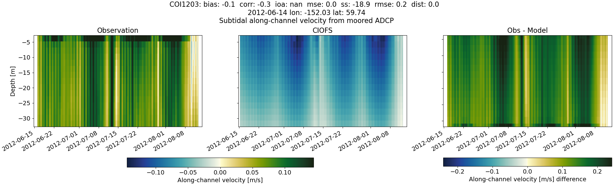
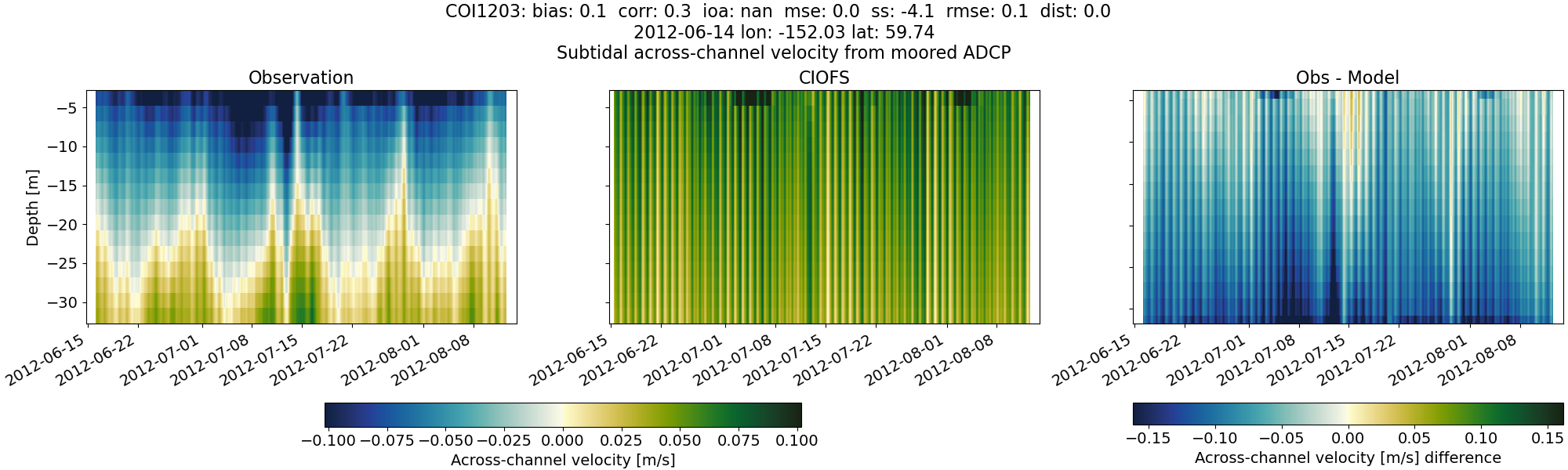
COI1203#
Tidal#
Horizontal speed#
CIOFS#
NWGOA#
NWGOA: Data time range is 2012-06-14 to 2012-08-14 but model ends 2009-01-01.
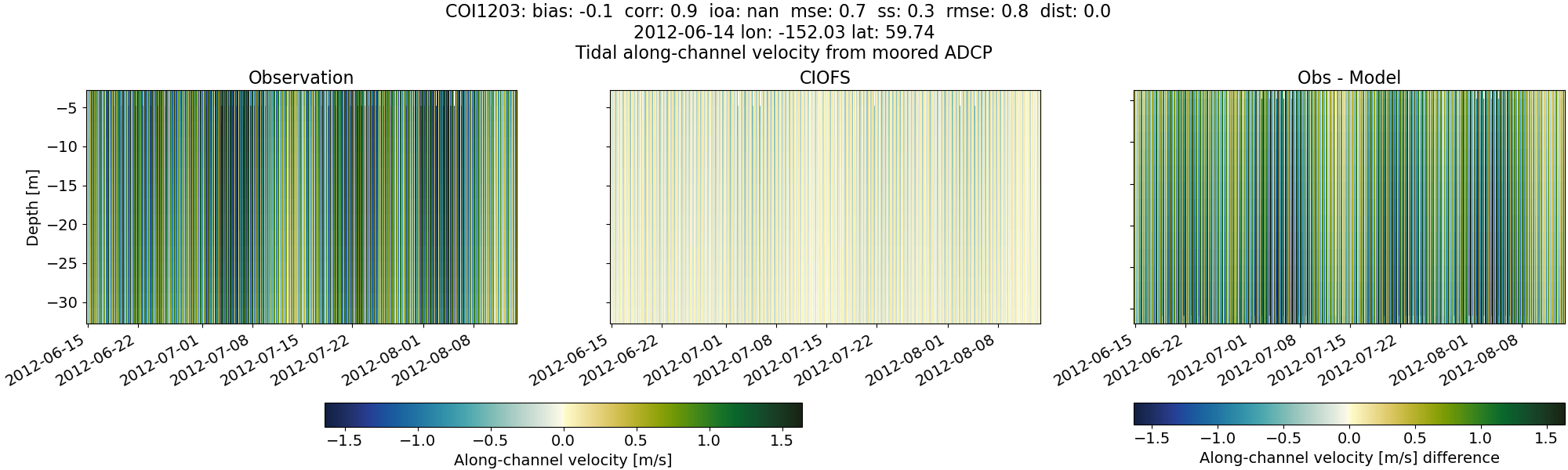
Along-channel velocity#
CIOFS#
NWGOA#
NWGOA: Data time range is 2012-06-14 to 2012-08-14 but model ends 2009-01-01.
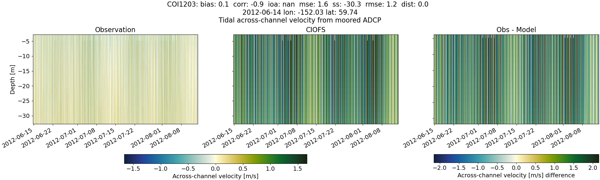
Across-channel velocity#
CIOFS#
NWGOA#
NWGOA: Data time range is 2012-06-14 to 2012-08-14 but model ends 2009-01-01.
Subtidal#
Horizontal speed#
CIOFS#
NWGOA#
NWGOA: Data time range is 2012-06-14 to 2012-08-14 but model ends 2009-01-01.
Along-channel velocity#
CIOFS#
NWGOA#
NWGOA: Data time range is 2012-06-14 to 2012-08-14 but model ends 2009-01-01.
Across-channel velocity#
CIOFS#
NWGOA#
NWGOA: Data time range is 2012-06-14 to 2012-08-14 but model ends 2009-01-01.
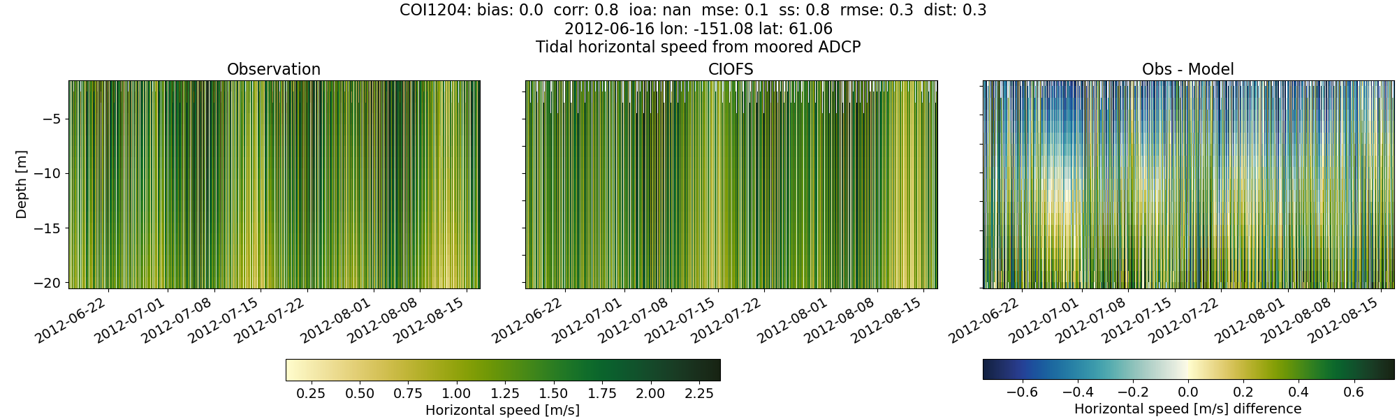
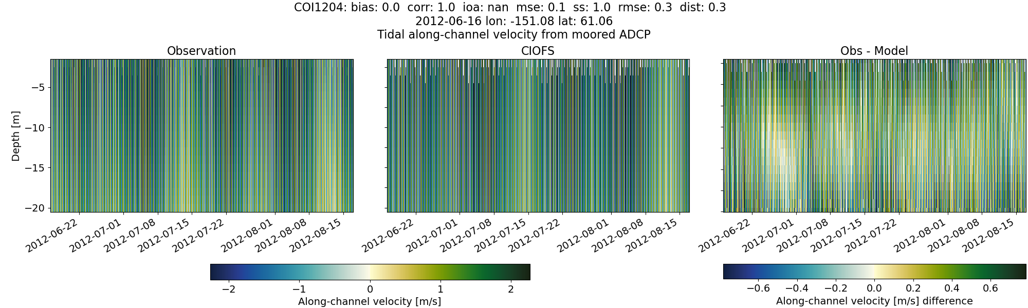
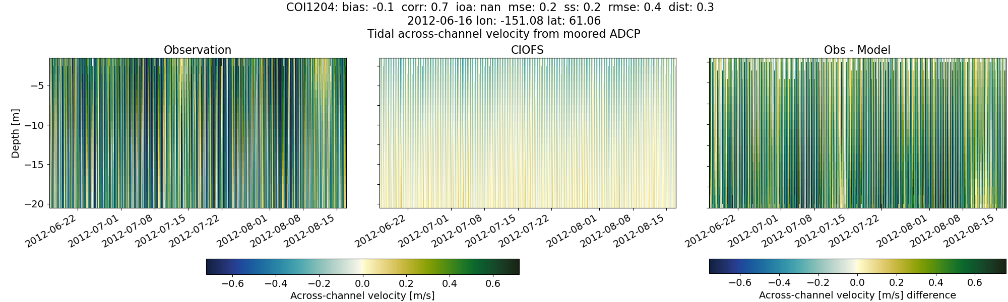
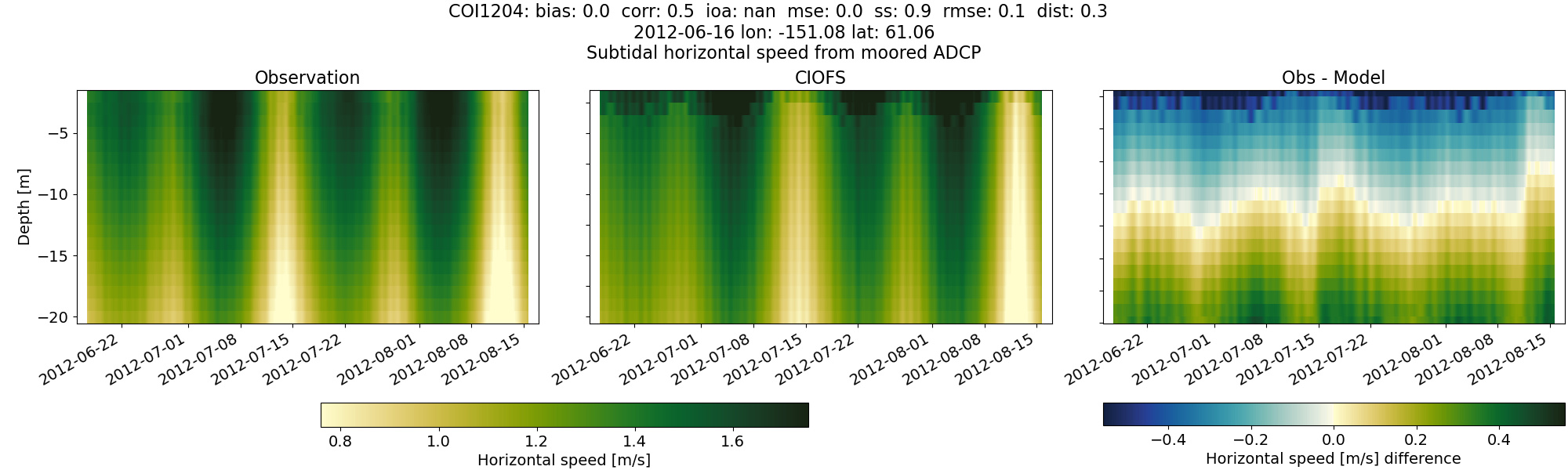
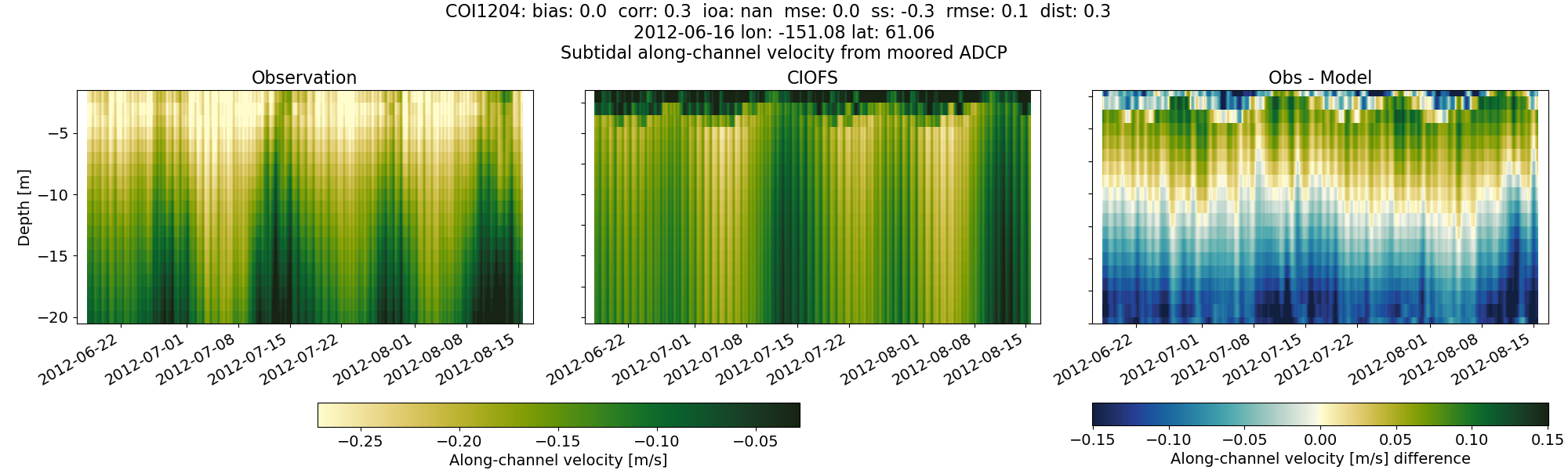
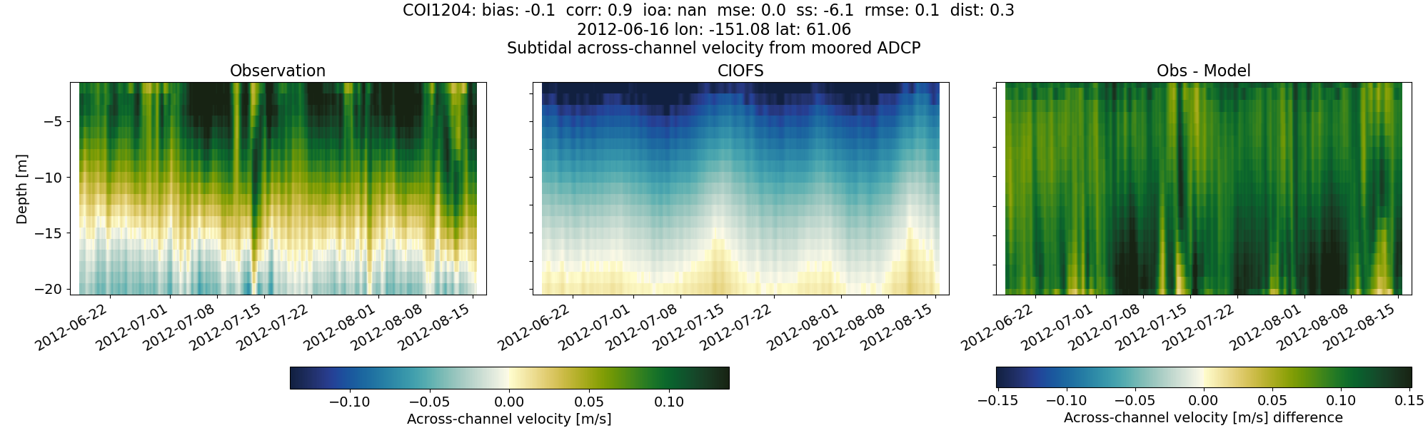
COI1204#
Tidal#
Horizontal speed#
CIOFS#
NWGOA#
NWGOA: Data time range is 2012-06-16 to 2012-08-17 but model ends 2009-01-01.
Along-channel velocity#
CIOFS#
NWGOA#
NWGOA: Data time range is 2012-06-16 to 2012-08-17 but model ends 2009-01-01.
Across-channel velocity#
CIOFS#
NWGOA#
NWGOA: Data time range is 2012-06-16 to 2012-08-17 but model ends 2009-01-01.
Subtidal#
Horizontal speed#
CIOFS#
NWGOA#
NWGOA: Data time range is 2012-06-16 to 2012-08-17 but model ends 2009-01-01.
Along-channel velocity#
CIOFS#
NWGOA#
NWGOA: Data time range is 2012-06-16 to 2012-08-17 but model ends 2009-01-01.
Across-channel velocity#
CIOFS#
NWGOA#
NWGOA: Data time range is 2012-06-16 to 2012-08-17 but model ends 2009-01-01.
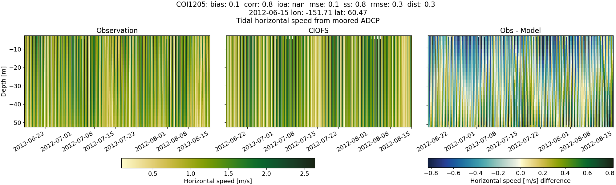
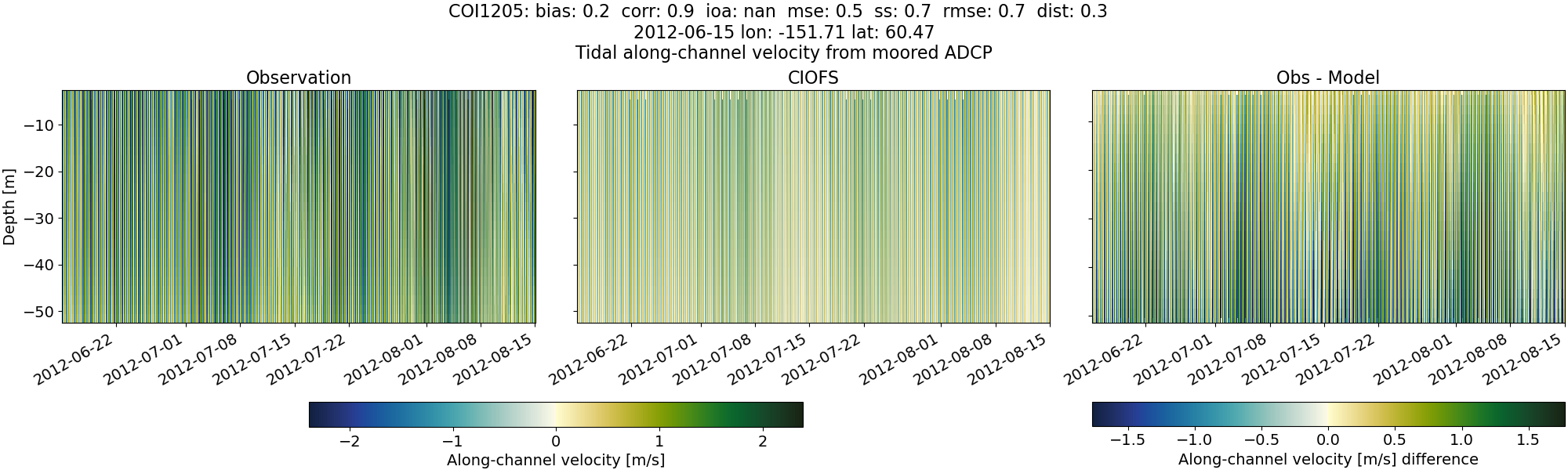
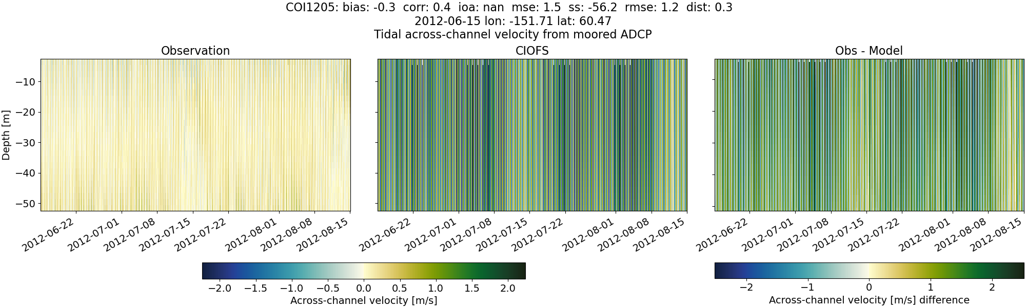
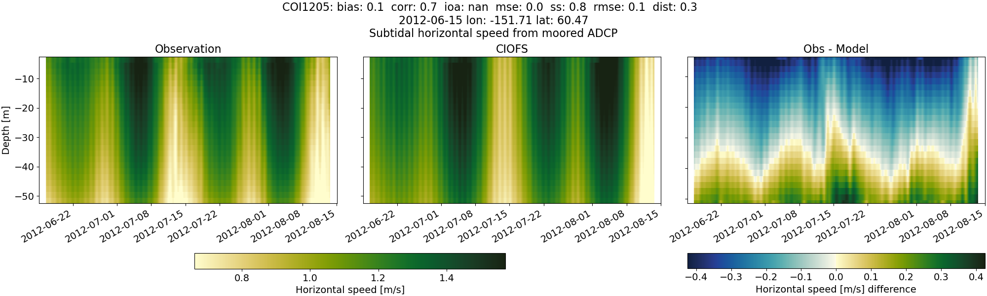
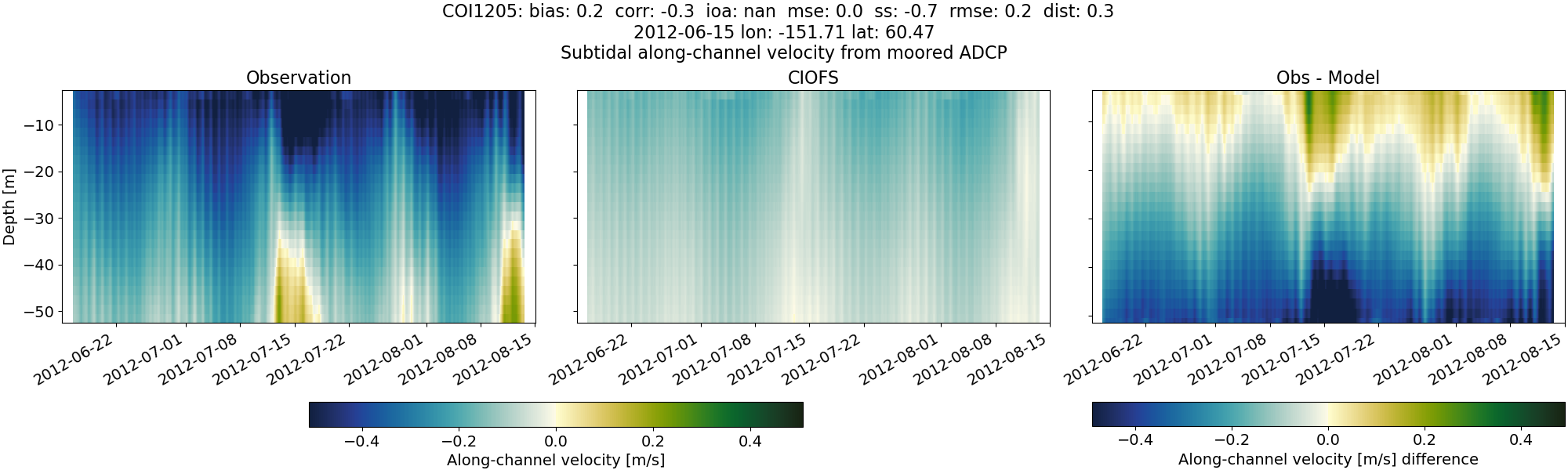
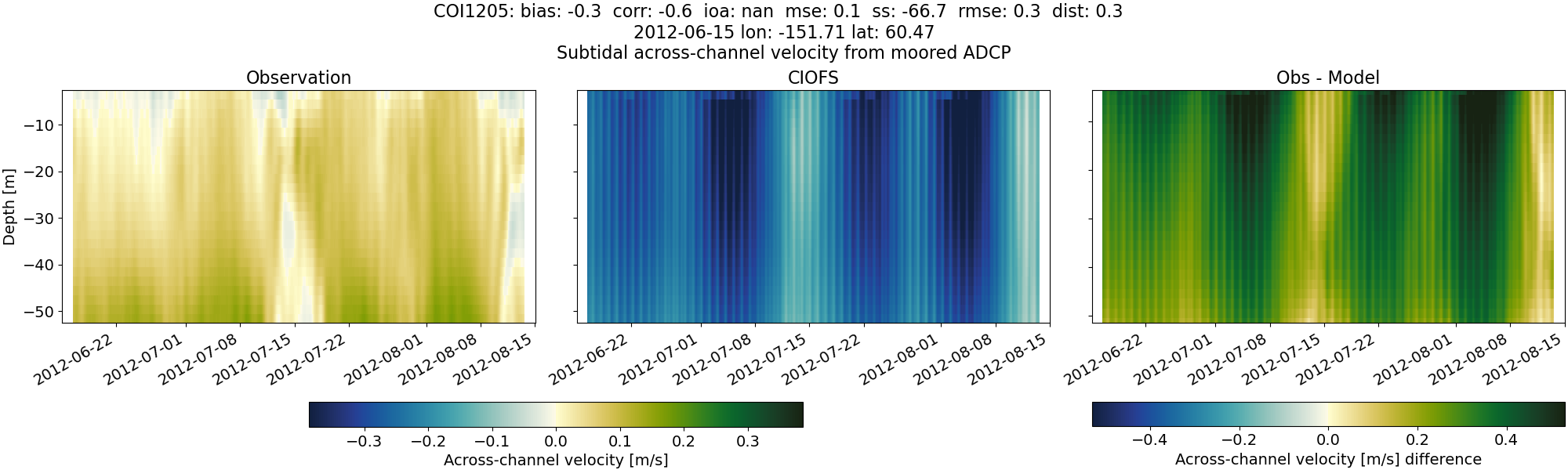
COI1205#
Tidal#
Horizontal speed#
CIOFS#
NWGOA#
NWGOA: Data time range is 2012-06-15 to 2012-08-15 but model ends 2009-01-01.
Along-channel velocity#
CIOFS#
NWGOA#
NWGOA: Data time range is 2012-06-15 to 2012-08-15 but model ends 2009-01-01.
Across-channel velocity#
CIOFS#
NWGOA#
NWGOA: Data time range is 2012-06-15 to 2012-08-15 but model ends 2009-01-01.
Subtidal#
Horizontal speed#
CIOFS#
NWGOA#
NWGOA: Data time range is 2012-06-15 to 2012-08-15 but model ends 2009-01-01.
Along-channel velocity#
CIOFS#
NWGOA#
NWGOA: Data time range is 2012-06-15 to 2012-08-15 but model ends 2009-01-01.
Across-channel velocity#
CIOFS#
NWGOA#
NWGOA: Data time range is 2012-06-15 to 2012-08-15 but model ends 2009-01-01.
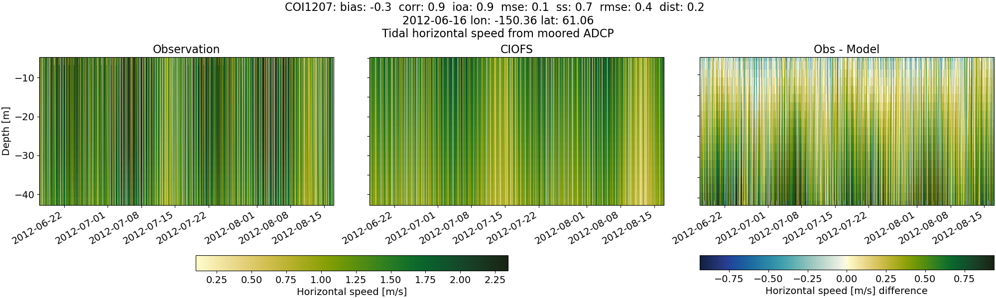
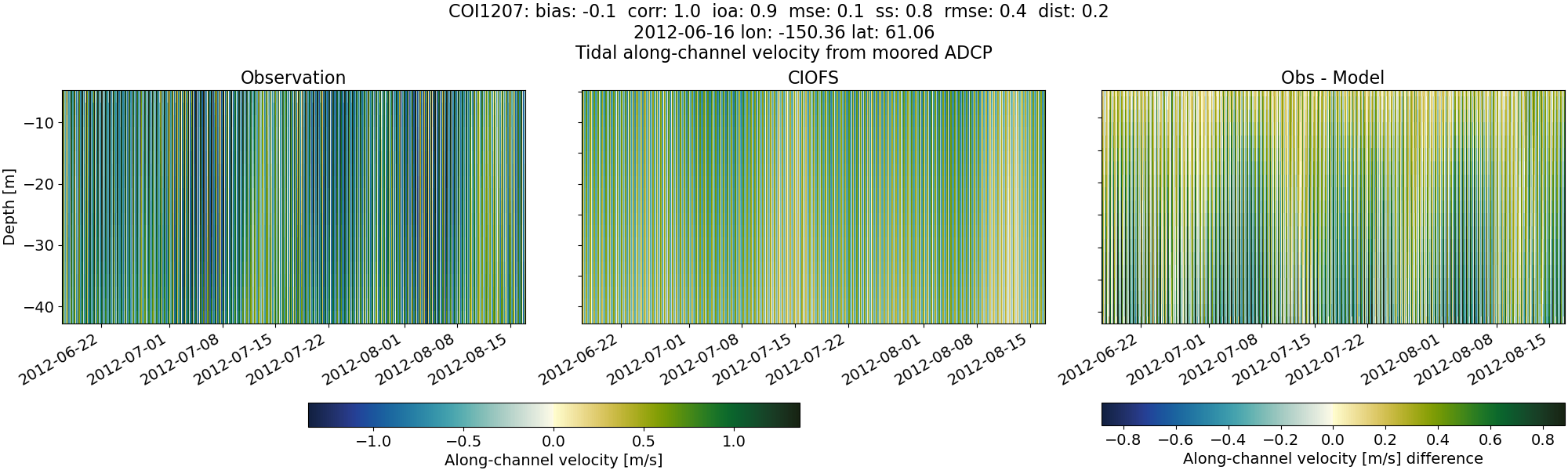
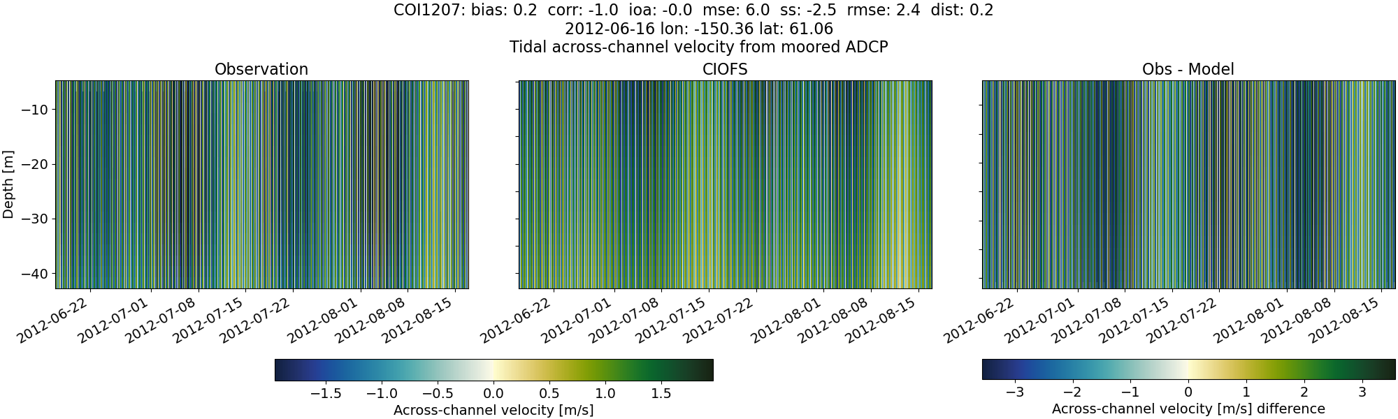
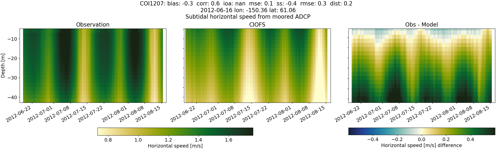
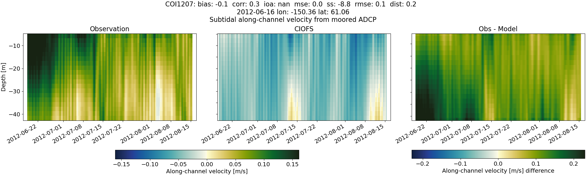
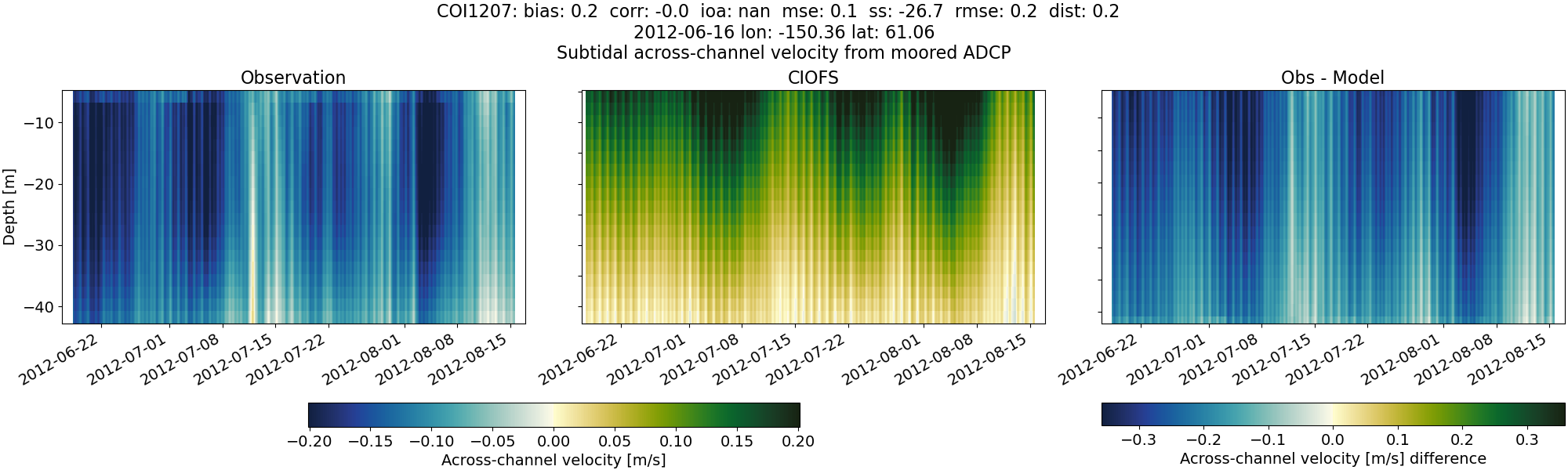
COI1207#
Tidal#
Horizontal speed#
CIOFS#
NWGOA#
NWGOA: Data time range is 2012-06-16 to 2012-08-17 but model ends 2009-01-01.
Along-channel velocity#
CIOFS#
NWGOA#
NWGOA: Data time range is 2012-06-16 to 2012-08-17 but model ends 2009-01-01.
Across-channel velocity#
CIOFS#
NWGOA#
NWGOA: Data time range is 2012-06-16 to 2012-08-17 but model ends 2009-01-01.
Subtidal#
Horizontal speed#
CIOFS#
NWGOA#
NWGOA: Data time range is 2012-06-16 to 2012-08-17 but model ends 2009-01-01.
Along-channel velocity#
CIOFS#
NWGOA#
NWGOA: Data time range is 2012-06-16 to 2012-08-17 but model ends 2009-01-01.
Across-channel velocity#
CIOFS#
NWGOA#
NWGOA: Data time range is 2012-06-16 to 2012-08-17 but model ends 2009-01-01.
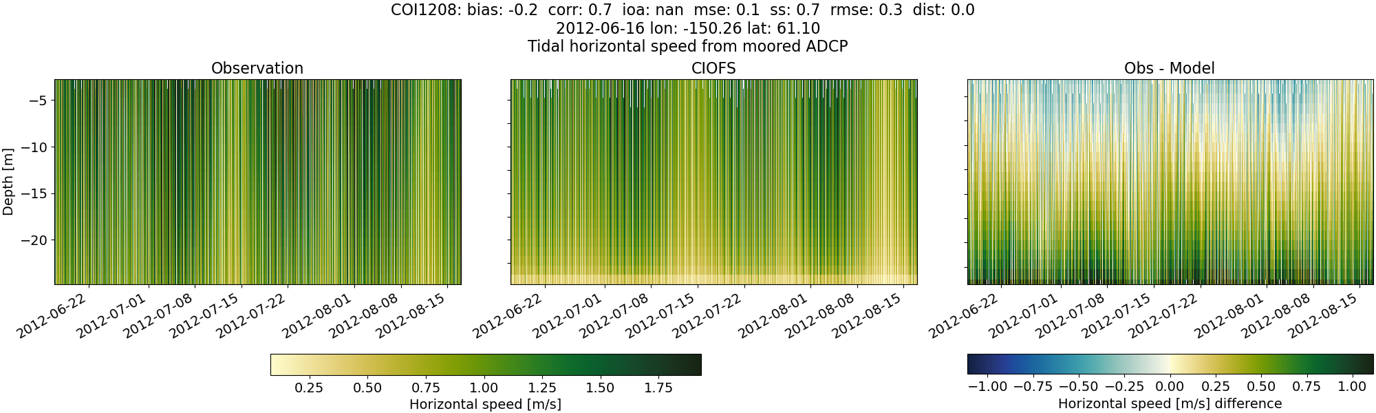
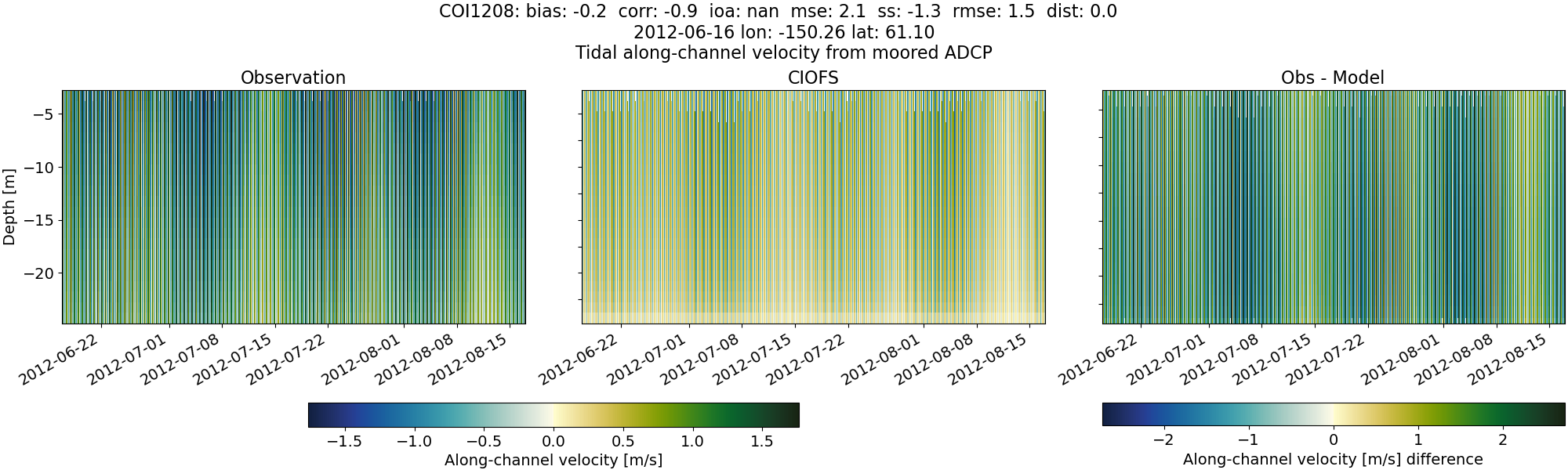
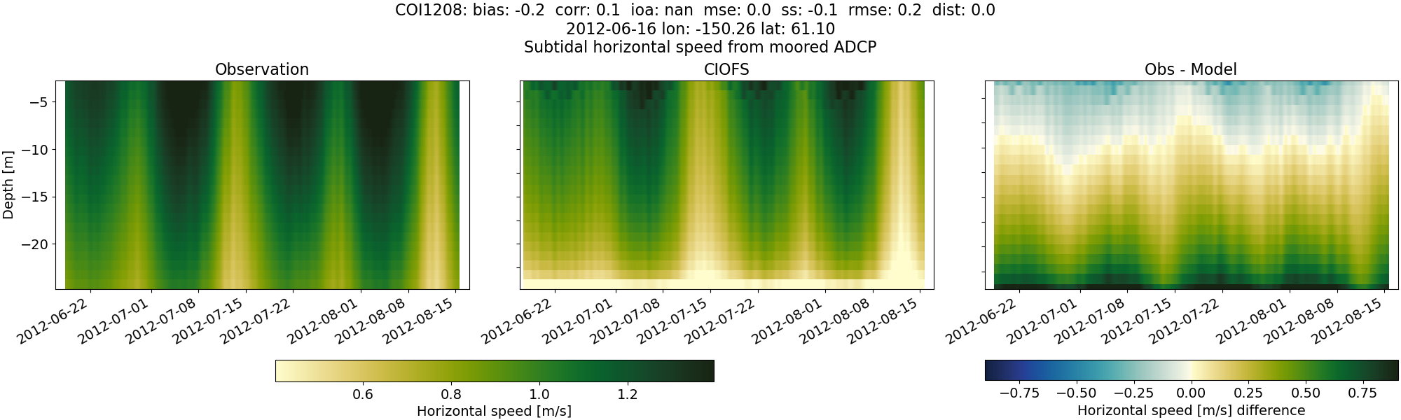
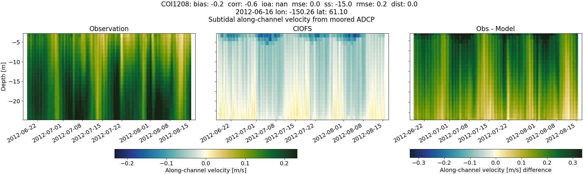
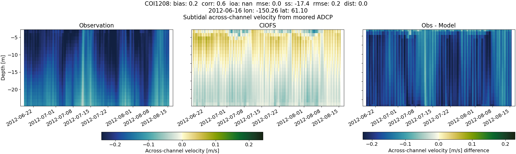
COI1208#
Tidal#
Horizontal speed#
CIOFS#
NWGOA#
NWGOA: Data time range is 2012-06-16 to 2012-08-17 but model ends 2009-01-01.
Along-channel velocity#
CIOFS#
NWGOA#
NWGOA: Data time range is 2012-06-16 to 2012-08-17 but model ends 2009-01-01.
Across-channel velocity#
CIOFS#
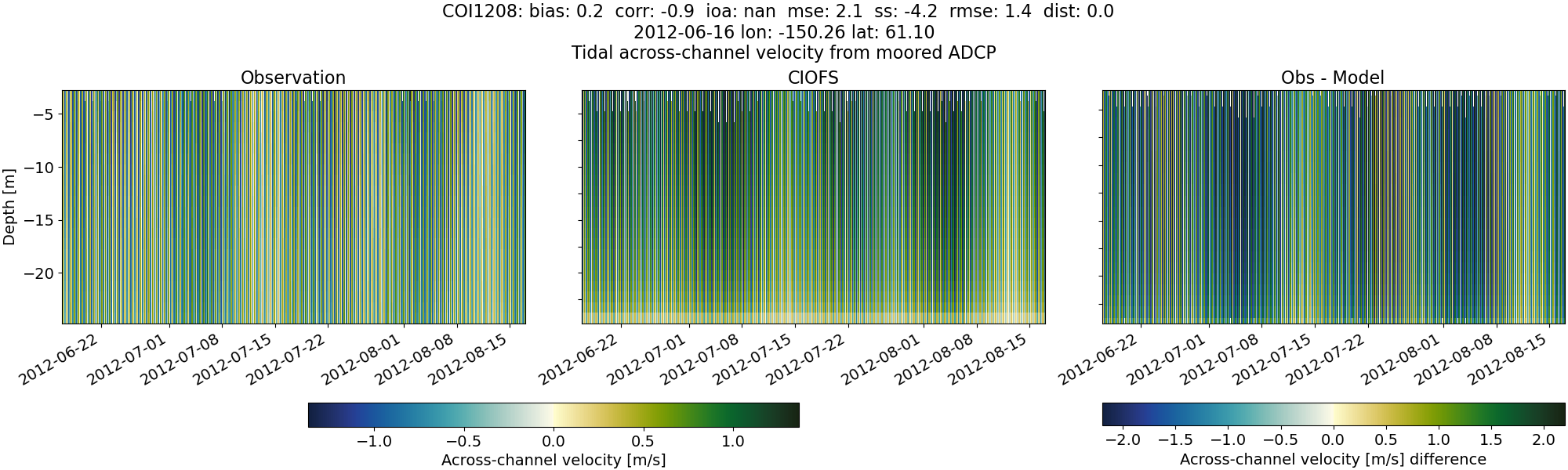
NWGOA#
NWGOA: Data time range is 2012-06-16 to 2012-08-17 but model ends 2009-01-01.
Subtidal#
Horizontal speed#
CIOFS#
NWGOA#
NWGOA: Data time range is 2012-06-16 to 2012-08-17 but model ends 2009-01-01.
Along-channel velocity#
CIOFS#
NWGOA#
NWGOA: Data time range is 2012-06-16 to 2012-08-17 but model ends 2009-01-01.
Across-channel velocity#
CIOFS#
NWGOA#
NWGOA: Data time range is 2012-06-16 to 2012-08-17 but model ends 2009-01-01.
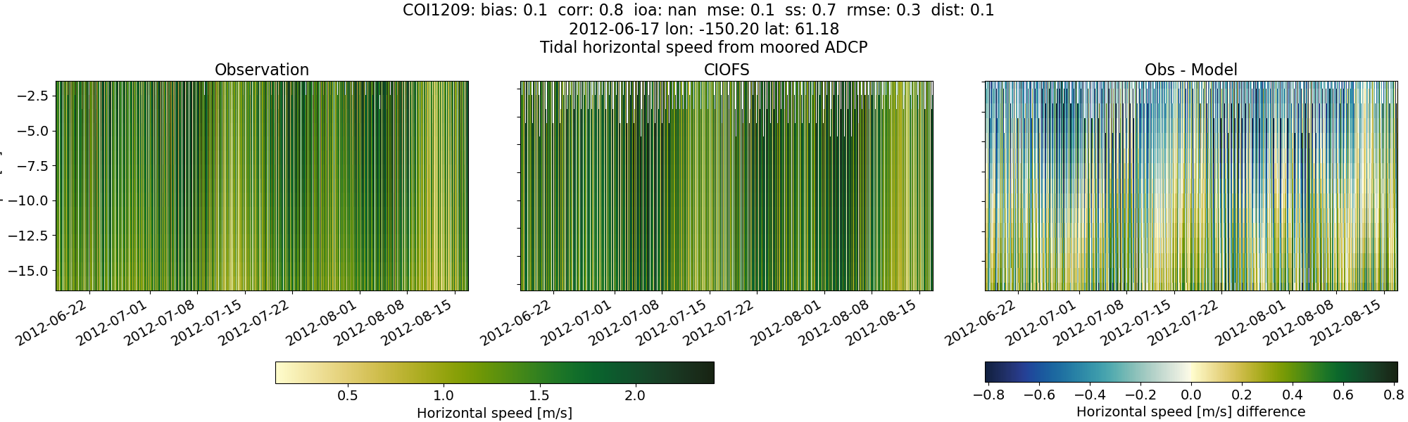
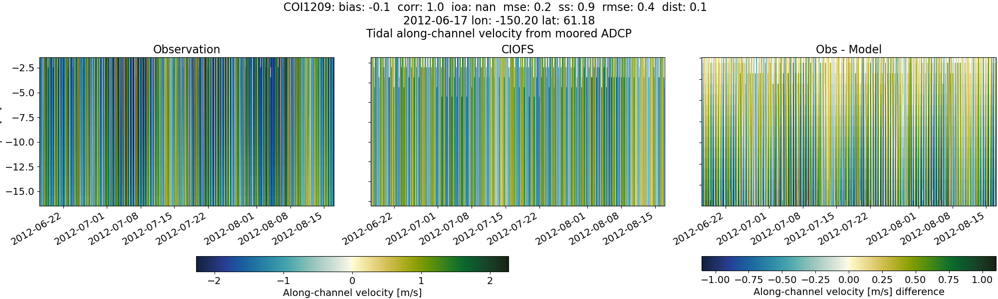
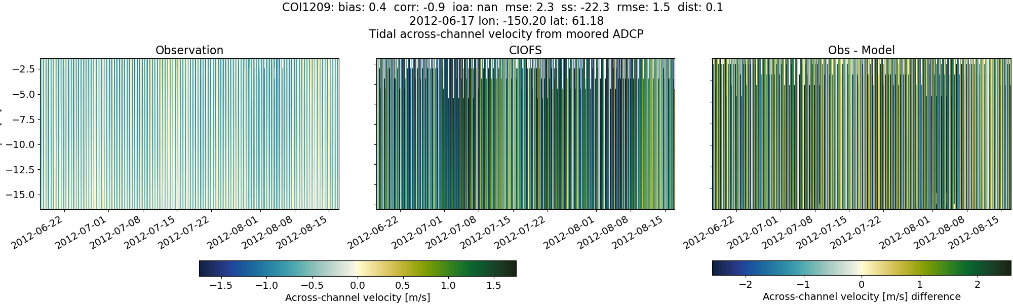
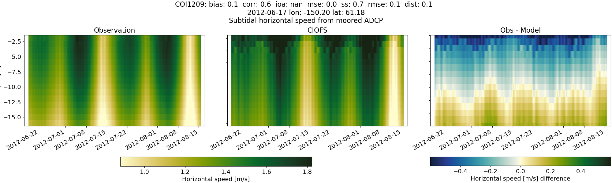
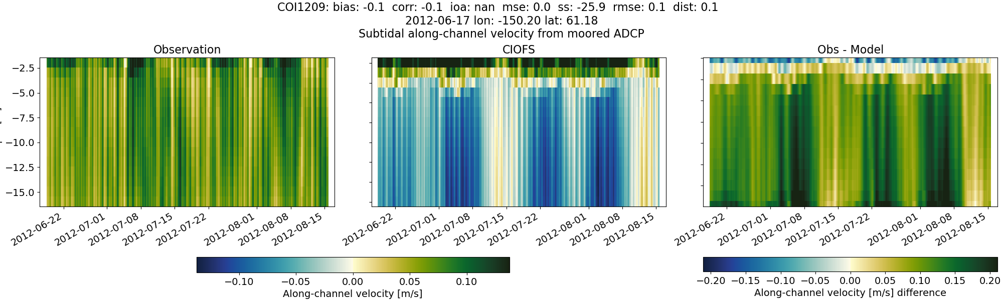
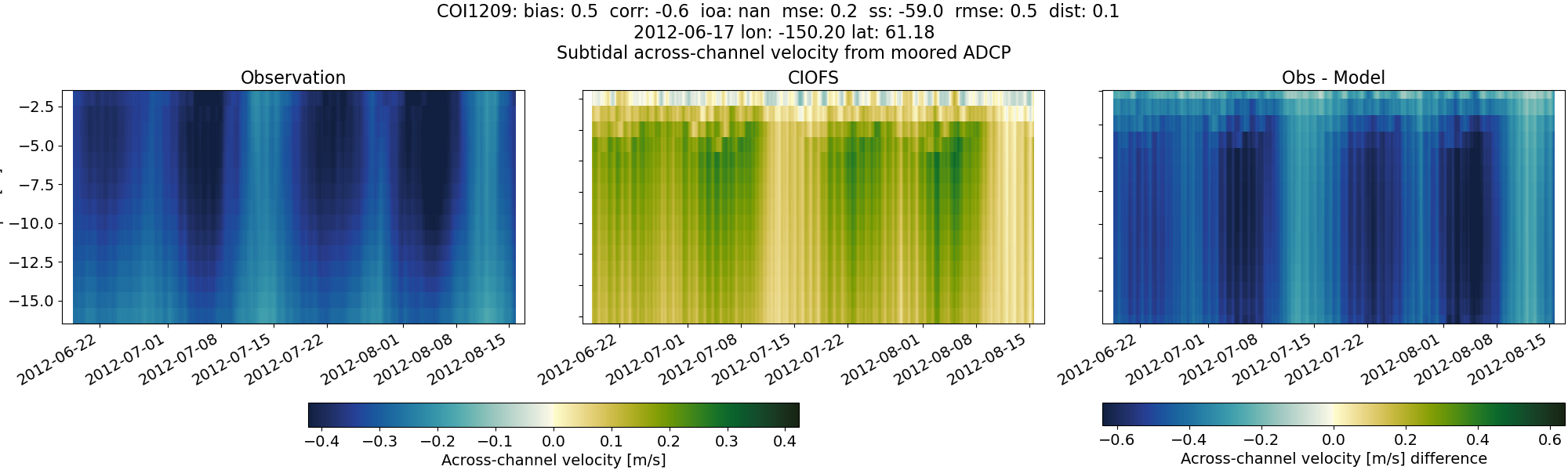
COI1209#
Tidal#
Horizontal speed#
CIOFS#
NWGOA#
NWGOA: Data time range is 2012-06-17 to 2012-08-17 but model ends 2009-01-01.
Along-channel velocity#
CIOFS#
NWGOA#
NWGOA: Data time range is 2012-06-17 to 2012-08-17 but model ends 2009-01-01.
Across-channel velocity#
CIOFS#
NWGOA#
NWGOA: Data time range is 2012-06-17 to 2012-08-17 but model ends 2009-01-01.
Subtidal#
Horizontal speed#
CIOFS#
NWGOA#
NWGOA: Data time range is 2012-06-17 to 2012-08-17 but model ends 2009-01-01.
Along-channel velocity#
CIOFS#
NWGOA#
NWGOA: Data time range is 2012-06-17 to 2012-08-17 but model ends 2009-01-01.
Across-channel velocity#
CIOFS#
NWGOA#
NWGOA: Data time range is 2012-06-17 to 2012-08-17 but model ends 2009-01-01.
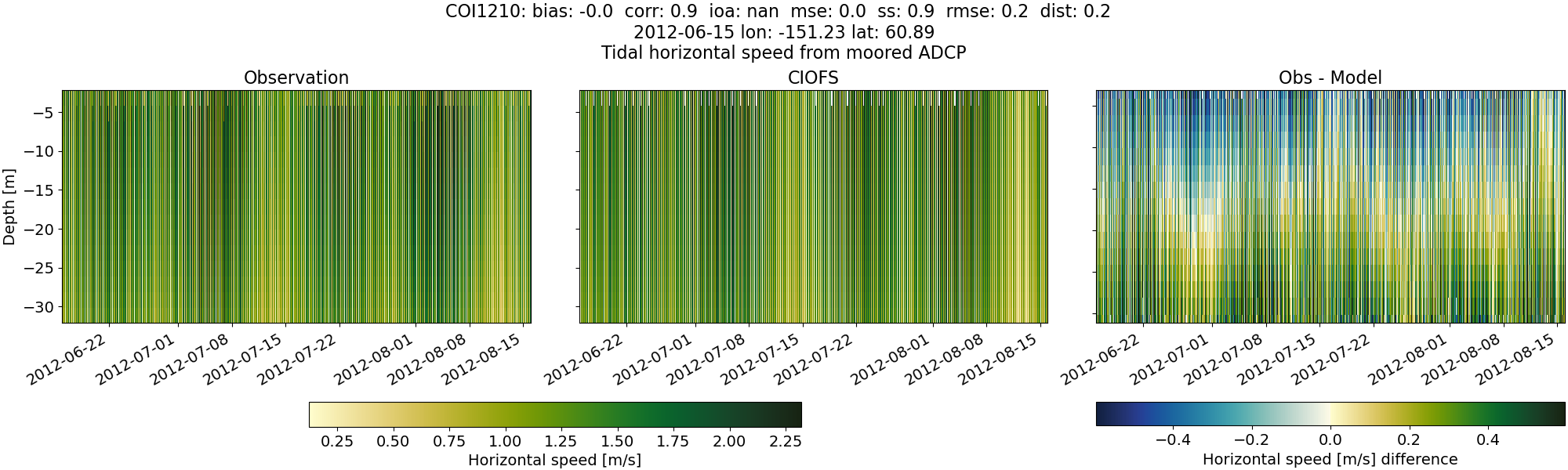
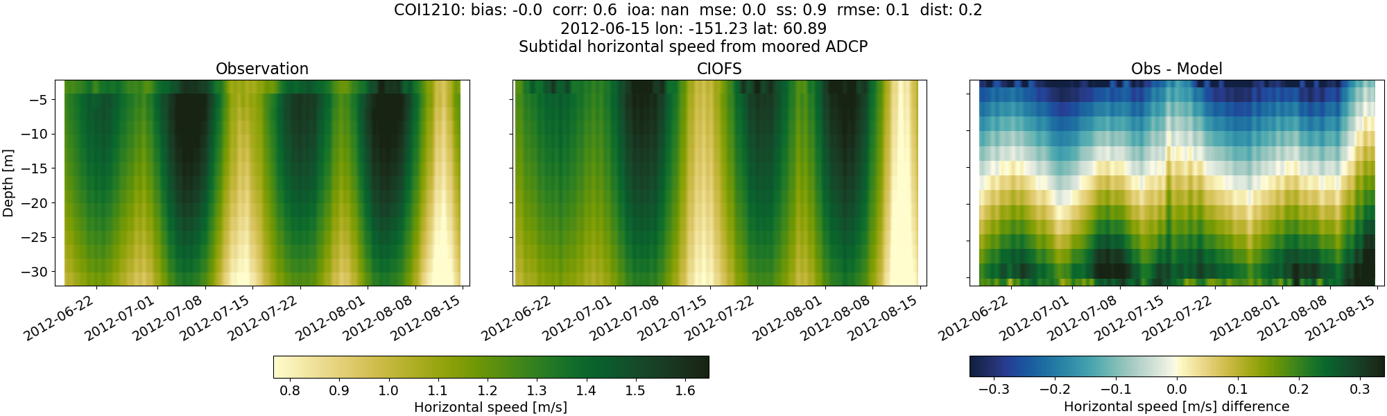
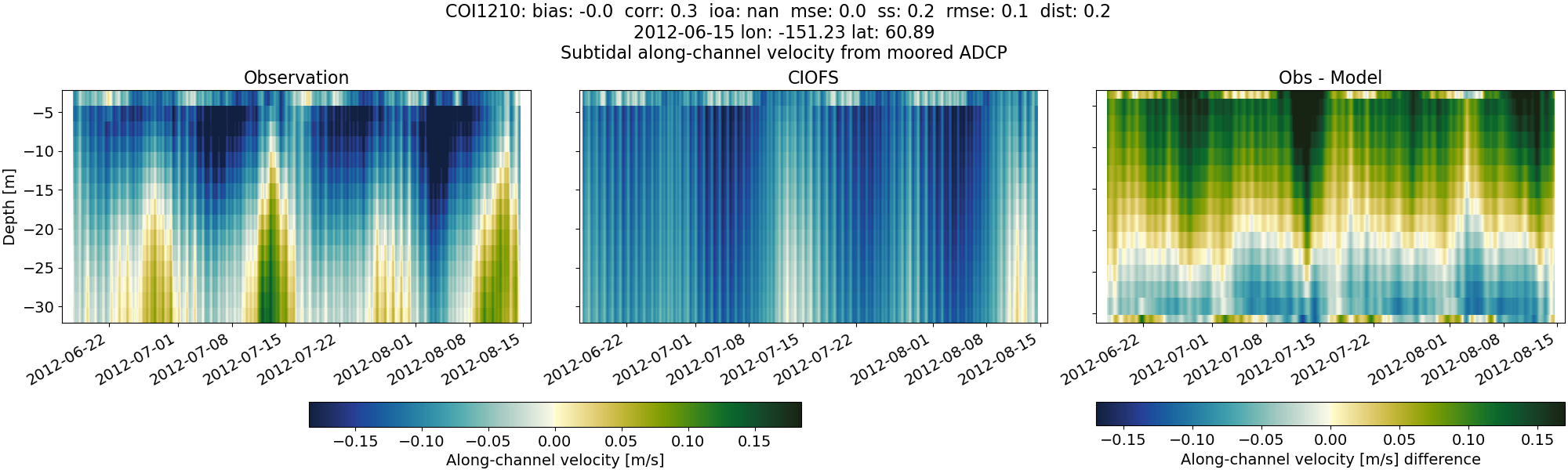
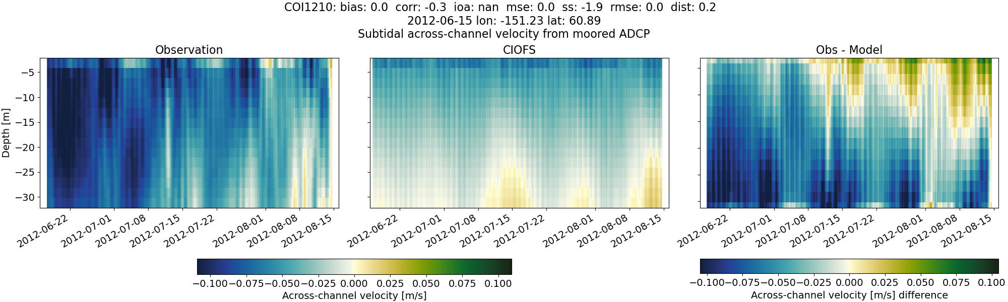
COI1210#
Tidal#
Horizontal speed#
CIOFS#
NWGOA#
NWGOA: Data time range is 2012-06-15 to 2012-08-16 but model ends 2009-01-01.
Along-channel velocity#
CIOFS#
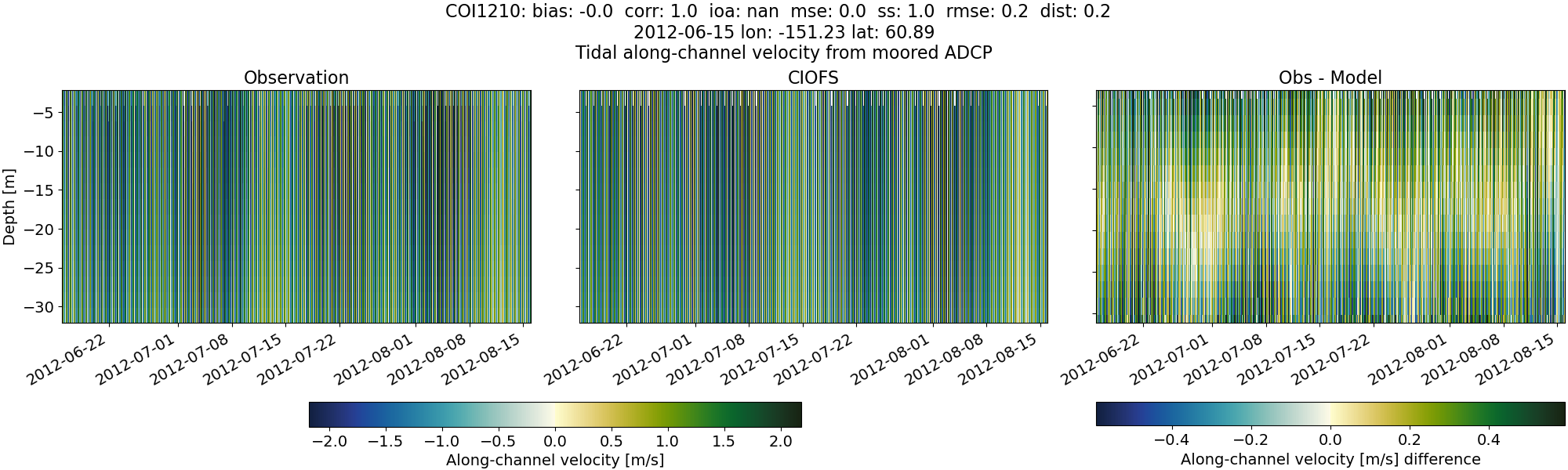
NWGOA#
NWGOA: Data time range is 2012-06-15 to 2012-08-16 but model ends 2009-01-01.
Across-channel velocity#
CIOFS#
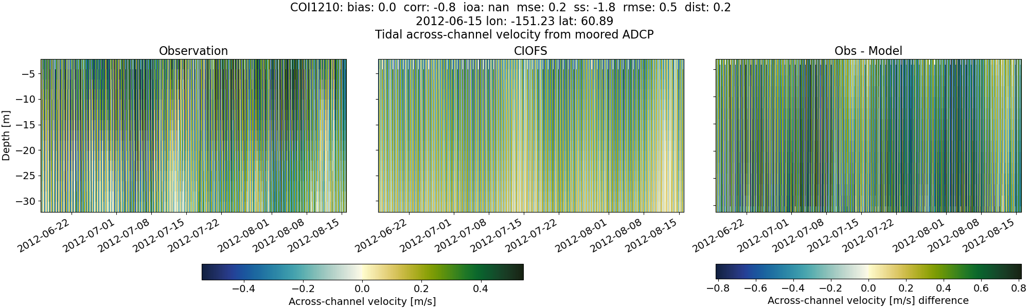
NWGOA#
NWGOA: Data time range is 2012-06-15 to 2012-08-16 but model ends 2009-01-01.
Subtidal#
Horizontal speed#
CIOFS#
NWGOA#
NWGOA: Data time range is 2012-06-15 to 2012-08-16 but model ends 2009-01-01.
Along-channel velocity#
CIOFS#
NWGOA#
NWGOA: Data time range is 2012-06-15 to 2012-08-16 but model ends 2009-01-01.
Across-channel velocity#
CIOFS#
NWGOA#
NWGOA: Data time range is 2012-06-15 to 2012-08-16 but model ends 2009-01-01.